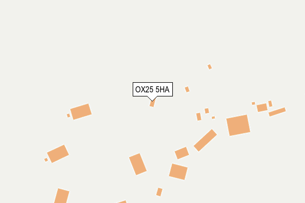
OX25 5HA is located in the Fringford and Heyfords electoral ward, within the local authority district of Cherwell and the English Parliamentary constituency of Banbury. The Sub Integrated Care Board (ICB) Location is NHS Buckinghamshire, Oxfordshire and Berkshire West ICB - 10Q and the police force is Thames Valley. This postcode has been in use since October 2000.


GetTheData
Source: OS OpenMap – Local (Ordnance Survey)
Source: OS VectorMap District (Ordnance Survey)
Licence: Open Government Licence (requires attribution)
| Easting | 451014 |
| Northing | 226406 |
| Latitude | 51.933843 |
| Longitude | -1.259404 |
GetTheData
Source: Open Postcode Geo
Licence: Open Government Licence
| Country | England |
| Postcode District | OX25 |
| ➜ OX25 open data dashboard ➜ See where OX25 is on a map | |
GetTheData
Source: Land Registry Price Paid Data
Licence: Open Government Licence
Elevation or altitude of OX25 5HA as distance above sea level:
| Metres | Feet | |
|---|---|---|
| Elevation | 130m | 427ft |
Elevation is measured from the approximate centre of the postcode, to the nearest point on an OS contour line from OS Terrain 50, which has contour spacing of ten vertical metres.
➜ How high above sea level am I? Find the elevation of your current position using your device's GPS.
GetTheData
Source: Open Postcode Elevation
Licence: Open Government Licence
| Ward | Fringford And Heyfords |
| Constituency | Banbury |
GetTheData
Source: ONS Postcode Database
Licence: Open Government Licence
| Upper Heyford Shop (Camp Road) | Upper Heyford | 688m |
| Camp Road West End (Camp Road) | Upper Heyford | 1,185m |
| Camp Road West End (Camp Road) | Upper Heyford | 1,195m |
| Heyford Station | 3.2km |
GetTheData
Source: NaPTAN
Licence: Open Government Licence
GetTheData
Source: ONS Postcode Database
Licence: Open Government Licence

➜ Get more ratings from the Food Standards Agency
GetTheData
Source: Food Standards Agency
Licence: FSA terms & conditions
| Last Collection | |||
|---|---|---|---|
| Location | Mon-Fri | Sat | Distance |
| The Leys | 16:45 | 09:00 | 674m |
| High Street | 16:45 | 07:30 | 1,224m |
| Caulcot | 17:00 | 08:00 | 2,275m |
GetTheData
Source: Dracos
Licence: Creative Commons Attribution-ShareAlike
| Facility | Distance |
|---|---|
| National Sports Training Centre @ Upper Heyford (Closed) Heyford Park, Camp Road, Upper Heyford, Bicester Athletics, Sports Hall, Grass Pitches, Squash Courts | 779m |
| Heyford Park Free School Izzard Road, Upper Heyford, Bicester Outdoor Tennis Courts, Sports Hall, Grass Pitches, Health and Fitness Gym, Squash Courts | 793m |
| Upper Heyford Playing Field Somerton Road, Upper Heyford, Bicester Grass Pitches | 1.1km |
GetTheData
Source: Active Places
Licence: Open Government Licence
| School | Phase of Education | Distance |
|---|---|---|
| Heyford Park School 74 Camp Road, Heyford Park, Bicester, OX25 5HD | All-through | 793m |
| Dr Radcliffe's Church of England Primary School Fir Lane, Steeple Aston, Bicester, OX25 4SF | Primary | 3.4km |
| Fritwell Church of England Primary School East Street, Fritwell, Bicester, OX27 7PX | Primary | 3.5km |
GetTheData
Source: Edubase
Licence: Open Government Licence
The below table lists the International Territorial Level (ITL) codes (formerly Nomenclature of Territorial Units for Statistics (NUTS) codes) and Local Administrative Units (LAU) codes for OX25 5HA:
| ITL 1 Code | Name |
|---|---|
| TLJ | South East (England) |
| ITL 2 Code | Name |
| TLJ1 | Berkshire, Buckinghamshire and Oxfordshire |
| ITL 3 Code | Name |
| TLJ14 | Oxfordshire CC |
| LAU 1 Code | Name |
| E07000177 | Cherwell |
GetTheData
Source: ONS Postcode Directory
Licence: Open Government Licence
The below table lists the Census Output Area (OA), Lower Layer Super Output Area (LSOA), and Middle Layer Super Output Area (MSOA) for OX25 5HA:
| Code | Name | |
|---|---|---|
| OA | E00145238 | |
| LSOA | E01028506 | Cherwell 010D |
| MSOA | E02005930 | Cherwell 010 |
GetTheData
Source: ONS Postcode Directory
Licence: Open Government Licence
| OX25 5AG | Camp Road | 616m |
| OX25 5AB | Izzard Road | 687m |
| OX25 5AD | Broad Way | 704m |
| OX25 5AE | Bourne End | 780m |
| OX25 5TB | Trenchard Circle | 895m |
| OX25 5LS | Camp Road | 932m |
| OX25 5AF | Hart Walk | 933m |
| OX25 5TA | Larsen Road | 944m |
| OX25 5LB | Somerton Road | 1179m |
| OX25 5LJ | Camp Road | 1186m |
GetTheData
Source: Open Postcode Geo; Land Registry Price Paid Data
Licence: Open Government Licence