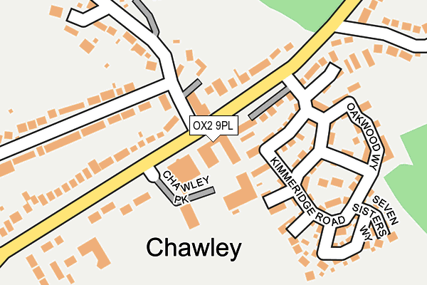
OX2 9PL is located in the Cumnor electoral ward, within the local authority district of Vale of White Horse and the English Parliamentary constituency of Oxford West and Abingdon. The Sub Integrated Care Board (ICB) Location is NHS Buckinghamshire, Oxfordshire and Berkshire West ICB - 10Q and the police force is Thames Valley. This postcode has been in use since January 1980.


GetTheData
Source: OS OpenMap – Local (Ordnance Survey)
Source: OS VectorMap District (Ordnance Survey)
Licence: Open Government Licence (requires attribution)
| Easting | 447160 |
| Northing | 204392 |
| Latitude | 51.736265 |
| Longitude | -1.318448 |
GetTheData
Source: Open Postcode Geo
Licence: Open Government Licence
| Country | England |
| Postcode District | OX2 |
| ➜ OX2 open data dashboard ➜ See where OX2 is on a map ➜ Where is Chawley? | |
GetTheData
Source: Land Registry Price Paid Data
Licence: Open Government Licence
Elevation or altitude of OX2 9PL as distance above sea level:
| Metres | Feet | |
|---|---|---|
| Elevation | 130m | 427ft |
Elevation is measured from the approximate centre of the postcode, to the nearest point on an OS contour line from OS Terrain 50, which has contour spacing of ten vertical metres.
➜ How high above sea level am I? Find the elevation of your current position using your device's GPS.
GetTheData
Source: Open Postcode Elevation
Licence: Open Government Licence
| Ward | Cumnor |
| Constituency | Oxford West And Abingdon |
GetTheData
Source: ONS Postcode Database
Licence: Open Government Licence
| February 2023 | Vehicle crime | On or near Norreys Road | 312m |
| October 2022 | Vehicle crime | On or near Norreys Road | 312m |
| September 2022 | Anti-social behaviour | On or near Norreys Road | 312m |
| ➜ Get more crime data in our Crime section | |||
GetTheData
Source: data.police.uk
Licence: Open Government Licence
| Chawley Lane (Cumnor Hill) | Cumnor Hill | 33m |
| Chawley Lane (Cumnor Hill) | Cumnor Hill | 45m |
| Cumnor Hill Top (Cumnor Hill) | Cumnor Hill | 220m |
| Colegrove Down (Cumnor Hill) | Cumnor Hill | 258m |
| Oxford Road | Cumnor | 349m |
| Oxford Station | 3.8km |
GetTheData
Source: NaPTAN
Licence: Open Government Licence
GetTheData
Source: ONS Postcode Database
Licence: Open Government Licence


➜ Get more ratings from the Food Standards Agency
GetTheData
Source: Food Standards Agency
Licence: FSA terms & conditions
| Last Collection | |||
|---|---|---|---|
| Location | Mon-Fri | Sat | Distance |
| Chawley Lane | 17:00 | 10:00 | 77m |
| Hids Copse Road | 17:00 | 11:30 | 842m |
| Cumnor School | 17:00 | 10:00 | 913m |
GetTheData
Source: Dracos
Licence: Creative Commons Attribution-ShareAlike
| Facility | Distance |
|---|---|
| Cumnor C Of E Primary School Oxford Road, Cumnor, Oxford Grass Pitches | 840m |
| Cumnor Cricket Club Park Field, Cumnor, Oxford Grass Pitches | 1.2km |
| Matthew Arnold School Arnolds Way, Oxford Sports Hall, Grass Pitches, Artificial Grass Pitch | 1.2km |
GetTheData
Source: Active Places
Licence: Open Government Licence
| School | Phase of Education | Distance |
|---|---|---|
| Cumnor Church of England School (Voluntary Controlled) Oxford Road, Cumnor, Oxford, OX2 9PQ | Primary | 849m |
| Matthew Arnold School Arnolds Way, Oxford, OX2 9JE | Secondary | 1.3km |
| Botley School Elms Road, Botley, Oxford, OX2 9JZ | Primary | 2.4km |
GetTheData
Source: Edubase
Licence: Open Government Licence
The below table lists the International Territorial Level (ITL) codes (formerly Nomenclature of Territorial Units for Statistics (NUTS) codes) and Local Administrative Units (LAU) codes for OX2 9PL:
| ITL 1 Code | Name |
|---|---|
| TLJ | South East (England) |
| ITL 2 Code | Name |
| TLJ1 | Berkshire, Buckinghamshire and Oxfordshire |
| ITL 3 Code | Name |
| TLJ14 | Oxfordshire CC |
| LAU 1 Code | Name |
| E07000180 | Vale of White Horse |
GetTheData
Source: ONS Postcode Directory
Licence: Open Government Licence
The below table lists the Census Output Area (OA), Lower Layer Super Output Area (LSOA), and Middle Layer Super Output Area (MSOA) for OX2 9PL:
| Code | Name | |
|---|---|---|
| OA | E00146228 | |
| LSOA | E01028710 | Vale of White Horse 001C |
| MSOA | E02005978 | Vale of White Horse 001 |
GetTheData
Source: ONS Postcode Directory
Licence: Open Government Licence
| OX2 9PH | Cumnor Hill | 128m |
| OX2 9PJ | Cumnor Hill | 146m |
| OX2 9RQ | Kimmeridge Road | 146m |
| OX2 9PT | Norreys Road | 165m |
| OX2 9PX | Chawley Lane | 207m |
| OX2 9RF | Kimmeridge Road | 210m |
| OX2 9RG | Cumnor Place | 252m |
| OX2 9RW | Oakwood Way | 253m |
| OX2 9RX | Seven Sisters Way | 255m |
| OX2 9PG | Oxford Road | 397m |
GetTheData
Source: Open Postcode Geo; Land Registry Price Paid Data
Licence: Open Government Licence