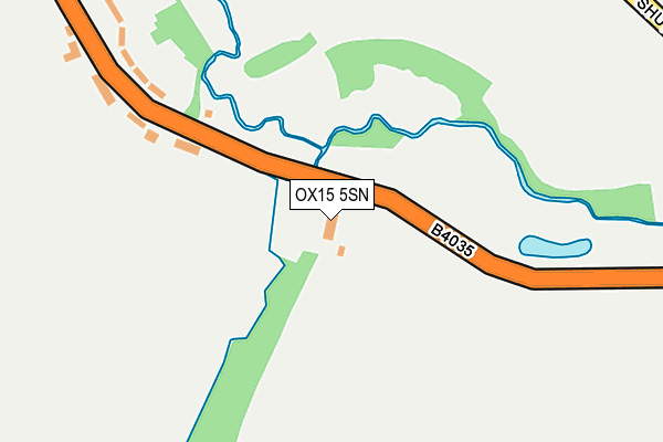
OX15 5SN is located in the Cropredy, Sibfords and Wroxton electoral ward, within the local authority district of Cherwell and the English Parliamentary constituency of Banbury. The Sub Integrated Care Board (ICB) Location is NHS Buckinghamshire, Oxfordshire and Berkshire West ICB - 10Q and the police force is Thames Valley. This postcode has been in use since January 1980.


GetTheData
Source: OS OpenMap – Local (Ordnance Survey)
Source: OS VectorMap District (Ordnance Survey)
Licence: Open Government Licence (requires attribution)
| Easting | 439833 |
| Northing | 237234 |
| Latitude | 52.032091 |
| Longitude | -1.420783 |
GetTheData
Source: Open Postcode Geo
Licence: Open Government Licence
| Country | England |
| Postcode District | OX15 |
| ➜ OX15 open data dashboard ➜ See where OX15 is on a map ➜ Where is Tadmarton? | |
GetTheData
Source: Land Registry Price Paid Data
Licence: Open Government Licence
Elevation or altitude of OX15 5SN as distance above sea level:
| Metres | Feet | |
|---|---|---|
| Elevation | 120m | 394ft |
Elevation is measured from the approximate centre of the postcode, to the nearest point on an OS contour line from OS Terrain 50, which has contour spacing of ten vertical metres.
➜ How high above sea level am I? Find the elevation of your current position using your device's GPS.
GetTheData
Source: Open Postcode Elevation
Licence: Open Government Licence
| Ward | Cropredy, Sibfords And Wroxton |
| Constituency | Banbury |
GetTheData
Source: ONS Postcode Database
Licence: Open Government Licence
| June 2022 | Violence and sexual offences | On or near B4035 | 56m |
| May 2022 | Violence and sexual offences | On or near B4035 | 56m |
| March 2022 | Other theft | On or near B4035 | 56m |
| ➜ Get more crime data in our Crime section | |||
GetTheData
Source: data.police.uk
Licence: Open Government Licence
| Brookfield Rise (Main Street) | Tadmarton | 336m |
| Brookfield Rise (Main Street) | Tadmarton | 341m |
| Fourways (Broughton Road) | Lower Tadmarton | 549m |
| Fourways (Broughton Road) | Lower Tadmarton | 557m |
| Church (Main Street) | Tadmarton | 809m |
GetTheData
Source: NaPTAN
Licence: Open Government Licence
| Percentage of properties with Next Generation Access | 100.0% |
| Percentage of properties with Superfast Broadband | 0.0% |
| Percentage of properties with Ultrafast Broadband | 0.0% |
| Percentage of properties with Full Fibre Broadband | 0.0% |
Superfast Broadband is between 30Mbps and 300Mbps
Ultrafast Broadband is > 300Mbps
| Percentage of properties unable to receive 2Mbps | 0.0% |
| Percentage of properties unable to receive 5Mbps | 0.0% |
| Percentage of properties unable to receive 10Mbps | 0.0% |
| Percentage of properties unable to receive 30Mbps | 100.0% |
GetTheData
Source: Ofcom
Licence: Ofcom Terms of Use (requires attribution)
GetTheData
Source: ONS Postcode Database
Licence: Open Government Licence


➜ Get more ratings from the Food Standards Agency
GetTheData
Source: Food Standards Agency
Licence: FSA terms & conditions
| Last Collection | |||
|---|---|---|---|
| Location | Mon-Fri | Sat | Distance |
| Bloxham Post Office | 17:00 | 09:30 | 3,399m |
| Sibford Ferris Post Office | 16:30 | 08:00 | 4,082m |
| Longfellow Road | 16:30 | 08:00 | 5,173m |
GetTheData
Source: Dracos
Licence: Creative Commons Attribution-ShareAlike
| Facility | Distance |
|---|---|
| Tadmarton Heath Golf Club Tadmarton Heath, Banbury Golf | 1.7km |
| Rye Hill Golf Club Milcombe, Banbury Golf | 2.1km |
| Swalcliffe Park School Trust Swalcliffe, Banbury Swimming Pool, Grass Pitches, Health and Fitness Gym, Sports Hall, Artificial Grass Pitch | 2.1km |
GetTheData
Source: Active Places
Licence: Open Government Licence
| School | Phase of Education | Distance |
|---|---|---|
| Swalcliffe Park School CIO Swalcliffe, Banbury, OX15 5EP | Not applicable | 2.1km |
| Bloxham Church of England Primary School Tadmarton Road, Bloxham, Banbury, OX15 4HP | Primary | 2.8km |
| Bishop Carpenter Church of England Primary School School Lane, North Newington, Banbury, OX15 6AQ | Primary | 3.4km |
GetTheData
Source: Edubase
Licence: Open Government Licence
The below table lists the International Territorial Level (ITL) codes (formerly Nomenclature of Territorial Units for Statistics (NUTS) codes) and Local Administrative Units (LAU) codes for OX15 5SN:
| ITL 1 Code | Name |
|---|---|
| TLJ | South East (England) |
| ITL 2 Code | Name |
| TLJ1 | Berkshire, Buckinghamshire and Oxfordshire |
| ITL 3 Code | Name |
| TLJ14 | Oxfordshire CC |
| LAU 1 Code | Name |
| E07000177 | Cherwell |
GetTheData
Source: ONS Postcode Directory
Licence: Open Government Licence
The below table lists the Census Output Area (OA), Lower Layer Super Output Area (LSOA), and Middle Layer Super Output Area (MSOA) for OX15 5SN:
| Code | Name | |
|---|---|---|
| OA | E00145224 | |
| LSOA | E01028503 | Cherwell 009D |
| MSOA | E02005929 | Cherwell 009 |
GetTheData
Source: ONS Postcode Directory
Licence: Open Government Licence
| OX15 5SL | Brookfield Rise | 250m |
| OX15 5TA | 389m | |
| OX15 5SJ | Main Road | 494m |
| OX15 5SU | 567m | |
| OX15 5SY | 576m | |
| OX15 5SQ | Main Road | 693m |
| OX15 5SH | Main Road | 697m |
| OX15 5SS | 698m | |
| OX15 5SG | 752m | |
| OX15 5TB | 1000m |
GetTheData
Source: Open Postcode Geo; Land Registry Price Paid Data
Licence: Open Government Licence