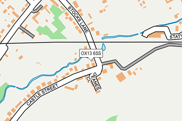
OX13 6SS lies on Stocks Lane in Steventon, Abingdon. OX13 6SS is located in the Steventon & the Hanneys electoral ward, within the local authority district of Vale of White Horse and the English Parliamentary constituency of Wantage. The Sub Integrated Care Board (ICB) Location is NHS Buckinghamshire, Oxfordshire and Berkshire West ICB - 10Q and the police force is Thames Valley. This postcode has been in use since January 1980.


GetTheData
Source: OS OpenMap – Local (Ordnance Survey)
Source: OS VectorMap District (Ordnance Survey)
Licence: Open Government Licence (requires attribution)
| Easting | 446906 |
| Northing | 191560 |
| Latitude | 51.620915 |
| Longitude | -1.323863 |
GetTheData
Source: Open Postcode Geo
Licence: Open Government Licence
| Street | Stocks Lane |
| Locality | Steventon |
| Town/City | Abingdon |
| Country | England |
| Postcode District | OX13 |
➜ See where OX13 is on a map ➜ Where is Steventon? | |
GetTheData
Source: Land Registry Price Paid Data
Licence: Open Government Licence
Elevation or altitude of OX13 6SS as distance above sea level:
| Metres | Feet | |
|---|---|---|
| Elevation | 70m | 230ft |
Elevation is measured from the approximate centre of the postcode, to the nearest point on an OS contour line from OS Terrain 50, which has contour spacing of ten vertical metres.
➜ How high above sea level am I? Find the elevation of your current position using your device's GPS.
GetTheData
Source: Open Postcode Elevation
Licence: Open Government Licence
| Ward | Steventon & The Hanneys |
| Constituency | Wantage |
GetTheData
Source: ONS Postcode Database
Licence: Open Government Licence
2013 11 OCT £640,000 |
22, STOCKS LANE, STEVENTON, ABINGDON, OX13 6SS 2005 26 AUG £245,000 |
22, STOCKS LANE, STEVENTON, ABINGDON, OX13 6SS 2002 26 JUL £230,000 |
1995 10 MAR £194,000 |
GetTheData
Source: HM Land Registry Price Paid Data
Licence: Contains HM Land Registry data © Crown copyright and database right 2025. This data is licensed under the Open Government Licence v3.0.
| Primary School (St Michaels Way) | Steventon | 276m |
| Primary School (St Michaels Way) | Steventon | 282m |
| The Cherry Tree Ph (High Street) | Steventon | 372m |
| The Cherry Tree Ph (High Street) | Steventon | 385m |
| The Causeway | Steventon | 429m |
GetTheData
Source: NaPTAN
Licence: Open Government Licence
| Percentage of properties with Next Generation Access | 100.0% |
| Percentage of properties with Superfast Broadband | 100.0% |
| Percentage of properties with Ultrafast Broadband | 80.0% |
| Percentage of properties with Full Fibre Broadband | 0.0% |
Superfast Broadband is between 30Mbps and 300Mbps
Ultrafast Broadband is > 300Mbps
| Percentage of properties unable to receive 2Mbps | 0.0% |
| Percentage of properties unable to receive 5Mbps | 0.0% |
| Percentage of properties unable to receive 10Mbps | 0.0% |
| Percentage of properties unable to receive 30Mbps | 0.0% |
GetTheData
Source: Ofcom
Licence: Ofcom Terms of Use (requires attribution)
GetTheData
Source: ONS Postcode Database
Licence: Open Government Licence

➜ Get more ratings from the Food Standards Agency
GetTheData
Source: Food Standards Agency
Licence: FSA terms & conditions
| Last Collection | |||
|---|---|---|---|
| Location | Mon-Fri | Sat | Distance |
| Church End | 16:30 | 08:15 | 306m |
| Milton Post Office | 17:00 | 08:45 | 1,611m |
| Milton Heights | 16:15 | 07:15 | 1,697m |
GetTheData
Source: Dracos
Licence: Creative Commons Attribution-ShareAlike
| Risk of OX13 6SS flooding from rivers and sea | Medium |
| ➜ OX13 6SS flood map | |
GetTheData
Source: Open Flood Risk by Postcode
Licence: Open Government Licence
The below table lists the International Territorial Level (ITL) codes (formerly Nomenclature of Territorial Units for Statistics (NUTS) codes) and Local Administrative Units (LAU) codes for OX13 6SS:
| ITL 1 Code | Name |
|---|---|
| TLJ | South East (England) |
| ITL 2 Code | Name |
| TLJ1 | Berkshire, Buckinghamshire and Oxfordshire |
| ITL 3 Code | Name |
| TLJ14 | Oxfordshire CC |
| LAU 1 Code | Name |
| E07000180 | Vale of White Horse |
GetTheData
Source: ONS Postcode Directory
Licence: Open Government Licence
The below table lists the Census Output Area (OA), Lower Layer Super Output Area (LSOA), and Middle Layer Super Output Area (MSOA) for OX13 6SS:
| Code | Name | |
|---|---|---|
| OA | E00146344 | |
| LSOA | E01028731 | Vale of White Horse 010B |
| MSOA | E02005987 | Vale of White Horse 010 |
GetTheData
Source: ONS Postcode Directory
Licence: Open Government Licence
| OX13 6SZ | Deanes Close | 60m |
| OX13 6SR | Castle Street | 122m |
| OX13 6SG | Stocks Lane | 158m |
| OX13 6SF | Franks Lane | 196m |
| OX13 6SQ | The Causeway | 282m |
| OX13 6RX | Station Yard | 303m |
| OX13 6SJ | The Causeway | 307m |
| OX13 6RU | Station Approach | 318m |
| OX13 6FB | Timsbury Court | 323m |
| OX13 6SE | The Causeway | 326m |
GetTheData
Source: Open Postcode Geo; Land Registry Price Paid Data
Licence: Open Government Licence