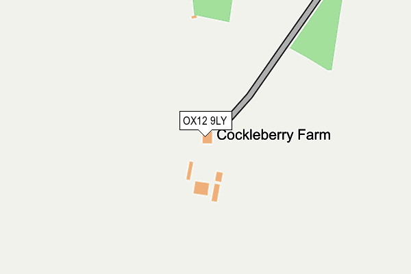
OX12 9LY is located in the Ridgeway electoral ward, within the local authority district of Vale of White Horse and the English Parliamentary constituency of Wantage. The Sub Integrated Care Board (ICB) Location is NHS Buckinghamshire, Oxfordshire and Berkshire West ICB - 10Q and the police force is Thames Valley. This postcode has been in use since January 1980.


GetTheData
Source: OS OpenMap – Local (Ordnance Survey)
Source: OS VectorMap District (Ordnance Survey)
Licence: Open Government Licence (requires attribution)
| Easting | 436870 |
| Northing | 183400 |
| Latitude | 51.548294 |
| Longitude | -1.469660 |
GetTheData
Source: Open Postcode Geo
Licence: Open Government Licence
| Country | England |
| Postcode District | OX12 |
| ➜ OX12 open data dashboard ➜ See where OX12 is on a map | |
GetTheData
Source: Land Registry Price Paid Data
Licence: Open Government Licence
Elevation or altitude of OX12 9LY as distance above sea level:
| Metres | Feet | |
|---|---|---|
| Elevation | 180m | 591ft |
Elevation is measured from the approximate centre of the postcode, to the nearest point on an OS contour line from OS Terrain 50, which has contour spacing of ten vertical metres.
➜ How high above sea level am I? Find the elevation of your current position using your device's GPS.
GetTheData
Source: Open Postcode Elevation
Licence: Open Government Licence
| Ward | Ridgeway |
| Constituency | Wantage |
GetTheData
Source: ONS Postcode Database
Licence: Open Government Licence
| Percentage of properties with Next Generation Access | 100.0% |
| Percentage of properties with Superfast Broadband | 0.0% |
| Percentage of properties with Ultrafast Broadband | 0.0% |
| Percentage of properties with Full Fibre Broadband | 0.0% |
Superfast Broadband is between 30Mbps and 300Mbps
Ultrafast Broadband is > 300Mbps
| Percentage of properties unable to receive 2Mbps | 0.0% |
| Percentage of properties unable to receive 5Mbps | 0.0% |
| Percentage of properties unable to receive 10Mbps | 50.0% |
| Percentage of properties unable to receive 30Mbps | 100.0% |
GetTheData
Source: Ofcom
Licence: Ofcom Terms of Use (requires attribution)
GetTheData
Source: ONS Postcode Database
Licence: Open Government Licence

➜ Get more ratings from the Food Standards Agency
GetTheData
Source: Food Standards Agency
Licence: FSA terms & conditions
| Last Collection | |||
|---|---|---|---|
| Location | Mon-Fri | Sat | Distance |
| Childrey | 16:15 | 09:30 | 4,105m |
| Windmill Place | 16:45 | 08:00 | 4,517m |
| Goodlake Arms | 16:45 | 07:30 | 4,731m |
GetTheData
Source: Dracos
Licence: Creative Commons Attribution-ShareAlike
| Facility | Distance |
|---|---|
| Letcombe Regis Recreation Ground Bassett Road, Letcombe Regis, Wantage Grass Pitches, Outdoor Tennis Courts | 3.2km |
| Childrey Playing Field High Street, Childrey, Wantage Grass Pitches | 4.2km |
| Challow And Childrey Cricket Club Vicarage Hill, East Challow, Wantage Grass Pitches | 4.5km |
GetTheData
Source: Active Places
Licence: Open Government Licence
| School | Phase of Education | Distance |
|---|---|---|
| The Ridgeway Church of England (C) Primary School West Street, Childrey, Wantage, OX12 9UL | Primary | 4.1km |
| St Nicholas CofE Primary School Sarajac Avenue, East Challow, Wantage, OX12 9RY | Primary | 4.6km |
| Wantage Church of England Primary School Newbury Street, Wantage, OX12 8DJ | Primary | 5.1km |
GetTheData
Source: Edubase
Licence: Open Government Licence
The below table lists the International Territorial Level (ITL) codes (formerly Nomenclature of Territorial Units for Statistics (NUTS) codes) and Local Administrative Units (LAU) codes for OX12 9LY:
| ITL 1 Code | Name |
|---|---|
| TLJ | South East (England) |
| ITL 2 Code | Name |
| TLJ1 | Berkshire, Buckinghamshire and Oxfordshire |
| ITL 3 Code | Name |
| TLJ14 | Oxfordshire CC |
| LAU 1 Code | Name |
| E07000180 | Vale of White Horse |
GetTheData
Source: ONS Postcode Directory
Licence: Open Government Licence
The below table lists the Census Output Area (OA), Lower Layer Super Output Area (LSOA), and Middle Layer Super Output Area (MSOA) for OX12 9LY:
| Code | Name | |
|---|---|---|
| OA | E00146284 | |
| LSOA | E01028720 | Vale of White Horse 016G |
| MSOA | E02006886 | Vale of White Horse 016 |
GetTheData
Source: ONS Postcode Directory
Licence: Open Government Licence
| OX12 9LU | Holborn Hill | 1643m |
| OX12 9LR | 1659m | |
| OX12 9LT | Filley Alley | 1707m |
| OX12 9LP | 1733m | |
| OX12 9LS | Knoll Close | 1805m |
| OX12 9LN | Rectory Lane | 1847m |
| OX12 9LL | 2220m | |
| OX12 8LT | Manor Road | 2745m |
| OX12 9LE | Warborough Road | 2897m |
| OX12 9LD | Warborough Road | 3015m |
GetTheData
Source: Open Postcode Geo; Land Registry Price Paid Data
Licence: Open Government Licence