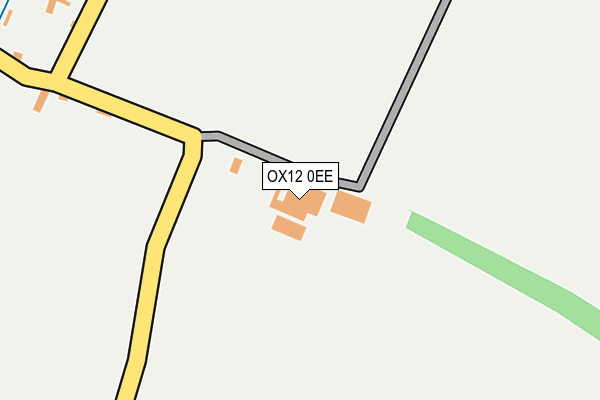
OX12 0EE is located in the Kingston Bagpuize electoral ward, within the local authority district of Vale of White Horse and the English Parliamentary constituency of Wantage. The Sub Integrated Care Board (ICB) Location is NHS Buckinghamshire, Oxfordshire and Berkshire West ICB - 10Q and the police force is Thames Valley. This postcode has been in use since January 1980.


GetTheData
Source: OS OpenMap – Local (Ordnance Survey)
Source: OS VectorMap District (Ordnance Survey)
Licence: Open Government Licence (requires attribution)
| Easting | 439466 |
| Northing | 194067 |
| Latitude | 51.644024 |
| Longitude | -1.431042 |
GetTheData
Source: Open Postcode Geo
Licence: Open Government Licence
| Country | England |
| Postcode District | OX12 |
| ➜ OX12 open data dashboard ➜ See where OX12 is on a map ➜ Where is Lyford? | |
GetTheData
Source: Land Registry Price Paid Data
Licence: Open Government Licence
Elevation or altitude of OX12 0EE as distance above sea level:
| Metres | Feet | |
|---|---|---|
| Elevation | 70m | 230ft |
Elevation is measured from the approximate centre of the postcode, to the nearest point on an OS contour line from OS Terrain 50, which has contour spacing of ten vertical metres.
➜ How high above sea level am I? Find the elevation of your current position using your device's GPS.
GetTheData
Source: Open Postcode Elevation
Licence: Open Government Licence
| Ward | Kingston Bagpuize |
| Constituency | Wantage |
GetTheData
Source: ONS Postcode Database
Licence: Open Government Licence
| March 2022 | Public order | On or near The Green | 384m |
| January 2022 | Other crime | On or near The Green | 384m |
| March 2021 | Violence and sexual offences | On or near The Green | 384m |
| ➜ Get more crime data in our Crime section | |||
GetTheData
Source: data.police.uk
Licence: Open Government Licence
| Tallys Buildings Bus Shelter (Lyford Bridge) | Lyford | 406m |
| Tallys Buildings Bus Shelter (Lyford Bridge) | Lyford | 443m |
| Green Bus Shelter (Church Street) | West Hanney | 1,606m |
GetTheData
Source: NaPTAN
Licence: Open Government Licence
| Percentage of properties with Next Generation Access | 0.0% |
| Percentage of properties with Superfast Broadband | 0.0% |
| Percentage of properties with Ultrafast Broadband | 0.0% |
| Percentage of properties with Full Fibre Broadband | 0.0% |
Superfast Broadband is between 30Mbps and 300Mbps
Ultrafast Broadband is > 300Mbps
| Percentage of properties unable to receive 2Mbps | 0.0% |
| Percentage of properties unable to receive 5Mbps | 0.0% |
| Percentage of properties unable to receive 10Mbps | 100.0% |
| Percentage of properties unable to receive 30Mbps | 100.0% |
GetTheData
Source: Ofcom
Licence: Ofcom Terms of Use (requires attribution)
GetTheData
Source: ONS Postcode Database
Licence: Open Government Licence


➜ Get more ratings from the Food Standards Agency
GetTheData
Source: Food Standards Agency
Licence: FSA terms & conditions
| Last Collection | |||
|---|---|---|---|
| Location | Mon-Fri | Sat | Distance |
| Mayfield Avenue | 16:45 | 08:00 | 3,787m |
| Grove Post Office | 18:30 | 11:30 | 3,871m |
| Cherry Tree Close | 16:30 | 08:45 | 4,008m |
GetTheData
Source: Dracos
Licence: Creative Commons Attribution-ShareAlike
| Facility | Distance |
|---|---|
| West Hanney Playing Field (Hanney Youth Fc) Brookside, East Hanney, Wantage Grass Pitches, Outdoor Tennis Courts | 2.1km |
| East Hanney Playing Field Brookside, East Hanney, Wantage Grass Pitches | 2.2km |
| The Hanney War Memorial Hall Brookside, East Hanney, Wantage Sports Hall | 2.2km |
GetTheData
Source: Active Places
Licence: Open Government Licence
| School | Phase of Education | Distance |
|---|---|---|
| St James Church of England Primary School, Hanney The Causeway, East Hanney, Wantage, OX12 0JN | Primary | 2km |
| Grove Church of England School North Drive, Grove, Wantage, OX12 7PW | Primary | 3.6km |
| Millbrook Primary School School Lane, Grove, Wantage, OX12 7LB | Primary | 3.8km |
GetTheData
Source: Edubase
Licence: Open Government Licence
The below table lists the International Territorial Level (ITL) codes (formerly Nomenclature of Territorial Units for Statistics (NUTS) codes) and Local Administrative Units (LAU) codes for OX12 0EE:
| ITL 1 Code | Name |
|---|---|
| TLJ | South East (England) |
| ITL 2 Code | Name |
| TLJ1 | Berkshire, Buckinghamshire and Oxfordshire |
| ITL 3 Code | Name |
| TLJ14 | Oxfordshire CC |
| LAU 1 Code | Name |
| E07000180 | Vale of White Horse |
GetTheData
Source: ONS Postcode Directory
Licence: Open Government Licence
The below table lists the Census Output Area (OA), Lower Layer Super Output Area (LSOA), and Middle Layer Super Output Area (MSOA) for OX12 0EE:
| Code | Name | |
|---|---|---|
| OA | E00146317 | |
| LSOA | E01028726 | Vale of White Horse 007A |
| MSOA | E02005984 | Vale of White Horse 007 |
GetTheData
Source: ONS Postcode Directory
Licence: Open Government Licence
| OX12 0EF | 314m | |
| OX12 0EQ | 410m | |
| OX12 0EG | 456m | |
| OX12 0LL | Townsend | 1318m |
| OX12 0LJ | The Meads | 1355m |
| OX12 0FJ | Elderberry Close | 1431m |
| OX12 0LH | Main Street | 1466m |
| OX12 0LQ | North Green | 1480m |
| OX12 0EN | 1489m | |
| OX12 0EU | The Green | 1510m |
GetTheData
Source: Open Postcode Geo; Land Registry Price Paid Data
Licence: Open Government Licence