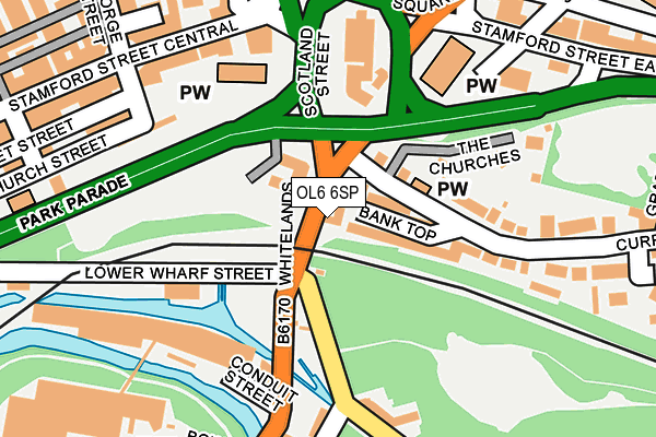
OL6 6SP is located in the Ashton St Michael's electoral ward, within the metropolitan district of Tameside and the English Parliamentary constituency of Ashton-under-Lyne. The Sub Integrated Care Board (ICB) Location is NHS Greater Manchester ICB - 01Y and the police force is Greater Manchester. This postcode has been in use since June 2009.


GetTheData
Source: OS OpenMap – Local (Ordnance Survey)
Source: OS VectorMap District (Ordnance Survey)
Licence: Open Government Licence (requires attribution)
| Easting | 394220 |
| Northing | 398863 |
| Latitude | 53.486449 |
| Longitude | -2.088575 |
GetTheData
Source: Open Postcode Geo
Licence: Open Government Licence
| Country | England |
| Postcode District | OL6 |
| ➜ OL6 open data dashboard ➜ See where OL6 is on a map ➜ Where is Ashton-under-Lyne? | |
GetTheData
Source: Land Registry Price Paid Data
Licence: Open Government Licence
Elevation or altitude of OL6 6SP as distance above sea level:
| Metres | Feet | |
|---|---|---|
| Elevation | 110m | 361ft |
Elevation is measured from the approximate centre of the postcode, to the nearest point on an OS contour line from OS Terrain 50, which has contour spacing of ten vertical metres.
➜ How high above sea level am I? Find the elevation of your current position using your device's GPS.
GetTheData
Source: Open Postcode Elevation
Licence: Open Government Licence
| Ward | Ashton St Michael's |
| Constituency | Ashton-under-lyne |
GetTheData
Source: ONS Postcode Database
Licence: Open Government Licence
| April 2021 | Violence and sexual offences | On or near Grafton Street | 341m |
| ➜ Get more crime data in our Crime section | |||
GetTheData
Source: data.police.uk
Licence: Open Government Licence
| Stamford St/Old Square (Stamford St) | Ashton Under Lyne | 206m |
| Whitelands/Bow St (Crescent Rd) | Dukinfield | 257m |
| Whitelands/Bow St (Crescent Rd) | Dukinfield | 267m |
| Park Parade/Shaw St (Park Parade) | Cockbrook | 296m |
| Old Cross St/Mulberry St (Old Cross St) | Ashton Under Lyne | 305m |
| Ashton-under-lyne (Manchester Metrolink) (Wellington Rd) | Ashton Under Lyne | 761m |
| Ashton West (Manchester Metrolink) (Lord Sheldon Way) | Ashton Moss | 1,465m |
| Ashton-under-Lyne Station | 0.7km |
| Stalybridge Station | 1.7km |
| Guide Bridge Station | 2.1km |
GetTheData
Source: NaPTAN
Licence: Open Government Licence
GetTheData
Source: ONS Postcode Database
Licence: Open Government Licence


➜ Get more ratings from the Food Standards Agency
GetTheData
Source: Food Standards Agency
Licence: FSA terms & conditions
| Last Collection | |||
|---|---|---|---|
| Location | Mon-Fri | Sat | Distance |
| Grafton Street | 17:30 | 11:25 | 360m |
| Ashton Delivery Office | 19:00 | 514m | |
| Crescent Road | 17:30 | 11:40 | 701m |
GetTheData
Source: Dracos
Licence: Creative Commons Attribution-ShareAlike
| Facility | Distance |
|---|---|
| Crossfit Tameside (Closed) Lower Wharf Street, Ashton-under-lyne Sports Hall | 154m |
| Tameside College Beaufort Road, Ashton-under-lyne Health and Fitness Gym, Sports Hall | 544m |
| Lyndhurst Primary School Hill Street, Dukinfield Grass Pitches | 610m |
GetTheData
Source: Active Places
Licence: Open Government Licence
| School | Phase of Education | Distance |
|---|---|---|
| Parochial CofE Primary and Nursery School, Ashton-under-Lyne Keppel Street, Ashton-under-Lyne, OL6 6NN | Primary | 367m |
| The Heys Primary School Whiteacre Road, Ashton-under-Lyne, OL6 9NS | Primary | 534m |
| Tameside College Beaufort Road, Ashton-under-Lyne, OL6 6NX | 16 plus | 544m |
GetTheData
Source: Edubase
Licence: Open Government Licence
The below table lists the International Territorial Level (ITL) codes (formerly Nomenclature of Territorial Units for Statistics (NUTS) codes) and Local Administrative Units (LAU) codes for OL6 6SP:
| ITL 1 Code | Name |
|---|---|
| TLD | North West (England) |
| ITL 2 Code | Name |
| TLD3 | Greater Manchester |
| ITL 3 Code | Name |
| TLD35 | Greater Manchester South East |
| LAU 1 Code | Name |
| E08000008 | Tameside |
GetTheData
Source: ONS Postcode Directory
Licence: Open Government Licence
The below table lists the Census Output Area (OA), Lower Layer Super Output Area (LSOA), and Middle Layer Super Output Area (MSOA) for OL6 6SP:
| Code | Name | |
|---|---|---|
| OA | E00030101 | |
| LSOA | E01005943 | Tameside 007C |
| MSOA | E02001235 | Tameside 007 |
GetTheData
Source: ONS Postcode Directory
Licence: Open Government Licence
| OL6 6TA | Bank Top | 52m |
| OL6 6TJ | The Churches | 164m |
| OL6 6UN | Whitelands Road | 182m |
| OL6 6UW | Minerva Road | 187m |
| OL6 6XJ | Stamford Street Central | 194m |
| OL6 6UL | Corner Street | 196m |
| OL6 6UP | Whitelands Terrace | 207m |
| OL6 6TD | Thornfield Terrace | 207m |
| OL6 6LE | St Michaels Square | 217m |
| OL6 6XE | Church Street | 221m |
GetTheData
Source: Open Postcode Geo; Land Registry Price Paid Data
Licence: Open Government Licence