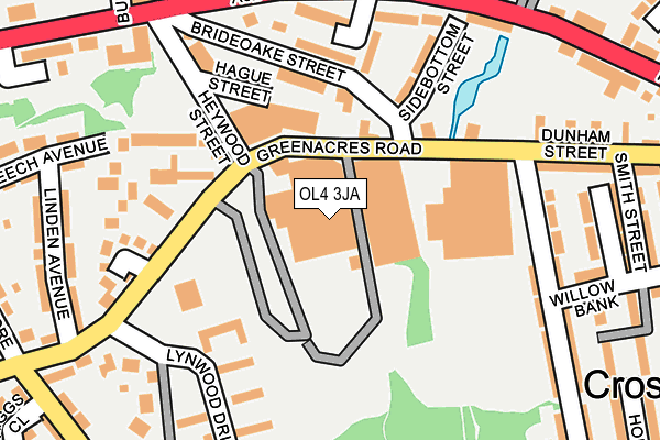
OL4 3JA is located in the Waterhead electoral ward, within the metropolitan district of Oldham and the English Parliamentary constituency of Oldham East and Saddleworth. The Sub Integrated Care Board (ICB) Location is NHS Greater Manchester ICB - 00Y and the police force is Greater Manchester. This postcode has been in use since January 1980.


GetTheData
Source: OS OpenMap – Local (Ordnance Survey)
Source: OS VectorMap District (Ordnance Survey)
Licence: Open Government Licence (requires attribution)
| Easting | 395157 |
| Northing | 405683 |
| Latitude | 53.547759 |
| Longitude | -2.074562 |
GetTheData
Source: Open Postcode Geo
Licence: Open Government Licence
| Country | England |
| Postcode District | OL4 |
| ➜ OL4 open data dashboard ➜ See where OL4 is on a map ➜ Where is Oldham? | |
GetTheData
Source: Land Registry Price Paid Data
Licence: Open Government Licence
Elevation or altitude of OL4 3JA as distance above sea level:
| Metres | Feet | |
|---|---|---|
| Elevation | 210m | 689ft |
Elevation is measured from the approximate centre of the postcode, to the nearest point on an OS contour line from OS Terrain 50, which has contour spacing of ten vertical metres.
➜ How high above sea level am I? Find the elevation of your current position using your device's GPS.
GetTheData
Source: Open Postcode Elevation
Licence: Open Government Licence
| Ward | Waterhead |
| Constituency | Oldham East And Saddleworth |
GetTheData
Source: ONS Postcode Database
Licence: Open Government Licence
| Greenacres Rd/Bulls Head (Greenacres Rd) | Waterhead | 91m |
| Greenacres Rd/Bulls Head (Greenacres Rd) | Waterhead | 112m |
| Greenacres Rd/Cotton Tree Cl (Greenacres Rd) | Top Of Moor | 173m |
| Greenacres Rd/Cotton Tree Cl (Greenacres Rd) | Top Of Moor | 180m |
| Huddersfield Rd/Church St East (Huddersfield Rd) | Waterhead | 211m |
| Greenfield Station | 4.1km |
| Mossley (Manchester) Station | 4.3km |
GetTheData
Source: NaPTAN
Licence: Open Government Licence
GetTheData
Source: ONS Postcode Database
Licence: Open Government Licence


➜ Get more ratings from the Food Standards Agency
GetTheData
Source: Food Standards Agency
Licence: FSA terms & conditions
| Last Collection | |||
|---|---|---|---|
| Location | Mon-Fri | Sat | Distance |
| Cooper Street | 16:55 | 11:20 | 862m |
| Burnley Street | 17:45 | 11:10 | 871m |
| 50 Spring Street | 17:40 | 12:15 | 908m |
GetTheData
Source: Dracos
Licence: Creative Commons Attribution-ShareAlike
| Facility | Distance |
|---|---|
| Waterhead Academy Huddersfield Road, Waterhead, Oldham Health and Fitness Gym, Sports Hall, Artificial Grass Pitch, Studio | 333m |
| Waterhead Park Peach Road, Oldham Grass Pitches, Outdoor Tennis Courts | 444m |
| Hey With Zion School Rowland Way, Lees, Oldham Grass Pitches | 612m |
GetTheData
Source: Active Places
Licence: Open Government Licence
| School | Phase of Education | Distance |
|---|---|---|
| Waterhead Academy Huddersfield Road, Oldham, OL4 3NY | Secondary | 409m |
| Hey-with-Zion Primary School Rowland Way, Lees, Oldham, OL4 3LQ | Primary | 612m |
| St Edwards Roman Catholic Primary, a Voluntary Academy Rowland Way, Lees, Oldham, OL4 3LQ | Primary | 672m |
GetTheData
Source: Edubase
Licence: Open Government Licence
The below table lists the International Territorial Level (ITL) codes (formerly Nomenclature of Territorial Units for Statistics (NUTS) codes) and Local Administrative Units (LAU) codes for OL4 3JA:
| ITL 1 Code | Name |
|---|---|
| TLD | North West (England) |
| ITL 2 Code | Name |
| TLD3 | Greater Manchester |
| ITL 3 Code | Name |
| TLD37 | Greater Manchester North East |
| LAU 1 Code | Name |
| E08000004 | Oldham |
GetTheData
Source: ONS Postcode Directory
Licence: Open Government Licence
The below table lists the Census Output Area (OA), Lower Layer Super Output Area (LSOA), and Middle Layer Super Output Area (MSOA) for OL4 3JA:
| Code | Name | |
|---|---|---|
| OA | E00027612 | |
| LSOA | E01005449 | Oldham 012B |
| MSOA | E02001109 | Oldham 012 |
GetTheData
Source: ONS Postcode Directory
Licence: Open Government Licence
| OL4 2TD | Sidebottom Street | 139m |
| OL4 2UY | Watergate Milne Court | 152m |
| OL4 2TA | Leach Walk | 154m |
| OL4 2HB | Brideoak Street | 165m |
| OL4 2TB | Grove Terrace | 172m |
| OL4 2UZ | Watergate Milne Court | 187m |
| OL4 2HD | Huddersfield Road | 192m |
| OL4 3EZ | Lynwood Drive | 207m |
| OL4 3NW | Larch Grove | 207m |
| OL4 2EP | Cotton Tree Close | 209m |
GetTheData
Source: Open Postcode Geo; Land Registry Price Paid Data
Licence: Open Government Licence