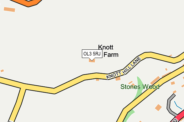
OL3 5RJ lies on Knott Hill Lane in Delph, Oldham. OL3 5RJ is located in the Saddleworth North electoral ward, within the metropolitan district of Oldham and the English Parliamentary constituency of Oldham East and Saddleworth. The Sub Integrated Care Board (ICB) Location is NHS Greater Manchester ICB - 00Y and the police force is Greater Manchester. This postcode has been in use since January 1980.


GetTheData
Source: OS OpenMap – Local (Ordnance Survey)
Source: OS VectorMap District (Ordnance Survey)
Licence: Open Government Licence (requires attribution)
| Easting | 398179 |
| Northing | 407498 |
| Latitude | 53.564093 |
| Longitude | -2.028965 |
GetTheData
Source: Open Postcode Geo
Licence: Open Government Licence
| Street | Knott Hill Lane |
| Locality | Delph |
| Town/City | Oldham |
| Country | England |
| Postcode District | OL3 |
| ➜ OL3 open data dashboard ➜ See where OL3 is on a map | |
GetTheData
Source: Land Registry Price Paid Data
Licence: Open Government Licence
Elevation or altitude of OL3 5RJ as distance above sea level:
| Metres | Feet | |
|---|---|---|
| Elevation | 300m | 984ft |
Elevation is measured from the approximate centre of the postcode, to the nearest point on an OS contour line from OS Terrain 50, which has contour spacing of ten vertical metres.
➜ How high above sea level am I? Find the elevation of your current position using your device's GPS.
GetTheData
Source: Open Postcode Elevation
Licence: Open Government Licence
| Ward | Saddleworth North |
| Constituency | Oldham East And Saddleworth |
GetTheData
Source: ONS Postcode Database
Licence: Open Government Licence
| Oldham Rd/Stoneswood (Oldham Rd) | Delph | 336m |
| Oldham Rd/Stoneswood (Oldham Rd) | Delph | 375m |
| Delph New Rd/Oakdale Mill (Delph New Rd) | Delph | 473m |
| Oldham Rd/Delph Cross Roads (Oldham Rd) | Delph | 482m |
| Delph New Rd/Oakdale Mill (Delph New Rd) | Delph | 487m |
| Greenfield Station | 3km |
GetTheData
Source: NaPTAN
Licence: Open Government Licence
| Percentage of properties with Next Generation Access | 100.0% |
| Percentage of properties with Superfast Broadband | 28.6% |
| Percentage of properties with Ultrafast Broadband | 0.0% |
| Percentage of properties with Full Fibre Broadband | 0.0% |
Superfast Broadband is between 30Mbps and 300Mbps
Ultrafast Broadband is > 300Mbps
| Percentage of properties unable to receive 2Mbps | 0.0% |
| Percentage of properties unable to receive 5Mbps | 0.0% |
| Percentage of properties unable to receive 10Mbps | 0.0% |
| Percentage of properties unable to receive 30Mbps | 71.4% |
GetTheData
Source: Ofcom
Licence: Ofcom Terms of Use (requires attribution)
GetTheData
Source: ONS Postcode Database
Licence: Open Government Licence


➜ Get more ratings from the Food Standards Agency
GetTheData
Source: Food Standards Agency
Licence: FSA terms & conditions
| Last Collection | |||
|---|---|---|---|
| Location | Mon-Fri | Sat | Distance |
| New Delph | 16:15 | 11:15 | 509m |
| Delph P.o. | 17:00 | 12:00 | 535m |
| Delph Lane | 17:30 | 12:05 | 979m |
GetTheData
Source: Dracos
Licence: Creative Commons Attribution-ShareAlike
| Facility | Distance |
|---|---|
| Delph And Dobcross Cricket Club Ainsbrook Avenue, Delph, Oldham Grass Pitches | 837m |
| Woolpack Dobcross New Road, Dobcross, Oldham Grass Pitches | 1.5km |
| Friarmere Cricket Club Denshaw Road, Delph Grass Pitches | 1.6km |
GetTheData
Source: Active Places
Licence: Open Government Licence
| School | Phase of Education | Distance |
|---|---|---|
| Delph Primary School Denshaw Road, Delph, Oldham, OL3 5HN | Primary | 607m |
| Holy Trinity CofE Dobcross Primary School Delph New Road, Dobcross, Oldham, OL3 5BP | Primary | 1.2km |
| Saddleworth School Huddersfield Road, Diggle, Oldham, OL3 5NU | Secondary | 2.2km |
GetTheData
Source: Edubase
Licence: Open Government Licence
The below table lists the International Territorial Level (ITL) codes (formerly Nomenclature of Territorial Units for Statistics (NUTS) codes) and Local Administrative Units (LAU) codes for OL3 5RJ:
| ITL 1 Code | Name |
|---|---|
| TLD | North West (England) |
| ITL 2 Code | Name |
| TLD3 | Greater Manchester |
| ITL 3 Code | Name |
| TLD37 | Greater Manchester North East |
| LAU 1 Code | Name |
| E08000004 | Oldham |
GetTheData
Source: ONS Postcode Directory
Licence: Open Government Licence
The below table lists the Census Output Area (OA), Lower Layer Super Output Area (LSOA), and Middle Layer Super Output Area (MSOA) for OL3 5RJ:
| Code | Name | |
|---|---|---|
| OA | E00027424 | |
| LSOA | E01005416 | Oldham 013C |
| MSOA | E02001110 | Oldham 013 |
GetTheData
Source: ONS Postcode Directory
Licence: Open Government Licence
| OL3 5DZ | Stoneswood Road | 254m |
| OL3 5EB | Oldham Road | 348m |
| OL3 5DS | Grains Road | 380m |
| OL3 5DY | Stoneswood Road | 428m |
| OL3 5RG | Knarr Cottages | 443m |
| OL3 5DR | Church Street | 454m |
| OL3 5ED | Rose Hill | 460m |
| OL3 5DX | Woodhouse Knowl | 461m |
| OL3 5EP | Green Lane | 470m |
| OL3 5EA | Lower Stones | 472m |
GetTheData
Source: Open Postcode Geo; Land Registry Price Paid Data
Licence: Open Government Licence