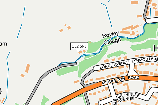
OL2 5NJ is located in the Royton North electoral ward, within the metropolitan district of Oldham and the English Parliamentary constituency of Oldham West and Royton. The Sub Integrated Care Board (ICB) Location is NHS Greater Manchester ICB - 00Y and the police force is Greater Manchester. This postcode has been in use since January 1980.


GetTheData
Source: OS OpenMap – Local (Ordnance Survey)
Source: OS VectorMap District (Ordnance Survey)
Licence: Open Government Licence (requires attribution)
| Easting | 390811 |
| Northing | 407471 |
| Latitude | 53.563771 |
| Longitude | -2.140205 |
GetTheData
Source: Open Postcode Geo
Licence: Open Government Licence
| Country | England |
| Postcode District | OL2 |
| ➜ OL2 open data dashboard ➜ See where OL2 is on a map ➜ Where is Royton? | |
GetTheData
Source: Land Registry Price Paid Data
Licence: Open Government Licence
Elevation or altitude of OL2 5NJ as distance above sea level:
| Metres | Feet | |
|---|---|---|
| Elevation | 130m | 427ft |
Elevation is measured from the approximate centre of the postcode, to the nearest point on an OS contour line from OS Terrain 50, which has contour spacing of ten vertical metres.
➜ How high above sea level am I? Find the elevation of your current position using your device's GPS.
GetTheData
Source: Open Postcode Elevation
Licence: Open Government Licence
| Ward | Royton North |
| Constituency | Oldham West And Royton |
GetTheData
Source: ONS Postcode Database
Licence: Open Government Licence
| Middleton Rd/Stottfield (Middleton Rd) | Royley | 191m |
| Middleton Rd/Stottfield (Middleton Rd) | Royley | 223m |
| Streetbridge Rd/Bridleway (Streetbridge) | Street Bridge | 340m |
| Lea View/Middleton Rd (Sbnd) (Lea View) | Royton | 360m |
| Streetbridge Rd/Bridleway (Streetbridge) | Street Bridge | 361m |
| Mills Hill (Manchester) Station | 2.5km |
| Castleton (Manchester) Station | 4km |
| Moston Station | 4.9km |
GetTheData
Source: NaPTAN
Licence: Open Government Licence
| Percentage of properties with Next Generation Access | 100.0% |
| Percentage of properties with Superfast Broadband | 100.0% |
| Percentage of properties with Ultrafast Broadband | 0.0% |
| Percentage of properties with Full Fibre Broadband | 0.0% |
Superfast Broadband is between 30Mbps and 300Mbps
Ultrafast Broadband is > 300Mbps
| Percentage of properties unable to receive 2Mbps | 0.0% |
| Percentage of properties unable to receive 5Mbps | 0.0% |
| Percentage of properties unable to receive 10Mbps | 0.0% |
| Percentage of properties unable to receive 30Mbps | 0.0% |
GetTheData
Source: Ofcom
Licence: Ofcom Terms of Use (requires attribution)
GetTheData
Source: ONS Postcode Database
Licence: Open Government Licence


➜ Get more ratings from the Food Standards Agency
GetTheData
Source: Food Standards Agency
Licence: FSA terms & conditions
| Last Collection | |||
|---|---|---|---|
| Location | Mon-Fri | Sat | Distance |
| Haggate Old Post Office | 17:00 | 11:20 | 385m |
| Woodland Park | 17:30 | 11:30 | 1,457m |
| Sheepfoot Lane | 17:30 | 11:15 | 1,647m |
GetTheData
Source: Dracos
Licence: Creative Commons Attribution-ShareAlike
| Facility | Distance |
|---|---|
| Haggate Middleton Road, Royton, Oldham Grass Pitches | 357m |
| Everlast Gyms (Oldham) Elk Mill Centre Retail Park, Royton, Oldham Swimming Pool, Health and Fitness Gym, Studio | 578m |
| Royton Cricket Club Bransdale Avenue, Royton, Oldham Grass Pitches, Outdoor Tennis Courts | 762m |
GetTheData
Source: Active Places
Licence: Open Government Licence
| School | Phase of Education | Distance |
|---|---|---|
| St Paul's CofE Primary School Hindle Drive, Royton, Oldham, OL2 5LU | Primary | 613m |
| Thorp Primary School Westerdale Drive, Royton, Oldham, OL2 5TY | Primary | 827m |
| The Oldham Academy North Broadway, Royton, Oldham, OL2 5BF | Secondary | 1.1km |
GetTheData
Source: Edubase
Licence: Open Government Licence
The below table lists the International Territorial Level (ITL) codes (formerly Nomenclature of Territorial Units for Statistics (NUTS) codes) and Local Administrative Units (LAU) codes for OL2 5NJ:
| ITL 1 Code | Name |
|---|---|
| TLD | North West (England) |
| ITL 2 Code | Name |
| TLD3 | Greater Manchester |
| ITL 3 Code | Name |
| TLD37 | Greater Manchester North East |
| LAU 1 Code | Name |
| E08000004 | Oldham |
GetTheData
Source: ONS Postcode Directory
Licence: Open Government Licence
The below table lists the Census Output Area (OA), Lower Layer Super Output Area (LSOA), and Middle Layer Super Output Area (MSOA) for OL2 5NJ:
| Code | Name | |
|---|---|---|
| OA | E00027320 | |
| LSOA | E01005391 | Oldham 008A |
| MSOA | E02001105 | Oldham 008 |
GetTheData
Source: ONS Postcode Directory
Licence: Open Government Licence
| OL2 5EQ | Lorne Avenue | 146m |
| OL2 5EH | Middleton Road | 174m |
| OL2 5EE | Lynton Avenue | 220m |
| OL2 5EN | Hamilton Avenue | 234m |
| OL2 5EJ | Stottfield | 272m |
| OL2 5NH | Thorp Clough | 284m |
| OL2 5EF | Lynmouth Avenue | 284m |
| OL2 5EL | Birchinlee Avenue | 287m |
| OL2 5EB | Middleton Road | 312m |
| OL2 5HB | Alpine Drive | 359m |
GetTheData
Source: Open Postcode Geo; Land Registry Price Paid Data
Licence: Open Government Licence