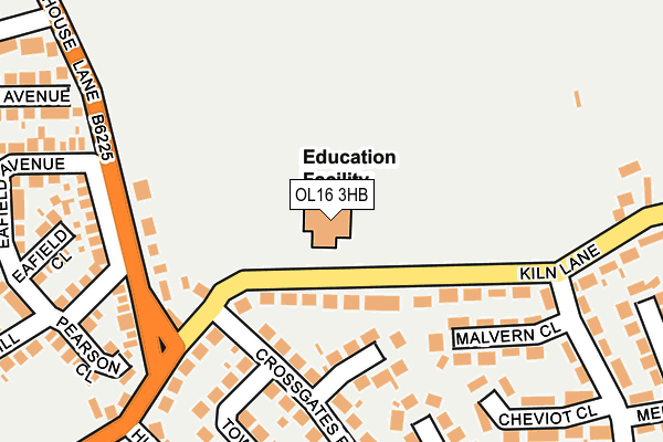
OL16 3HB is located in the Milnrow & Newhey electoral ward, within the metropolitan district of Rochdale and the English Parliamentary constituency of Rochdale. The Sub Integrated Care Board (ICB) Location is NHS Greater Manchester ICB - 01D and the police force is Greater Manchester. This postcode has been in use since January 1980.


GetTheData
Source: OS OpenMap – Local (Ordnance Survey)
Source: OS VectorMap District (Ordnance Survey)
Licence: Open Government Licence (requires attribution)
| Easting | 393053 |
| Northing | 413180 |
| Latitude | 53.615120 |
| Longitude | -2.106485 |
GetTheData
Source: Open Postcode Geo
Licence: Open Government Licence
| Country | England |
| Postcode District | OL16 |
| ➜ OL16 open data dashboard ➜ See where OL16 is on a map ➜ Where is Milnrow? | |
GetTheData
Source: Land Registry Price Paid Data
Licence: Open Government Licence
Elevation or altitude of OL16 3HB as distance above sea level:
| Metres | Feet | |
|---|---|---|
| Elevation | 180m | 591ft |
Elevation is measured from the approximate centre of the postcode, to the nearest point on an OS contour line from OS Terrain 50, which has contour spacing of ten vertical metres.
➜ How high above sea level am I? Find the elevation of your current position using your device's GPS.
GetTheData
Source: Open Postcode Elevation
Licence: Open Government Licence
| Ward | Milnrow & Newhey |
| Constituency | Rochdale |
GetTheData
Source: ONS Postcode Database
Licence: Open Government Licence
| August 2021 | Violence and sexual offences | On or near Sandstone Road | 408m |
| August 2021 | Violence and sexual offences | On or near Sandstone Road | 408m |
| August 2021 | Violence and sexual offences | On or near Sandstone Road | 408m |
| ➜ Get more crime data in our Crime section | |||
GetTheData
Source: data.police.uk
Licence: Open Government Licence
| Kiln Lane (E Bnd) (Kiln Lane) | Holt Estate | 127m |
| Wildhouse Ln/Kiln Ln (Wildhouse Ln) | Holt Estate | 184m |
| Wildhouse Ln/Kiln Ln (Wildhouse Ln) | Holt Estate | 200m |
| Kiln Lane (W Bnd) (Kiln Lane) | Holt Estate | 202m |
| Hursted Rd/Kiln Ln (Hursted Rd) | Holt Estate | 260m |
| Milnrow (Manchester Metrolink) (Station Road) | Milnrow | 865m |
| Kingsway Business Park (Manchester Metrolink) (Leyfield Road) | Milnrow | 1,233m |
| Smithy Bridge Station | 2.1km |
| Rochdale Station | 3.2km |
| Littleborough Station | 3.2km |
GetTheData
Source: NaPTAN
Licence: Open Government Licence
GetTheData
Source: ONS Postcode Database
Licence: Open Government Licence


➜ Get more ratings from the Food Standards Agency
GetTheData
Source: Food Standards Agency
Licence: FSA terms & conditions
| Last Collection | |||
|---|---|---|---|
| Location | Mon-Fri | Sat | Distance |
| Derwent Drive | 17:00 | 11:00 | 1,618m |
| 128 Huddersfield Road Newhey | 16:45 | 11:00 | 1,725m |
| 19 Lakebank | 17:00 | 11:00 | 1,815m |
GetTheData
Source: Dracos
Licence: Creative Commons Attribution-ShareAlike
| Facility | Distance |
|---|---|
| The Soccer Village (Closed) Wild House Lane, Milnrow, Rochdale Artificial Grass Pitch | 547m |
| Hollingworth Academy Cornfield Street, Milnrow, Rochdale Sports Hall, Health and Fitness Gym, Grass Pitches, Studio, Artificial Grass Pitch | 703m |
| Moorhouse Academy Crossley Street, Milnrow, Rochdale Grass Pitches | 853m |
GetTheData
Source: Active Places
Licence: Open Government Licence
| School | Phase of Education | Distance |
|---|---|---|
| Crossgates Primary School Kiln Lane, Milnrow, Rochdale, OL16 3HB | Primary | 0m |
| Milnrow Parish Church of England Primary School St James Street, Milnrow, Milnrow Parish Ce Primary School, Rochdale, OL16 3JT | Primary | 459m |
| Hollingworth Academy Cornfield Street, Milnrow, Rochdale, OL16 3DR | Secondary | 751m |
GetTheData
Source: Edubase
Licence: Open Government Licence
The below table lists the International Territorial Level (ITL) codes (formerly Nomenclature of Territorial Units for Statistics (NUTS) codes) and Local Administrative Units (LAU) codes for OL16 3HB:
| ITL 1 Code | Name |
|---|---|
| TLD | North West (England) |
| ITL 2 Code | Name |
| TLD3 | Greater Manchester |
| ITL 3 Code | Name |
| TLD37 | Greater Manchester North East |
| LAU 1 Code | Name |
| E08000005 | Rochdale |
GetTheData
Source: ONS Postcode Directory
Licence: Open Government Licence
The below table lists the Census Output Area (OA), Lower Layer Super Output Area (LSOA), and Middle Layer Super Output Area (MSOA) for OL16 3HB:
| Code | Name | |
|---|---|---|
| OA | E00028147 | |
| LSOA | E01005555 | Rochdale 014A |
| MSOA | E02001145 | Rochdale 014 |
GetTheData
Source: ONS Postcode Directory
Licence: Open Government Licence
| OL16 3HA | Kiln Lane | 85m |
| OL16 3EP | Low House Close | 109m |
| OL16 3JW | Wildhouse Lane | 163m |
| OL16 3HQ | Malvern Close | 168m |
| OL16 3EW | Crossgates Road | 182m |
| OL16 3UW | Laneside Walk | 207m |
| OL16 3EN | Townley Road | 218m |
| OL16 3JN | Kiln Lane | 227m |
| OL16 3ER | Smith Hill | 232m |
| OL16 3HH | Cheviot Close | 243m |
GetTheData
Source: Open Postcode Geo; Land Registry Price Paid Data
Licence: Open Government Licence