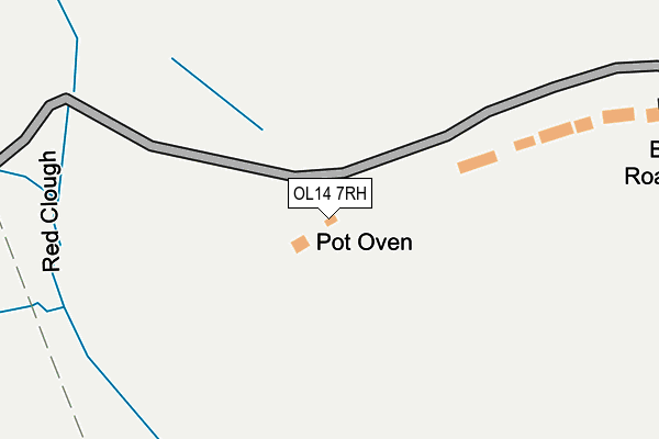
OL14 7RH lies on Foul Clough Road in Todmorden. OL14 7RH is located in the Todmorden electoral ward, within the metropolitan district of Calderdale and the English Parliamentary constituency of Calder Valley. The Sub Integrated Care Board (ICB) Location is NHS West Yorkshire ICB - 02T and the police force is West Yorkshire. This postcode has been in use since January 1980.


GetTheData
Source: OS OpenMap – Local (Ordnance Survey)
Source: OS VectorMap District (Ordnance Survey)
Licence: Open Government Licence (requires attribution)
| Easting | 392033 |
| Northing | 421850 |
| Latitude | 53.693033 |
| Longitude | -2.122129 |
GetTheData
Source: Open Postcode Geo
Licence: Open Government Licence
| Street | Foul Clough Road |
| Town/City | Todmorden |
| Country | England |
| Postcode District | OL14 |
| ➜ OL14 open data dashboard ➜ See where OL14 is on a map | |
GetTheData
Source: Land Registry Price Paid Data
Licence: Open Government Licence
Elevation or altitude of OL14 7RH as distance above sea level:
| Metres | Feet | |
|---|---|---|
| Elevation | 310m | 1,017ft |
Elevation is measured from the approximate centre of the postcode, to the nearest point on an OS contour line from OS Terrain 50, which has contour spacing of ten vertical metres.
➜ How high above sea level am I? Find the elevation of your current position using your device's GPS.
GetTheData
Source: Open Postcode Elevation
Licence: Open Government Licence
| Ward | Todmorden |
| Constituency | Calder Valley |
GetTheData
Source: ONS Postcode Database
Licence: Open Government Licence
| March 2021 | Other crime | On or near Foul Clough Road | 143m |
| ➜ Foul Clough Road crime map and outcomes | |||
GetTheData
Source: data.police.uk
Licence: Open Government Licence
| Rochdale Rd Granville Street (Rochdale Road) | Walsden | 1,209m |
| Rochdale Rd Granville Street (Rochdale Road) | Walsden | 1,220m |
| Rochdale Road Walsden Station (Rochdale Road) | Walsden | 1,231m |
| Scott Street Cricket Ground (Scott Street) | Walsden | 1,246m |
| Rochdale Road Monas Ter (Rochdale Road) | Walsden | 1,270m |
| Walsden Station | 1.2km |
| Todmorden Station | 2.7km |
GetTheData
Source: NaPTAN
Licence: Open Government Licence
| Percentage of properties with Next Generation Access | 100.0% |
| Percentage of properties with Superfast Broadband | 0.0% |
| Percentage of properties with Ultrafast Broadband | 0.0% |
| Percentage of properties with Full Fibre Broadband | 0.0% |
Superfast Broadband is between 30Mbps and 300Mbps
Ultrafast Broadband is > 300Mbps
| Percentage of properties unable to receive 2Mbps | 0.0% |
| Percentage of properties unable to receive 5Mbps | 0.0% |
| Percentage of properties unable to receive 10Mbps | 0.0% |
| Percentage of properties unable to receive 30Mbps | 100.0% |
GetTheData
Source: Ofcom
Licence: Ofcom Terms of Use (requires attribution)
GetTheData
Source: ONS Postcode Database
Licence: Open Government Licence


➜ Get more ratings from the Food Standards Agency
GetTheData
Source: Food Standards Agency
Licence: FSA terms & conditions
| Last Collection | |||
|---|---|---|---|
| Location | Mon-Fri | Sat | Distance |
| Walsden Station | 17:15 | 11:30 | 1,218m |
| Copperas | 17:15 | 11:30 | 1,366m |
| Walsden P.o. | 17:15 | 11:30 | 1,483m |
GetTheData
Source: Dracos
Licence: Creative Commons Attribution-ShareAlike
| Facility | Distance |
|---|---|
| Walsden St Peter's Ce (Vc) Primary School Playing Field Clough Mill, Rochdale Road, Todmorden Grass Pitches | 1.2km |
| Walsden Recreation Ground Scott Street, Todmorden Grass Pitches | 1.3km |
| Walsden Cricket & Bowling Club Scott Street, Todmorden Grass Pitches | 1.3km |
GetTheData
Source: Active Places
Licence: Open Government Licence
| School | Phase of Education | Distance |
|---|---|---|
| Walsden St Peter's CE (VC) Primary School Rochdale Road, Walsden, Todmorden, OL14 6RN | Primary | 1.2km |
| Shade Primary School Knowlwood Road, Shade, Todmorden, OL14 7PD | Primary | 1.8km |
| Todmorden CofE J, I & N School Burnley Road, Todmorden, OL14 7BS | Primary | 3km |
GetTheData
Source: Edubase
Licence: Open Government Licence
The below table lists the International Territorial Level (ITL) codes (formerly Nomenclature of Territorial Units for Statistics (NUTS) codes) and Local Administrative Units (LAU) codes for OL14 7RH:
| ITL 1 Code | Name |
|---|---|
| TLE | Yorkshire and The Humber |
| ITL 2 Code | Name |
| TLE4 | West Yorkshire |
| ITL 3 Code | Name |
| TLE44 | Calderdale and Kirklees |
| LAU 1 Code | Name |
| E08000033 | Calderdale |
GetTheData
Source: ONS Postcode Directory
Licence: Open Government Licence
The below table lists the Census Output Area (OA), Lower Layer Super Output Area (LSOA), and Middle Layer Super Output Area (MSOA) for OL14 7RH:
| Code | Name | |
|---|---|---|
| OA | E00054869 | |
| LSOA | E01010886 | Calderdale 022C |
| MSOA | E02002265 | Calderdale 022 |
GetTheData
Source: ONS Postcode Directory
Licence: Open Government Licence
| OL14 7RJ | Ditches | 574m |
| OL14 7RS | Ramsden Lane | 590m |
| OL14 7QP | Inchfield Road | 959m |
| OL14 7QH | Calf Hey Terrace | 1090m |
| OL14 7QQ | Fairmount | 1119m |
| OL14 7UN | Spring Bottom | 1123m |
| OL14 7UH | The Mullions | 1133m |
| OL14 7UW | Top Street | 1134m |
| OL14 7QG | Melbourne Road | 1141m |
| OL14 7QB | Fir Wood Close | 1154m |
GetTheData
Source: Open Postcode Geo; Land Registry Price Paid Data
Licence: Open Government Licence