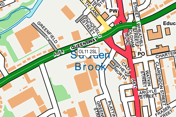
OL11 2SL is located in the Balderstone & Kirkholt electoral ward, within the metropolitan district of Rochdale and the English Parliamentary constituency of Rochdale. The Sub Integrated Care Board (ICB) Location is NHS Greater Manchester ICB - 01D and the police force is Greater Manchester. This postcode has been in use since March 1982.


GetTheData
Source: OS OpenMap – Local (Ordnance Survey)
Source: OS VectorMap District (Ordnance Survey)
Licence: Open Government Licence (requires attribution)
| Easting | 390277 |
| Northing | 411839 |
| Latitude | 53.603022 |
| Longitude | -2.148405 |
GetTheData
Source: Open Postcode Geo
Licence: Open Government Licence
| Country | England |
| Postcode District | OL11 |
| ➜ OL11 open data dashboard ➜ See where OL11 is on a map ➜ Where is Rochdale? | |
GetTheData
Source: Land Registry Price Paid Data
Licence: Open Government Licence
Elevation or altitude of OL11 2SL as distance above sea level:
| Metres | Feet | |
|---|---|---|
| Elevation | 140m | 459ft |
Elevation is measured from the approximate centre of the postcode, to the nearest point on an OS contour line from OS Terrain 50, which has contour spacing of ten vertical metres.
➜ How high above sea level am I? Find the elevation of your current position using your device's GPS.
GetTheData
Source: Open Postcode Elevation
Licence: Open Government Licence
| Ward | Balderstone & Kirkholt |
| Constituency | Rochdale |
GetTheData
Source: ONS Postcode Database
Licence: Open Government Licence
| May 2022 | Violence and sexual offences | On or near Queen Victoria Street | 273m |
| January 2022 | Violence and sexual offences | On or near Field Street | 140m |
| September 2021 | Violence and sexual offences | On or near Letchworth Avenue | 381m |
| ➜ Get more crime data in our Crime section | |||
GetTheData
Source: data.police.uk
Licence: Open Government Licence
| Queensway/Well I'th Ln (Queensway) | Stoneyfield | 66m |
| Queensway/Greenfield Ln (Queensway) | Stoneyfield | 124m |
| Queensway/Greenfield Ln (Queensway) | Stoneyfield | 140m |
| Oldham Rd/Charter St (Oldham Rd) | Lower Place | 141m |
| Oldham Rd/Kingsway (Oldham Rd) | Lower Place | 149m |
| Rochdale Railway Station (Manchester Metrolink) (Maclure Rd) | Rochdale | 974m |
| Newbold (Manchester Metrolink) (Kingsway) | Newbold | 1,432m |
| Rochdale Station | 0.9km |
| Castleton (Manchester) Station | 2.3km |
| Smithy Bridge Station | 4.1km |
GetTheData
Source: NaPTAN
Licence: Open Government Licence
GetTheData
Source: ONS Postcode Database
Licence: Open Government Licence


➜ Get more ratings from the Food Standards Agency
GetTheData
Source: Food Standards Agency
Licence: FSA terms & conditions
| Last Collection | |||
|---|---|---|---|
| Location | Mon-Fri | Sat | Distance |
| Lowerplace P.o. | 18:30 | 11:30 | 230m |
| Kingsway | 17:00 | 11:00 | 446m |
| Queensway P.o. | 17:30 | 11:30 | 537m |
GetTheData
Source: Dracos
Licence: Creative Commons Attribution-ShareAlike
| Facility | Distance |
|---|---|
| Rochdale St Marys C Of E Primary School Oldham Road, Oldham Road, Rochdale Grass Pitches | 298m |
| Kingsway Park High School (Closed) Queen Victoria Street, Rochdale Sports Hall, Health and Fitness Gym, Artificial Grass Pitch, Grass Pitches | 386m |
| Lower Place Kingsway, Rochdale Grass Pitches, Artificial Grass Pitch | 397m |
GetTheData
Source: Active Places
Licence: Open Government Licence
| School | Phase of Education | Distance |
|---|---|---|
| Lowerplace Primary School Kingsway, Rochdale, OL16 4UU | Primary | 348m |
| St Mary's Church of England Primary School, Balderstone Oldham Road, Rochdale, OL11 2HB | Primary | 351m |
| Deeplish Primary Academy Derby Street, Rochdale, OL11 1LT | Primary | 561m |
GetTheData
Source: Edubase
Licence: Open Government Licence
The below table lists the International Territorial Level (ITL) codes (formerly Nomenclature of Territorial Units for Statistics (NUTS) codes) and Local Administrative Units (LAU) codes for OL11 2SL:
| ITL 1 Code | Name |
|---|---|
| TLD | North West (England) |
| ITL 2 Code | Name |
| TLD3 | Greater Manchester |
| ITL 3 Code | Name |
| TLD37 | Greater Manchester North East |
| LAU 1 Code | Name |
| E08000005 | Rochdale |
GetTheData
Source: ONS Postcode Directory
Licence: Open Government Licence
The below table lists the Census Output Area (OA), Lower Layer Super Output Area (LSOA), and Middle Layer Super Output Area (MSOA) for OL11 2SL:
| Code | Name | |
|---|---|---|
| OA | E00027676 | |
| LSOA | E01005469 | Rochdale 012A |
| MSOA | E02001143 | Rochdale 012 |
GetTheData
Source: ONS Postcode Directory
Licence: Open Government Licence
| OL11 2JZ | Brow Street | 73m |
| OL11 2JR | Well Ith'lane | 97m |
| OL11 2ES | Sutcliffe Place | 115m |
| OL11 1BA | Schofield Street | 121m |
| OL11 2ER | Oldham Road | 133m |
| OL11 2LA | Queensway | 134m |
| OL11 2EY | May Place | 135m |
| OL11 1BB | Well Ith'lane | 145m |
| OL16 4SZ | Oldham Road | 158m |
| OL11 2EX | Burlington Street | 170m |
GetTheData
Source: Open Postcode Geo; Land Registry Price Paid Data
Licence: Open Government Licence