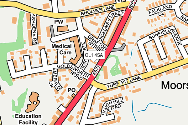
OL1 4SA is located in the St James' electoral ward, within the metropolitan district of Oldham and the English Parliamentary constituency of Oldham East and Saddleworth. The Sub Integrated Care Board (ICB) Location is NHS Greater Manchester ICB - 00Y and the police force is Greater Manchester. This postcode has been in use since January 1980.


GetTheData
Source: OS OpenMap – Local (Ordnance Survey)
Source: OS VectorMap District (Ordnance Survey)
Licence: Open Government Licence (requires attribution)
| Easting | 395164 |
| Northing | 407434 |
| Latitude | 53.563514 |
| Longitude | -2.074482 |
GetTheData
Source: Open Postcode Geo
Licence: Open Government Licence
| Country | England |
| Postcode District | OL1 |
| ➜ OL1 open data dashboard ➜ See where OL1 is on a map ➜ Where is Oldham? | |
GetTheData
Source: Land Registry Price Paid Data
Licence: Open Government Licence
Elevation or altitude of OL1 4SA as distance above sea level:
| Metres | Feet | |
|---|---|---|
| Elevation | 270m | 886ft |
Elevation is measured from the approximate centre of the postcode, to the nearest point on an OS contour line from OS Terrain 50, which has contour spacing of ten vertical metres.
➜ How high above sea level am I? Find the elevation of your current position using your device's GPS.
GetTheData
Source: Open Postcode Elevation
Licence: Open Government Licence
| Ward | St James' |
| Constituency | Oldham East And Saddleworth |
GetTheData
Source: ONS Postcode Database
Licence: Open Government Licence
| Ripponden Rd/The Moorside (Ripponden Rd) | Moorside | 14m |
| Turf Pit Ln/Ripponden Rd (Turf Pit Ln) | Moorside | 85m |
| Turf Pit La (Wbnd) (Turf Pit Ln) | Moorside | 92m |
| Ripponden Rd/Turf Pit Ln (Ripponden Rd) | Moorside | 145m |
| Ripponden Rd/Sholver Ln (Ripponden Rd) | Sholver | 195m |
| Shaw And Crompton (Manchester Metrolink) (Beal Lane) | Shaw | 1,725m |
| Greenfield Station | 4.9km |
GetTheData
Source: NaPTAN
Licence: Open Government Licence
GetTheData
Source: ONS Postcode Database
Licence: Open Government Licence


➜ Get more ratings from the Food Standards Agency
GetTheData
Source: Food Standards Agency
Licence: FSA terms & conditions
| Last Collection | |||
|---|---|---|---|
| Location | Mon-Fri | Sat | Distance |
| Royal Oldham Hospital | 17:25 | 11:15 | 226m |
| Moorside P.o. | 17:30 | 11:30 | 246m |
| Mossgate | 17:10 | 11:30 | 412m |
GetTheData
Source: Dracos
Licence: Creative Commons Attribution-ShareAlike
| Facility | Distance |
|---|---|
| Heavenly Bodies Fitness Club Ripponden Road, Oldham Health and Fitness Gym, Studio | 282m |
| Parkfield Country Club (Closed) Ripponden Road, Oldham Swimming Pool, Squash Courts | 317m |
| Moorside Cricket & Bowling Club Turf Pit Lane, Oldham Grass Pitches | 482m |
GetTheData
Source: Active Places
Licence: Open Government Licence
| School | Phase of Education | Distance |
|---|---|---|
| Hodge Clough Primary School Conduit Street, Moorside, Oldham, OL1 4JX | Primary | 231m |
| St Thomas Moorside CofE (VA) Primary School Coleridge Road, Sholver, Oldham, OL1 4RL | Primary | 411m |
| Kingsland School Whitecroft Street, Watersheddings, Oldham, OL1 4HX | Not applicable | 1.3km |
GetTheData
Source: Edubase
Licence: Open Government Licence
The below table lists the International Territorial Level (ITL) codes (formerly Nomenclature of Territorial Units for Statistics (NUTS) codes) and Local Administrative Units (LAU) codes for OL1 4SA:
| ITL 1 Code | Name |
|---|---|
| TLD | North West (England) |
| ITL 2 Code | Name |
| TLD3 | Greater Manchester |
| ITL 3 Code | Name |
| TLD37 | Greater Manchester North East |
| LAU 1 Code | Name |
| E08000004 | Oldham |
GetTheData
Source: ONS Postcode Directory
Licence: Open Government Licence
The below table lists the Census Output Area (OA), Lower Layer Super Output Area (LSOA), and Middle Layer Super Output Area (MSOA) for OL1 4SA:
| Code | Name | |
|---|---|---|
| OA | E00168605 | |
| LSOA | E01032559 | Oldham 007F |
| MSOA | E02001104 | Oldham 007 |
GetTheData
Source: ONS Postcode Directory
Licence: Open Government Licence
| OL1 4SL | Cavannah Court | 59m |
| OL1 4SD | Grafton Street | 91m |
| OL1 4TJ | Lupin Close | 102m |
| OL4 2NE | Turf Pit Lane | 105m |
| OL1 4SG | Ripponden Road | 120m |
| OL1 4SF | Dickens Street | 124m |
| OL1 4SE | Glendon Court | 125m |
| OL1 4TL | Emerald Drive | 132m |
| OL1 4SJ | Glebe Lane | 133m |
| OL4 2LW | Ripponden Road | 149m |
GetTheData
Source: Open Postcode Geo; Land Registry Price Paid Data
Licence: Open Government Licence