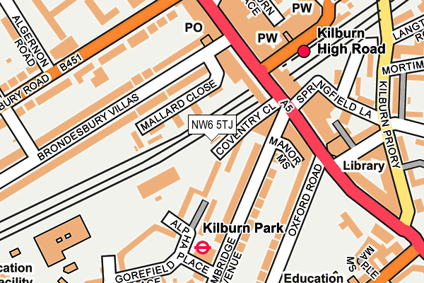
NW6 5TJ is located in the Kilburn electoral ward, within the London borough of Brent and the English Parliamentary constituency of Hampstead and Kilburn. The Sub Integrated Care Board (ICB) Location is NHS North West London ICB - W2U3Z and the police force is Metropolitan Police. This postcode has been in use since January 1980.


GetTheData
Source: OS OpenMap – Local (Ordnance Survey)
Source: OS VectorMap District (Ordnance Survey)
Licence: Open Government Licence (requires attribution)
| Easting | 525375 |
| Northing | 183498 |
| Latitude | 51.536471 |
| Longitude | -0.193711 |
GetTheData
Source: Open Postcode Geo
Licence: Open Government Licence
| Country | England |
| Postcode District | NW6 |
| ➜ NW6 open data dashboard ➜ See where NW6 is on a map ➜ Where is London? | |
GetTheData
Source: Land Registry Price Paid Data
Licence: Open Government Licence
Elevation or altitude of NW6 5TJ as distance above sea level:
| Metres | Feet | |
|---|---|---|
| Elevation | 30m | 98ft |
Elevation is measured from the approximate centre of the postcode, to the nearest point on an OS contour line from OS Terrain 50, which has contour spacing of ten vertical metres.
➜ How high above sea level am I? Find the elevation of your current position using your device's GPS.
GetTheData
Source: Open Postcode Elevation
Licence: Open Government Licence
| Ward | Kilburn |
| Constituency | Hampstead And Kilburn |
GetTheData
Source: ONS Postcode Database
Licence: Open Government Licence
| June 2022 | Anti-social behaviour | On or near Coventry Close | 52m |
| June 2022 | Burglary | On or near Coventry Close | 52m |
| June 2022 | Violence and sexual offences | On or near Coventry Close | 52m |
| ➜ Get more crime data in our Crime section | |||
GetTheData
Source: data.police.uk
Licence: Open Government Licence
| Kilburn High Road Station | Kilburn | 73m |
| Kilburn High Rd Cambridge Ave | Kilburn | 93m |
| Kilburn Park (Cambridge Avenue) | Kilburn Park | 112m |
| Brondesbury Road (Nw6) (Kilburn High Road) | Kilburn | 120m |
| Kilburn High Road Station | Kilburn | 133m |
| Kilburn Park Underground Station | Kilburn Park | 170m |
| Queen's Park Underground Station | Queen's Park | 796m |
| Maida Vale Underground Station | Maida Vale | 927m |
| West Hampstead Underground Station | West Hampstead | 1,146m |
| Kilburn Underground Station | Brondesbury | 1,357m |
| Kilburn High Road Station | 0.1km |
| Queens Park (London) Station | 0.8km |
| Brondesbury Station | 1.1km |
GetTheData
Source: NaPTAN
Licence: Open Government Licence
GetTheData
Source: ONS Postcode Database
Licence: Open Government Licence


➜ Get more ratings from the Food Standards Agency
GetTheData
Source: Food Standards Agency
Licence: FSA terms & conditions
| Last Collection | |||
|---|---|---|---|
| Location | Mon-Fri | Sat | Distance |
| Kilburn Delivery Office | 18:30 | 12:00 | 22m |
| Kilburn Post Office | 18:30 | 12:00 | 134m |
| High Road | 18:30 | 12:00 | 153m |
GetTheData
Source: Dracos
Licence: Creative Commons Attribution-ShareAlike
| Facility | Distance |
|---|---|
| Anytime Fitness (London Kilburn) Kilburn High Road, Kilburn High Road, London Health and Fitness Gym | 128m |
| Energie Fitness (Kilburn) Kilburn High Road, London Health and Fitness Gym | 133m |
| Profiles For Women (Kilburn) (Closed) Kilburn High Road, London Health and Fitness Gym, Studio | 154m |
GetTheData
Source: Active Places
Licence: Open Government Licence
| School | Phase of Education | Distance |
|---|---|---|
| St Augustine's Federated Schools: CE High School Oxford Road, London, NW6 5SN | Secondary | 260m |
| St Augustines Federated Schools: CofE Primary School Kilburn Park Road, Kilburn, London, NW6 5XA | Primary | 261m |
| St Mary's RC Primary School Canterbury Road, London, NW6 5ST | Primary | 271m |
GetTheData
Source: Edubase
Licence: Open Government Licence
The below table lists the International Territorial Level (ITL) codes (formerly Nomenclature of Territorial Units for Statistics (NUTS) codes) and Local Administrative Units (LAU) codes for NW6 5TJ:
| ITL 1 Code | Name |
|---|---|
| TLI | London |
| ITL 2 Code | Name |
| TLI7 | Outer London - West and North West |
| ITL 3 Code | Name |
| TLI72 | Brent |
| LAU 1 Code | Name |
| E09000005 | Brent |
GetTheData
Source: ONS Postcode Directory
Licence: Open Government Licence
The below table lists the Census Output Area (OA), Lower Layer Super Output Area (LSOA), and Middle Layer Super Output Area (MSOA) for NW6 5TJ:
| Code | Name | |
|---|---|---|
| OA | E00002661 | |
| LSOA | E01000550 | Brent 034B |
| MSOA | E02000126 | Brent 034 |
GetTheData
Source: ONS Postcode Directory
Licence: Open Government Licence
| NW6 6AZ | Mallard Close | 66m |
| NW6 5TE | Alpha Place | 66m |
| NW6 5AA | Cambridge Avenue | 78m |
| NW6 6AH | Brondesbury Villas | 94m |
| NW6 5FH | Bristol Walk | 108m |
| NW6 6HY | Kilburn High Road | 115m |
| NW6 5BA | Cambridge Avenue | 120m |
| NW6 6AA | Brondesbury Villas | 125m |
| NW6 5SB | Kilburn High Road | 132m |
| NW6 4HJ | Kilburn High Road | 154m |
GetTheData
Source: Open Postcode Geo; Land Registry Price Paid Data
Licence: Open Government Licence