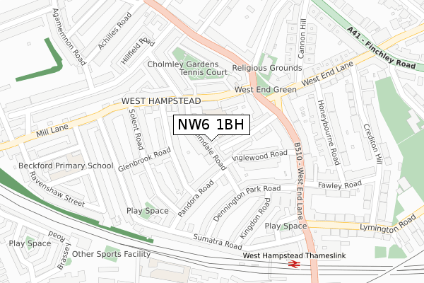
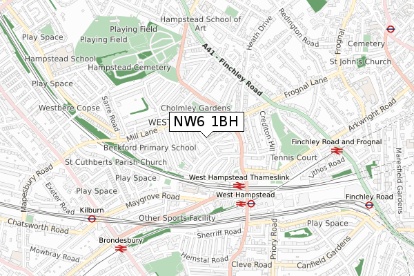
NW6 1BH lies on Holmdale Road in London. NW6 1BH is located in the West Hampstead electoral ward, within the London borough of Camden and the English Parliamentary constituency of Hampstead and Kilburn. The Sub Integrated Care Board (ICB) Location is NHS North Central London ICB - 93C and the police force is Metropolitan Police. This postcode has been in use since January 1980.


GetTheData
Source: OS Open Zoomstack (Ordnance Survey)
Licence: Open Government Licence (requires attribution)
Attribution: Contains OS data © Crown copyright and database right 2024
Source: Open Postcode Geo
Licence: Open Government Licence (requires attribution)
Attribution: Contains OS data © Crown copyright and database right 2024; Contains Royal Mail data © Royal Mail copyright and database right 2024; Source: Office for National Statistics licensed under the Open Government Licence v.3.0
| Easting | 525284 |
| Northing | 185124 |
| Latitude | 51.551104 |
| Longitude | -0.194444 |
GetTheData
Source: Open Postcode Geo
Licence: Open Government Licence
| Street | Holmdale Road |
| Town/City | London |
| Country | England |
| Postcode District | NW6 |
| ➜ NW6 open data dashboard ➜ See where NW6 is on a map ➜ Where is Hampstead? | |
GetTheData
Source: Land Registry Price Paid Data
Licence: Open Government Licence
Elevation or altitude of NW6 1BH as distance above sea level:
| Metres | Feet | |
|---|---|---|
| Elevation | 60m | 197ft |
Elevation is measured from the approximate centre of the postcode, to the nearest point on an OS contour line from OS Terrain 50, which has contour spacing of ten vertical metres.
➜ How high above sea level am I? Find the elevation of your current position using your device's GPS.
GetTheData
Source: Open Postcode Elevation
Licence: Open Government Licence
| Ward | West Hampstead |
| Constituency | Hampstead And Kilburn |
GetTheData
Source: ONS Postcode Database
Licence: Open Government Licence
| January 2024 | Anti-social behaviour | On or near Police Station | 308m |
| December 2023 | Public order | On or near Glenbrook Road | 165m |
| October 2023 | Anti-social behaviour | On or near Police Station | 308m |
| ➜ Holmdale Road crime map and outcomes | |||
GetTheData
Source: data.police.uk
Licence: Open Government Licence
| Mill Lane West Hampstead | West Hampstead | 99m |
| Fortune Green Road West Hampstead | West Hampstead | 110m |
| West Hampsteadwest End Green | West Hampstead | 178m |
| West Hampsteadwest End Green | West Hampstead | 189m |
| Solent Road (Mill Lane) | West Hampstead | 192m |
| West Hampstead Underground Station | West Hampstead | 550m |
| Kilburn Underground Station | Brondesbury | 823m |
| Finchley Road Underground Station | Finchley Road | 1,119m |
| Hampstead Underground Station | Hampstead | 1,266m |
| Swiss Cottage Underground Station | Swiss Cottage | 1,588m |
| West Hampstead Thameslink Station | 0.3km |
| West Hampstead Station | 0.5km |
| Finchley Road & Frognal Station | 0.8km |
GetTheData
Source: NaPTAN
Licence: Open Government Licence
| Percentage of properties with Next Generation Access | 100.0% |
| Percentage of properties with Superfast Broadband | 100.0% |
| Percentage of properties with Ultrafast Broadband | 100.0% |
| Percentage of properties with Full Fibre Broadband | 0.0% |
Superfast Broadband is between 30Mbps and 300Mbps
Ultrafast Broadband is > 300Mbps
| Percentage of properties unable to receive 2Mbps | 0.0% |
| Percentage of properties unable to receive 5Mbps | 0.0% |
| Percentage of properties unable to receive 10Mbps | 0.0% |
| Percentage of properties unable to receive 30Mbps | 0.0% |
GetTheData
Source: Ofcom
Licence: Ofcom Terms of Use (requires attribution)
GetTheData
Source: ONS Postcode Database
Licence: Open Government Licence


➜ Get more ratings from the Food Standards Agency
GetTheData
Source: Food Standards Agency
Licence: FSA terms & conditions
| Last Collection | |||
|---|---|---|---|
| Location | Mon-Fri | Sat | Distance |
| Kingdon Road | 17:30 | 12:00 | 187m |
| 279 West End Lane | 17:30 | 12:00 | 208m |
| Lyncroft Gardens | 17:30 | 12:00 | 208m |
GetTheData
Source: Dracos
Licence: Creative Commons Attribution-ShareAlike
| Facility | Distance |
|---|---|
| The Fitness Lounge (Closed) Finchley Road, London Health and Fitness Gym | 476m |
| Cumberland Lawn Tennis Club And Hampstead Cricket Club Alvanley Gardens, London Health and Fitness Gym, Grass Pitches, Squash Courts, Studio, Outdoor Tennis Courts | 481m |
| The Gym Group (London West Hampstead) Fortune Green Road, London Health and Fitness Gym | 486m |
GetTheData
Source: Active Places
Licence: Open Government Licence
| School | Phase of Education | Distance |
|---|---|---|
| Emmanuel Church of England Primary School 152-158 Mill Lane, West Hampstead, London, NW6 1TF | Primary | 149m |
| West Hampstead Primary School Dornfell Street, West Hampstead, London, NW6 1QL | Primary | 400m |
| St Luke's Church of England School 12 Kidderpore Avenue, London, NW3 7SU | Primary | 788m |
GetTheData
Source: Edubase
Licence: Open Government Licence
The below table lists the International Territorial Level (ITL) codes (formerly Nomenclature of Territorial Units for Statistics (NUTS) codes) and Local Administrative Units (LAU) codes for NW6 1BH:
| ITL 1 Code | Name |
|---|---|
| TLI | London |
| ITL 2 Code | Name |
| TLI3 | Inner London - West |
| ITL 3 Code | Name |
| TLI31 | Camden and City of London |
| LAU 1 Code | Name |
| E09000007 | Camden |
GetTheData
Source: ONS Postcode Directory
Licence: Open Government Licence
The below table lists the Census Output Area (OA), Lower Layer Super Output Area (LSOA), and Middle Layer Super Output Area (MSOA) for NW6 1BH:
| Code | Name | |
|---|---|---|
| OA | E00004851 | |
| LSOA | E01000970 | Camden 010B |
| MSOA | E02000175 | Camden 010 |
GetTheData
Source: ONS Postcode Directory
Licence: Open Government Licence
| NW6 1BG | Holmdale Road | 27m |
| NW6 1BN | Holmdale Road | 31m |
| NW6 1BS | Holmdale Road | 39m |
| NW6 1BJ | Holmdale Road | 41m |
| NW6 1RY | Inglewood Road | 53m |
| NW6 1BL | Holmdale Road | 64m |
| NW6 1QX | Inglewood Road | 72m |
| NW6 1RJ | West End Lane | 74m |
| NW6 1TF | Mill Lane | 82m |
| NW6 1TH | Narcissus Road | 85m |
GetTheData
Source: Open Postcode Geo; Land Registry Price Paid Data
Licence: Open Government Licence