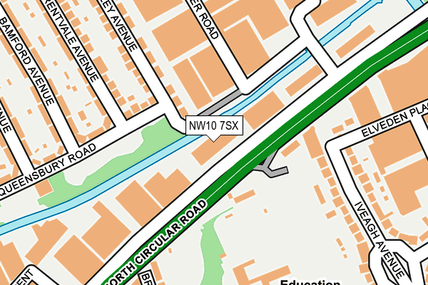
NW10 7SX is located in the Hanger Hill electoral ward, within the London borough of Ealing and the English Parliamentary constituency of Ealing Central and Acton. The Sub Integrated Care Board (ICB) Location is NHS North West London ICB - W2U3Z and the police force is Metropolitan Police. This postcode has been in use since October 1987.


GetTheData
Source: OS OpenMap – Local (Ordnance Survey)
Source: OS VectorMap District (Ordnance Survey)
Licence: Open Government Licence (requires attribution)
| Easting | 518964 |
| Northing | 183373 |
| Latitude | 51.536735 |
| Longitude | -0.286120 |
GetTheData
Source: Open Postcode Geo
Licence: Open Government Licence
| Country | England |
| Postcode District | NW10 |
➜ See where NW10 is on a map ➜ Where is Ealing? | |
GetTheData
Source: Land Registry Price Paid Data
Licence: Open Government Licence
Elevation or altitude of NW10 7SX as distance above sea level:
| Metres | Feet | |
|---|---|---|
| Elevation | 20m | 66ft |
Elevation is measured from the approximate centre of the postcode, to the nearest point on an OS contour line from OS Terrain 50, which has contour spacing of ten vertical metres.
➜ How high above sea level am I? Find the elevation of your current position using your device's GPS.
GetTheData
Source: Open Postcode Elevation
Licence: Open Government Licence
| Ward | Hanger Hill |
| Constituency | Ealing Central And Acton |
GetTheData
Source: ONS Postcode Database
Licence: Open Government Licence
| Brentmead Gardens (North Circular Road) | Park Royal | 113m |
| Iveagh Avenue (North Circular Road) | Park Royal | 170m |
| Brentmead Gardens (North Circular Road) | Park Royal | 227m |
| Iveagh Avenue (North Circular Road) | Park Royal | 261m |
| Iveagh Avenue | Park Royal | 330m |
| Hanger Lane Underground Station | Hanger Lane | 860m |
| Alperton Underground Station | Alperton | 1,030m |
| Stonebridge Park Underground Station | Stonebridge Park | 1,073m |
| Park Royal Underground Station | Park Royal | 1,077m |
| Stonebridge Park Station | 1.1km |
| Wembley Central Station | 1.9km |
| Wembley Stadium Station | 2km |
GetTheData
Source: NaPTAN
Licence: Open Government Licence
GetTheData
Source: ONS Postcode Database
Licence: Open Government Licence

➜ Get more ratings from the Food Standards Agency
GetTheData
Source: Food Standards Agency
Licence: FSA terms & conditions
| Last Collection | |||
|---|---|---|---|
| Location | Mon-Fri | Sat | Distance |
| 74 Queensbury Road | 18:00 | 12:00 | 80m |
| Brentmead Place | 17:30 | 12:00 | 266m |
| 42 Iveagh Avenue | 17:45 | 12:00 | 295m |
GetTheData
Source: Dracos
Licence: Creative Commons Attribution-ShareAlike
| Risk of NW10 7SX flooding from rivers and sea | Medium |
| ➜ NW10 7SX flood map | |
GetTheData
Source: Open Flood Risk by Postcode
Licence: Open Government Licence
The below table lists the International Territorial Level (ITL) codes (formerly Nomenclature of Territorial Units for Statistics (NUTS) codes) and Local Administrative Units (LAU) codes for NW10 7SX:
| ITL 1 Code | Name |
|---|---|
| TLI | London |
| ITL 2 Code | Name |
| TLI7 | Outer London - West and North West |
| ITL 3 Code | Name |
| TLI73 | Ealing |
| LAU 1 Code | Name |
| E09000009 | Ealing |
GetTheData
Source: ONS Postcode Directory
Licence: Open Government Licence
The below table lists the Census Output Area (OA), Lower Layer Super Output Area (LSOA), and Middle Layer Super Output Area (MSOA) for NW10 7SX:
| Code | Name | |
|---|---|---|
| OA | E00006368 | |
| LSOA | E01001276 | Ealing 011A |
| MSOA | E02000248 | Ealing 011 |
GetTheData
Source: ONS Postcode Directory
Licence: Open Government Licence
| HA0 1QG | Queensbury Road | 94m |
| HA0 1NH | Queensbury Road | 105m |
| HA0 1ND | Queensbury Road | 168m |
| NW10 7DJ | Iveagh Terrace | 178m |
| NW10 7ED | Brentmead Gardens | 215m |
| HA0 1JW | Water Road | 227m |
| HA0 1LZ | Queensbury Road | 232m |
| HA0 1NG | Longley Avenue | 235m |
| HA0 1NQ | Longley Avenue | 235m |
| HA0 1NF | Brentvale Avenue | 250m |
GetTheData
Source: Open Postcode Geo; Land Registry Price Paid Data
Licence: Open Government Licence