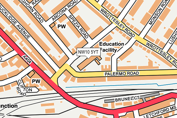
NW10 5YT is located in the Harlesden & Kensal Green electoral ward, within the London borough of Brent and the English Parliamentary constituency of Brent Central. The Sub Integrated Care Board (ICB) Location is NHS North West London ICB - W2U3Z and the police force is Metropolitan Police. This postcode has been in use since May 1994.


GetTheData
Source: OS OpenMap – Local (Ordnance Survey)
Source: OS VectorMap District (Ordnance Survey)
Licence: Open Government Licence (requires attribution)
| Easting | 522270 |
| Northing | 183129 |
| Latitude | 51.533835 |
| Longitude | -0.238585 |
GetTheData
Source: Open Postcode Geo
Licence: Open Government Licence
| Country | England |
| Postcode District | NW10 |
| ➜ NW10 open data dashboard ➜ See where NW10 is on a map ➜ Where is London? | |
GetTheData
Source: Land Registry Price Paid Data
Licence: Open Government Licence
Elevation or altitude of NW10 5YT as distance above sea level:
| Metres | Feet | |
|---|---|---|
| Elevation | 40m | 131ft |
Elevation is measured from the approximate centre of the postcode, to the nearest point on an OS contour line from OS Terrain 50, which has contour spacing of ten vertical metres.
➜ How high above sea level am I? Find the elevation of your current position using your device's GPS.
GetTheData
Source: Open Postcode Elevation
Licence: Open Government Licence
| Ward | Harlesden & Kensal Green |
| Constituency | Brent Central |
GetTheData
Source: ONS Postcode Database
Licence: Open Government Licence
| December 2023 | Vehicle crime | On or near Ancona Road | 185m |
| October 2023 | Anti-social behaviour | On or near Ancona Road | 185m |
| October 2023 | Burglary | On or near Ancona Road | 185m |
| ➜ Get more crime data in our Crime section | |||
GetTheData
Source: data.police.uk
Licence: Open Government Licence
| Willesden Jnc Stn Furness Rd (Harrow Road) | Harlesden | 153m |
| Furness Road (Nw10) | Harlesden | 159m |
| Furness Road (Nw10) | Harlesden | 168m |
| Scrubs Lane (Harrow Road) | Kensal Green | 224m |
| Scrubs Lane (Harrow Road) | Kensal Green | 241m |
| Willesden Junction Underground Station | Willesden Junction | 433m |
| Kensal Green Underground Station | Kensal Green | 1,010m |
| Harlesden Underground Station | Harlesden | 1,367m |
| North Acton Underground Station | North Acton | 1,864m |
| Willesden Junction Station | 0.4km |
| Kensal Green Station | 1km |
| Kensal Rise Station | 1.3km |
GetTheData
Source: NaPTAN
Licence: Open Government Licence
GetTheData
Source: ONS Postcode Database
Licence: Open Government Licence


➜ Get more ratings from the Food Standards Agency
GetTheData
Source: Food Standards Agency
Licence: FSA terms & conditions
| Last Collection | |||
|---|---|---|---|
| Location | Mon-Fri | Sat | Distance |
| Rucklidge Avenue | 17:30 | 12:00 | 189m |
| 191 High Road | 17:30 | 12:00 | 201m |
| Wrottesley Road | 17:30 | 12:00 | 206m |
GetTheData
Source: Dracos
Licence: Creative Commons Attribution-ShareAlike
| Facility | Distance |
|---|---|
| Newman Catholic College Harlesden Road, London Health and Fitness Gym, Sports Hall, Artificial Grass Pitch | 420m |
| Elmwood Lawn Tennis Club Holland Road, London Outdoor Tennis Courts | 463m |
| St Claudine's Catholic School For Girls Crownhill Road, London Health and Fitness Gym, Grass Pitches, Sports Hall, Outdoor Tennis Courts | 727m |
GetTheData
Source: Active Places
Licence: Open Government Licence
| School | Phase of Education | Distance |
|---|---|---|
| Furness Primary School Furness Road, Harlesden, London, NW10 5YT | Primary | 16m |
| Kenmont Primary School Kenmont Primary School, Valliere Road, London, NW10 6AL | Primary | 327m |
| Newman Catholic College Harlesden Road, Brent, London, NW10 3RN | Secondary | 423m |
GetTheData
Source: Edubase
Licence: Open Government Licence
The below table lists the International Territorial Level (ITL) codes (formerly Nomenclature of Territorial Units for Statistics (NUTS) codes) and Local Administrative Units (LAU) codes for NW10 5YT:
| ITL 1 Code | Name |
|---|---|
| TLI | London |
| ITL 2 Code | Name |
| TLI7 | Outer London - West and North West |
| ITL 3 Code | Name |
| TLI72 | Brent |
| LAU 1 Code | Name |
| E09000005 | Brent |
GetTheData
Source: ONS Postcode Directory
Licence: Open Government Licence
The below table lists the Census Output Area (OA), Lower Layer Super Output Area (LSOA), and Middle Layer Super Output Area (MSOA) for NW10 5YT:
| Code | Name | |
|---|---|---|
| OA | E00002604 | |
| LSOA | E01000535 | Brent 031F |
| MSOA | E02000123 | Brent 031 |
GetTheData
Source: ONS Postcode Directory
Licence: Open Government Licence
| NW10 4QD | Furness Road | 50m |
| NW10 5YR | Palermo Road | 65m |
| NW10 4QG | Furness Road | 78m |
| NW10 5YP | Palermo Road | 81m |
| NW10 4PP | Furness Road | 82m |
| NW10 5YH | Odessa Road | 87m |
| NW10 4QE | Furness Road | 92m |
| NW10 4QH | Furness Road | 101m |
| NW10 4QJ | Spezia Road | 122m |
| NW10 4PN | Leghorn Road | 125m |
GetTheData
Source: Open Postcode Geo; Land Registry Price Paid Data
Licence: Open Government Licence