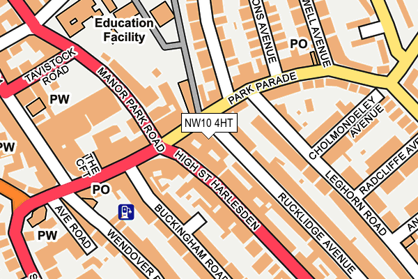
NW10 4HT is located in the Harlesden & Kensal Green electoral ward, within the London borough of Brent and the English Parliamentary constituency of Brent Central. The Sub Integrated Care Board (ICB) Location is NHS North West London ICB - W2U3Z and the police force is Metropolitan Police. This postcode has been in use since January 1980.


GetTheData
Source: OS OpenMap – Local (Ordnance Survey)
Source: OS VectorMap District (Ordnance Survey)
Licence: Open Government Licence (requires attribution)
| Easting | 521862 |
| Northing | 183390 |
| Latitude | 51.536269 |
| Longitude | -0.244374 |
GetTheData
Source: Open Postcode Geo
Licence: Open Government Licence
| Country | England |
| Postcode District | NW10 |
➜ See where NW10 is on a map ➜ Where is London? | |
GetTheData
Source: Land Registry Price Paid Data
Licence: Open Government Licence
Elevation or altitude of NW10 4HT as distance above sea level:
| Metres | Feet | |
|---|---|---|
| Elevation | 50m | 164ft |
Elevation is measured from the approximate centre of the postcode, to the nearest point on an OS contour line from OS Terrain 50, which has contour spacing of ten vertical metres.
➜ How high above sea level am I? Find the elevation of your current position using your device's GPS.
GetTheData
Source: Open Postcode Elevation
Licence: Open Government Licence
| Ward | Harlesden & Kensal Green |
| Constituency | Brent Central |
GetTheData
Source: ONS Postcode Database
Licence: Open Government Licence
| Park Parade | Harlesden | 59m |
| Park Parade | Harlesden | 59m |
| Park Parade | Harlesden | 109m |
| Buckingham Road Harlesden | Harlesden | 120m |
| Tavistock Road (Manor Park Road) | Harlesden | 163m |
| Willesden Junction Underground Station | Willesden Junction | 446m |
| Harlesden Underground Station | Harlesden | 937m |
| Kensal Green Underground Station | Kensal Green | 1,487m |
| North Acton Underground Station | North Acton | 1,775m |
| Willesden Junction Station | 0.4km |
| Harlesden Station | 0.9km |
| Kensal Green Station | 1.5km |
GetTheData
Source: NaPTAN
Licence: Open Government Licence
GetTheData
Source: ONS Postcode Database
Licence: Open Government Licence


➜ Get more ratings from the Food Standards Agency
GetTheData
Source: Food Standards Agency
Licence: FSA terms & conditions
| Last Collection | |||
|---|---|---|---|
| Location | Mon-Fri | Sat | Distance |
| Park Parade Post Office | 17:30 | 12:00 | 109m |
| 147 High Street | 17:30 | 12:00 | 153m |
| Nw10 Harlesden P.o. | 18:30 | 12:00 | 190m |
GetTheData
Source: Dracos
Licence: Creative Commons Attribution-ShareAlike
The below table lists the International Territorial Level (ITL) codes (formerly Nomenclature of Territorial Units for Statistics (NUTS) codes) and Local Administrative Units (LAU) codes for NW10 4HT:
| ITL 1 Code | Name |
|---|---|
| TLI | London |
| ITL 2 Code | Name |
| TLI7 | Outer London - West and North West |
| ITL 3 Code | Name |
| TLI72 | Brent |
| LAU 1 Code | Name |
| E09000005 | Brent |
GetTheData
Source: ONS Postcode Directory
Licence: Open Government Licence
The below table lists the Census Output Area (OA), Lower Layer Super Output Area (LSOA), and Middle Layer Super Output Area (MSOA) for NW10 4HT:
| Code | Name | |
|---|---|---|
| OA | E00174711 | |
| LSOA | E01033455 | Brent 031G |
| MSOA | E02000123 | Brent 031 |
GetTheData
Source: ONS Postcode Directory
Licence: Open Government Licence
| NW10 4TS | High Street | 26m |
| NW10 4PT | Willows Terrace | 45m |
| NW10 4JH | Park Parade | 48m |
| NW10 4SL | High Street | 85m |
| NW10 4SP | High Street | 92m |
| NW10 4JG | Park Parade | 108m |
| NW10 4PE | Leghorn Road | 109m |
| NW10 4RP | Buckingham Road | 110m |
| NW10 4NT | High Street | 114m |
| NW10 4RN | Buckingham Mews | 118m |
GetTheData
Source: Open Postcode Geo; Land Registry Price Paid Data
Licence: Open Government Licence