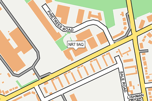
NR7 9AQ is located in the Sprowston East electoral ward, within the local authority district of Broadland and the English Parliamentary constituency of Norwich North. The Sub Integrated Care Board (ICB) Location is NHS Norfolk and Waveney ICB - 26A and the police force is Norfolk. This postcode has been in use since January 1980.


GetTheData
Source: OS OpenMap – Local (Ordnance Survey)
Source: OS VectorMap District (Ordnance Survey)
Licence: Open Government Licence (requires attribution)
| Easting | 625843 |
| Northing | 310949 |
| Latitude | 52.649249 |
| Longitude | 1.337242 |
GetTheData
Source: Open Postcode Geo
Licence: Open Government Licence
| Country | England |
| Postcode District | NR7 |
| ➜ NR7 open data dashboard ➜ See where NR7 is on a map ➜ Where is Norwich? | |
GetTheData
Source: Land Registry Price Paid Data
Licence: Open Government Licence
Elevation or altitude of NR7 9AQ as distance above sea level:
| Metres | Feet | |
|---|---|---|
| Elevation | 40m | 131ft |
Elevation is measured from the approximate centre of the postcode, to the nearest point on an OS contour line from OS Terrain 50, which has contour spacing of ten vertical metres.
➜ How high above sea level am I? Find the elevation of your current position using your device's GPS.
GetTheData
Source: Open Postcode Elevation
Licence: Open Government Licence
| Ward | Sprowston East |
| Constituency | Norwich North |
GetTheData
Source: ONS Postcode Database
Licence: Open Government Licence
| June 2022 | Anti-social behaviour | On or near Shopping Area | 235m |
| June 2022 | Anti-social behaviour | On or near Lishman Road | 291m |
| June 2022 | Anti-social behaviour | On or near Barnes Close | 321m |
| ➜ Get more crime data in our Crime section | |||
GetTheData
Source: data.police.uk
Licence: Open Government Licence
| Pinetrees Road (Salhouse Road) | Heartsease | 129m |
| Sale Road | Heartsease | 188m |
| Falcon Road East (Salhouse Road) | Heartsease | 245m |
| Towers (Watling Road) | Heartsease | 254m |
| Bp Garage (Salhouse Road) | Heartsease | 302m |
| Norwich Station | 3.2km |
| Salhouse Station | 4.7km |
GetTheData
Source: NaPTAN
Licence: Open Government Licence
| Median download speed | 40.0Mbps |
| Average download speed | 45.3Mbps |
| Maximum download speed | 78.73Mbps |
| Median upload speed | 12.5Mbps |
| Average upload speed | 12.7Mbps |
| Maximum upload speed | 20.00Mbps |
GetTheData
Source: Ofcom
Licence: Ofcom Terms of Use (requires attribution)
GetTheData
Source: ONS Postcode Database
Licence: Open Government Licence


➜ Get more ratings from the Food Standards Agency
GetTheData
Source: Food Standards Agency
Licence: FSA terms & conditions
| Last Collection | |||
|---|---|---|---|
| Location | Mon-Fri | Sat | Distance |
| Woodside Road | 17:45 | 11:00 | 239m |
| Salhouse Road East | 18:00 | 11:00 | 286m |
| Blithewood Gardens | 17:30 | 11:00 | 543m |
GetTheData
Source: Dracos
Licence: Creative Commons Attribution-ShareAlike
| Facility | Distance |
|---|---|
| Heartsease Towers Recreation Ground Sale Road, Norwich Grass Pitches | 209m |
| Heartsease Towers (Closed) Sale Road, Norwich Grass Pitches | 228m |
| The Arena (Norwich) Avian Way, Salhouse Road, Salhouse Road, Norwich Artificial Grass Pitch | 504m |
GetTheData
Source: Active Places
Licence: Open Government Licence
| School | Phase of Education | Distance |
|---|---|---|
| Falcon Junior School Falcon Road West, Sprowston, Norwich, NR7 8NT | Primary | 649m |
| Cecil Gowing Infant School Falcon Road West, Sprowston, Norwich, NR7 8NZ | Primary | 759m |
| Sprowston Community Academy Cannerby Lane, Sprowston, Norwich, NR7 8NE | Secondary | 916m |
GetTheData
Source: Edubase
Licence: Open Government Licence
The below table lists the International Territorial Level (ITL) codes (formerly Nomenclature of Territorial Units for Statistics (NUTS) codes) and Local Administrative Units (LAU) codes for NR7 9AQ:
| ITL 1 Code | Name |
|---|---|
| TLH | East |
| ITL 2 Code | Name |
| TLH1 | East Anglia |
| ITL 3 Code | Name |
| TLH15 | Norwich and East Norfolk |
| LAU 1 Code | Name |
| E07000144 | Broadland |
GetTheData
Source: ONS Postcode Directory
Licence: Open Government Licence
The below table lists the Census Output Area (OA), Lower Layer Super Output Area (LSOA), and Middle Layer Super Output Area (MSOA) for NR7 9AQ:
| Code | Name | |
|---|---|---|
| OA | E00134955 | |
| LSOA | E01026560 | Broadland 013D |
| MSOA | E02005532 | Broadland 013 |
GetTheData
Source: ONS Postcode Directory
Licence: Open Government Licence
| NR7 9AG | Caston Industrial Estate | 62m |
| NR7 9TS | Sale Road | 113m |
| NR7 9TT | Sale Road | 116m |
| NR7 9AF | Salhouse Road | 167m |
| NR7 9TR | Sale Road | 197m |
| NR7 9TU | Woodside Road | 216m |
| NR7 8RZ | Blue Boar Lane | 221m |
| NR7 9BB | Pinetrees Road | 232m |
| NR7 9TE | Watling Road | 259m |
| NR7 9HF | Woodside Road | 262m |
GetTheData
Source: Open Postcode Geo; Land Registry Price Paid Data
Licence: Open Government Licence