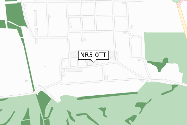
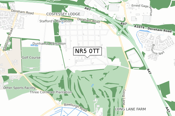
NR5 0TT is located in the Hethersett electoral ward, within the local authority district of South Norfolk and the English Parliamentary constituency of South Norfolk. The Sub Integrated Care Board (ICB) Location is NHS Norfolk and Waveney ICB - 26A and the police force is Norfolk. This postcode has been in use since August 2010.


GetTheData
Source: OS Open Zoomstack (Ordnance Survey)
Licence: Open Government Licence (requires attribution)
Attribution: Contains OS data © Crown copyright and database right 2024
Source: Open Postcode Geo
Licence: Open Government Licence (requires attribution)
Attribution: Contains OS data © Crown copyright and database right 2024; Contains Royal Mail data © Royal Mail copyright and database right 2024; Source: Office for National Statistics licensed under the Open Government Licence v.3.0
| Easting | 615062 |
| Northing | 310184 |
| Latitude | 52.646735 |
| Longitude | 1.177617 |
GetTheData
Source: Open Postcode Geo
Licence: Open Government Licence
| Country | England |
| Postcode District | NR5 |
| ➜ NR5 open data dashboard ➜ See where NR5 is on a map | |
GetTheData
Source: Land Registry Price Paid Data
Licence: Open Government Licence
Elevation or altitude of NR5 0TT as distance above sea level:
| Metres | Feet | |
|---|---|---|
| Elevation | 40m | 131ft |
Elevation is measured from the approximate centre of the postcode, to the nearest point on an OS contour line from OS Terrain 50, which has contour spacing of ten vertical metres.
➜ How high above sea level am I? Find the elevation of your current position using your device's GPS.
GetTheData
Source: Open Postcode Elevation
Licence: Open Government Licence
| Ward | Hethersett |
| Constituency | South Norfolk |
GetTheData
Source: ONS Postcode Database
Licence: Open Government Licence
| Travel Inn (Easton Road) | New Costessey | 537m |
| Travel Inn (Easton Road) | New Costessey | 567m |
| Showground (Dereham Road) | New Costessey | 578m |
| Showground (Dereham Road) | New Costessey | 588m |
| Park & Ride (Bawburgh Lane) | New Costessey | 624m |
GetTheData
Source: NaPTAN
Licence: Open Government Licence
GetTheData
Source: ONS Postcode Database
Licence: Open Government Licence

➜ Get more ratings from the Food Standards Agency
GetTheData
Source: Food Standards Agency
Licence: FSA terms & conditions
| Last Collection | |||
|---|---|---|---|
| Location | Mon-Fri | Sat | Distance |
| Bawburgh Lane | 17:00 | 08:15 | 1,237m |
| Marlingford Road (Former Po) | 17:00 | 10:30 | 1,631m |
| Longwater Lane | 18:00 | 11:00 | 1,831m |
GetTheData
Source: Dracos
Licence: Creative Commons Attribution-ShareAlike
| Facility | Distance |
|---|---|
| Bawburgh Golf Club Marlingford Road, Bawburgh, Norwich Golf | 617m |
| The Norwich Family Golf Centre Dunham Road, Easton, Norwich Golf | 819m |
| Bannatyne Health Club (Norwich West) William Frost Way, Longwater Business Park, Norwich Swimming Pool, Health and Fitness Gym, Studio | 1km |
GetTheData
Source: Active Places
Licence: Open Government Licence
| School | Phase of Education | Distance |
|---|---|---|
| The Bridge Easton Bawburgh Road, Easton, NR9 5EA | Not applicable | 1km |
| St Peter's CofE Primary Academy, Easton Marlingford Road, Easton, Norwich, NR9 5AD | Primary | 1.5km |
| The Bawburgh School Hockering Lane, Bawburgh, The Bawburgh School, Norwich, NR9 3LR | Primary | 1.7km |
GetTheData
Source: Edubase
Licence: Open Government Licence
The below table lists the International Territorial Level (ITL) codes (formerly Nomenclature of Territorial Units for Statistics (NUTS) codes) and Local Administrative Units (LAU) codes for NR5 0TT:
| ITL 1 Code | Name |
|---|---|
| TLH | East |
| ITL 2 Code | Name |
| TLH1 | East Anglia |
| ITL 3 Code | Name |
| TLH17 | Breckland and South Norfolk |
| LAU 1 Code | Name |
| E07000149 | South Norfolk |
GetTheData
Source: ONS Postcode Directory
Licence: Open Government Licence
The below table lists the Census Output Area (OA), Lower Layer Super Output Area (LSOA), and Middle Layer Super Output Area (MSOA) for NR5 0TT:
| Code | Name | |
|---|---|---|
| OA | E00136722 | |
| LSOA | E01026883 | South Norfolk 002C |
| MSOA | E02005598 | South Norfolk 002 |
GetTheData
Source: ONS Postcode Directory
Licence: Open Government Licence
| NR5 0JH | Forest Way | 679m |
| NR5 0JT | Alex Moorhouse Way | 818m |
| NR5 0UY | Colossus Way | 867m |
| NR9 3LU | Marlingford Road | 883m |
| NR5 0UX | Colossus Way | 895m |
| NR5 0UT | Britannia Way | 941m |
| NR5 0UW | Britannia Way | 1032m |
| NR5 0UZ | Minotaur Way | 1059m |
| NR9 5EE | Parkers Close | 1069m |
| NR9 5EG | Dereham Road | 1085m |
GetTheData
Source: Open Postcode Geo; Land Registry Price Paid Data
Licence: Open Government Licence