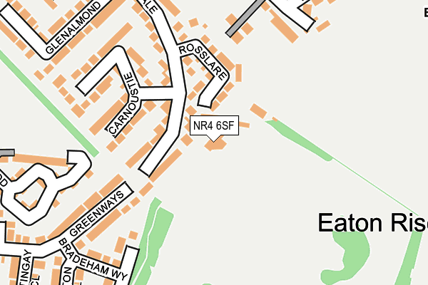
NR4 6SF is located in the Eaton electoral ward, within the local authority district of Norwich and the English Parliamentary constituency of Norwich South. The Sub Integrated Care Board (ICB) Location is NHS Norfolk and Waveney ICB - 26A and the police force is Norfolk. This postcode has been in use since January 1980.


GetTheData
Source: OS OpenMap – Local (Ordnance Survey)
Source: OS VectorMap District (Ordnance Survey)
Licence: Open Government Licence (requires attribution)
| Easting | 621421 |
| Northing | 306370 |
| Latitude | 52.609948 |
| Longitude | 1.268898 |
GetTheData
Source: Open Postcode Geo
Licence: Open Government Licence
| Country | England |
| Postcode District | NR4 |
| ➜ NR4 open data dashboard ➜ See where NR4 is on a map ➜ Where is Norwich? | |
GetTheData
Source: Land Registry Price Paid Data
Licence: Open Government Licence
Elevation or altitude of NR4 6SF as distance above sea level:
| Metres | Feet | |
|---|---|---|
| Elevation | 30m | 98ft |
Elevation is measured from the approximate centre of the postcode, to the nearest point on an OS contour line from OS Terrain 50, which has contour spacing of ten vertical metres.
➜ How high above sea level am I? Find the elevation of your current position using your device's GPS.
GetTheData
Source: Open Postcode Elevation
Licence: Open Government Licence
| Ward | Eaton |
| Constituency | Norwich South |
GetTheData
Source: ONS Postcode Database
Licence: Open Government Licence
| June 2022 | Criminal damage and arson | On or near Duverlin Close | 379m |
| June 2022 | Public order | On or near Brentwood | 398m |
| May 2022 | Violence and sexual offences | On or near Rosslare | 114m |
| ➜ Get more crime data in our Crime section | |||
GetTheData
Source: data.police.uk
Licence: Open Government Licence
| Bradeham Way (Greenways) | Eaton | 244m |
| Duverlin Close (Greenways) | Eaton | 356m |
| Ellcar Rise (Greenways) | Eaton | 391m |
| Branksome Road (Newmarket Road) | Norwich | 509m |
| Branksome Road (Newmarket Road) | Norwich | 512m |
| Norwich Station | 3.2km |
GetTheData
Source: NaPTAN
Licence: Open Government Licence
GetTheData
Source: ONS Postcode Database
Licence: Open Government Licence


➜ Get more ratings from the Food Standards Agency
GetTheData
Source: Food Standards Agency
Licence: FSA terms & conditions
| Last Collection | |||
|---|---|---|---|
| Location | Mon-Fri | Sat | Distance |
| Waverley Road | 18:00 | 11:00 | 328m |
| Welsford Avenue | 17:30 | 11:00 | 499m |
| Judges Walk | 18:00 | 11:00 | 513m |
GetTheData
Source: Dracos
Licence: Creative Commons Attribution-ShareAlike
| Facility | Distance |
|---|---|
| Eaton Golf Club Sunningdale, Norwich Golf | 0m |
| Eaton Primary School Duverlin Close, Norwich Grass Pitches | 428m |
| City Of Norwich School Eaton Road, Norwich Grass Pitches, Sports Hall | 471m |
GetTheData
Source: Active Places
Licence: Open Government Licence
| School | Phase of Education | Distance |
|---|---|---|
| Eaton Primary School Duverlin Close, Norwich, NR4 6HS | Primary | 434m |
| City of Norwich School, An Ormiston Academy Eaton Road, Norwich, NR4 6PP | Secondary | 496m |
| Harford Manor School, Norwich 43 Ipswich Road, Norwich, NR2 2LN | Not applicable | 1.1km |
GetTheData
Source: Edubase
Licence: Open Government Licence
The below table lists the International Territorial Level (ITL) codes (formerly Nomenclature of Territorial Units for Statistics (NUTS) codes) and Local Administrative Units (LAU) codes for NR4 6SF:
| ITL 1 Code | Name |
|---|---|
| TLH | East |
| ITL 2 Code | Name |
| TLH1 | East Anglia |
| ITL 3 Code | Name |
| TLH15 | Norwich and East Norfolk |
| LAU 1 Code | Name |
| E07000148 | Norwich |
GetTheData
Source: ONS Postcode Directory
Licence: Open Government Licence
The below table lists the Census Output Area (OA), Lower Layer Super Output Area (LSOA), and Middle Layer Super Output Area (MSOA) for NR4 6SF:
| Code | Name | |
|---|---|---|
| OA | E00136339 | |
| LSOA | E01026812 | Norwich 012C |
| MSOA | E02005595 | Norwich 012 |
GetTheData
Source: ONS Postcode Directory
Licence: Open Government Licence
| NR4 6AN | Sunningdale | 78m |
| NR4 6AW | Rosslare | 94m |
| NR4 6AY | Carnoustie | 175m |
| NR4 6JB | Norton Drive | 190m |
| NR4 6HA | Greenways | 193m |
| NR4 6SW | Branksome Road | 219m |
| NR4 6JA | Bradeham Way | 223m |
| NR4 6AG | Glenalmond | 273m |
| NR4 6PW | Brentwood | 292m |
| NR4 6PD | Greenways | 298m |
GetTheData
Source: Open Postcode Geo; Land Registry Price Paid Data
Licence: Open Government Licence