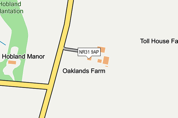
NR31 9AP is located in the Bradwell South and Hopton electoral ward, within the local authority district of Great Yarmouth and the English Parliamentary constituency of Great Yarmouth. The Sub Integrated Care Board (ICB) Location is NHS Norfolk and Waveney ICB - 26A and the police force is Norfolk. This postcode has been in use since January 1980.


GetTheData
Source: OS OpenMap – Local (Ordnance Survey)
Source: OS VectorMap District (Ordnance Survey)
Licence: Open Government Licence (requires attribution)
| Easting | 651774 |
| Northing | 301468 |
| Latitude | 52.552768 |
| Longitude | 1.712519 |
GetTheData
Source: Open Postcode Geo
Licence: Open Government Licence
| Country | England |
| Postcode District | NR31 |
| ➜ NR31 open data dashboard ➜ See where NR31 is on a map | |
GetTheData
Source: Land Registry Price Paid Data
Licence: Open Government Licence
Elevation or altitude of NR31 9AP as distance above sea level:
| Metres | Feet | |
|---|---|---|
| Elevation | 10m | 33ft |
Elevation is measured from the approximate centre of the postcode, to the nearest point on an OS contour line from OS Terrain 50, which has contour spacing of ten vertical metres.
➜ How high above sea level am I? Find the elevation of your current position using your device's GPS.
GetTheData
Source: Open Postcode Elevation
Licence: Open Government Licence
| Ward | Bradwell South And Hopton |
| Constituency | Great Yarmouth |
GetTheData
Source: ONS Postcode Database
Licence: Open Government Licence
| June 2022 | Violence and sexual offences | On or near Galahad Road | 383m |
| June 2022 | Violence and sexual offences | On or near Galahad Road | 383m |
| March 2022 | Burglary | On or near Sidegate Road | 220m |
| ➜ Get more crime data in our Crime section | |||
GetTheData
Source: data.police.uk
Licence: Open Government Licence
| Sidegate Road (Lowestoft Road) | Gorleston | 343m |
| Masons Farm (Lowestoft Road) | Gorleston | 370m |
| Excalibur Road (Beaufort Way) | Gorleston | 572m |
| Excalibur Road (Beaufort Way) | Gorleston | 593m |
| Links Road (Lowestoft Road) | Gorleston | 617m |
| Somerleyton Station | 6.3km |
GetTheData
Source: NaPTAN
Licence: Open Government Licence
GetTheData
Source: ONS Postcode Database
Licence: Open Government Licence


➜ Get more ratings from the Food Standards Agency
GetTheData
Source: Food Standards Agency
Licence: FSA terms & conditions
| Last Collection | |||
|---|---|---|---|
| Location | Mon-Fri | Sat | Distance |
| Links Road | 17:30 | 12:15 | 928m |
| Links Hotel Bridge Road | 17:30 | 12:15 | 1,601m |
| Marine Parade | 17:30 | 12:15 | 1,842m |
GetTheData
Source: Dracos
Licence: Creative Commons Attribution-ShareAlike
| Facility | Distance |
|---|---|
| Gorleston Golf Club Warren Road, Hopton-on-sea Golf | 1km |
| Bwell At Gorleston (Closed) Lowestoft Road, Gorleston, Great Yarmouth Health and Fitness Gym, Studio | 1.1km |
| Cliff Park Ormiston Academy Kennedy Avenue, Gorleston, Great Yarmouth Sports Hall, Artificial Grass Pitch, Grass Pitches, Studio, Outdoor Tennis Courts | 1.2km |
GetTheData
Source: Active Places
Licence: Open Government Licence
| School | Phase of Education | Distance |
|---|---|---|
| Cliff Park Ormiston Academy Kennedy Avenue, Gorleston, Great Yarmouth, NR31 6TA | Secondary | 1.3km |
| Ormiston Cliff Park Primary Academy Orde Avenue, Gorleston-on-Sea, Great Yarmouth, NR31 6SZ | Primary | 1.3km |
| Ormiston Venture Academy Oriel Avenue, Great Yarmouth, Gorleston, NR31 7JJ | Secondary | 1.7km |
GetTheData
Source: Edubase
Licence: Open Government Licence
The below table lists the International Territorial Level (ITL) codes (formerly Nomenclature of Territorial Units for Statistics (NUTS) codes) and Local Administrative Units (LAU) codes for NR31 9AP:
| ITL 1 Code | Name |
|---|---|
| TLH | East |
| ITL 2 Code | Name |
| TLH1 | East Anglia |
| ITL 3 Code | Name |
| TLH15 | Norwich and East Norfolk |
| LAU 1 Code | Name |
| E07000145 | Great Yarmouth |
GetTheData
Source: ONS Postcode Directory
Licence: Open Government Licence
The below table lists the Census Output Area (OA), Lower Layer Super Output Area (LSOA), and Middle Layer Super Output Area (MSOA) for NR31 9AP:
| Code | Name | |
|---|---|---|
| OA | E00135106 | |
| LSOA | E01026588 | Great Yarmouth 013D |
| MSOA | E02005550 | Great Yarmouth 013 |
GetTheData
Source: ONS Postcode Directory
Licence: Open Government Licence
| NR31 9AN | Lowestoft Road | 352m |
| NR31 9AL | Sidegate Cottages | 421m |
| NR31 9AS | Seamans Cottages | 423m |
| NR31 7RW | Guinevere Road | 445m |
| NR31 7RQ | Excalibur Road | 533m |
| NR31 9AT | Sidegate Road | 563m |
| NR31 7RH | Curie Drive | 610m |
| NR31 7RD | Horsley Drive | 627m |
| NR31 6TS | Mariners Compass | 645m |
| NR31 7RG | Lister Close | 678m |
GetTheData
Source: Open Postcode Geo; Land Registry Price Paid Data
Licence: Open Government Licence