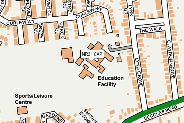
NR31 8AP is located in the Bradwell North electoral ward, within the local authority district of Great Yarmouth and the English Parliamentary constituency of Great Yarmouth. The Sub Integrated Care Board (ICB) Location is NHS Norfolk and Waveney ICB - 26A and the police force is Norfolk. This postcode has been in use since January 1980.


GetTheData
Source: OS OpenMap – Local (Ordnance Survey)
Source: OS VectorMap District (Ordnance Survey)
Licence: Open Government Licence (requires attribution)
| Easting | 651351 |
| Northing | 304861 |
| Latitude | 52.583402 |
| Longitude | 1.708864 |
GetTheData
Source: Open Postcode Geo
Licence: Open Government Licence
| Country | England |
| Postcode District | NR31 |
| ➜ NR31 open data dashboard ➜ See where NR31 is on a map ➜ Where is Bradwell? | |
GetTheData
Source: Land Registry Price Paid Data
Licence: Open Government Licence
Elevation or altitude of NR31 8AP as distance above sea level:
| Metres | Feet | |
|---|---|---|
| Elevation | 10m | 33ft |
Elevation is measured from the approximate centre of the postcode, to the nearest point on an OS contour line from OS Terrain 50, which has contour spacing of ten vertical metres.
➜ How high above sea level am I? Find the elevation of your current position using your device's GPS.
GetTheData
Source: Open Postcode Elevation
Licence: Open Government Licence
| Ward | Bradwell North |
| Constituency | Great Yarmouth |
GetTheData
Source: ONS Postcode Database
Licence: Open Government Licence
| January 2024 | Violence and sexual offences | On or near Kalmia Green | 428m |
| January 2024 | Violence and sexual offences | On or near Kalmia Green | 428m |
| November 2023 | Public order | On or near Kalmia Green | 428m |
| ➜ Get more crime data in our Crime section | |||
GetTheData
Source: data.police.uk
Licence: Open Government Licence
| Lynn Grove (Beccles Road) | Gorleston | 267m |
| Lynn Grove (Beccles Road) | Gorleston | 270m |
| Gainsborough Avenue (Burgh Road) | Bradwell | 316m |
| Widgeon Close (Mallard Way) | Bradwell | 330m |
| Claydon Grove (Burgh Road) | Gorleston | 338m |
| Great Yarmouth Station | 3.3km |
GetTheData
Source: NaPTAN
Licence: Open Government Licence
GetTheData
Source: ONS Postcode Database
Licence: Open Government Licence


➜ Get more ratings from the Food Standards Agency
GetTheData
Source: Food Standards Agency
Licence: FSA terms & conditions
| Last Collection | |||
|---|---|---|---|
| Location | Mon-Fri | Sat | Distance |
| Claydon Grove | 17:30 | 12:00 | 281m |
| Wren Drive | 17:30 | 11:30 | 370m |
| Shrublands Post Office | 17:30 | 12:15 | 376m |
GetTheData
Source: Dracos
Licence: Creative Commons Attribution-ShareAlike
| Facility | Distance |
|---|---|
| Lynn Grove Academy Lynn Grove, Gorleston, Great Yarmouth Sports Hall, Grass Pitches, Artificial Grass Pitch | 0m |
| Phoenix Leisure Centre Widgeon Close, Bradwell, Great Yarmouth Swimming Pool, Health and Fitness Gym, Studio | 278m |
| East Norfolk Sixth Form College Church Lane, Gorleston, Great Yarmouth Sports Hall, Health and Fitness Gym, Outdoor Tennis Courts, Grass Pitches, Artificial Grass Pitch | 926m |
GetTheData
Source: Active Places
Licence: Open Government Licence
| School | Phase of Education | Distance |
|---|---|---|
| Lynn Grove Academy Lynn Grove, Gorleston, Great Yarmouth, NR31 8AP | Secondary | 22m |
| Wroughton Infant Academy Beccles Road, Gorleston, Great Yarmouth, NR31 8AH | Primary | 608m |
| Wroughton Junior Academy Burgh Road, Gorleston, Great Yarmouth, NR31 8BD | Primary | 608m |
GetTheData
Source: Edubase
Licence: Open Government Licence
The below table lists the International Territorial Level (ITL) codes (formerly Nomenclature of Territorial Units for Statistics (NUTS) codes) and Local Administrative Units (LAU) codes for NR31 8AP:
| ITL 1 Code | Name |
|---|---|
| TLH | East |
| ITL 2 Code | Name |
| TLH1 | East Anglia |
| ITL 3 Code | Name |
| TLH15 | Norwich and East Norfolk |
| LAU 1 Code | Name |
| E07000145 | Great Yarmouth |
GetTheData
Source: ONS Postcode Directory
Licence: Open Government Licence
The below table lists the Census Output Area (OA), Lower Layer Super Output Area (LSOA), and Middle Layer Super Output Area (MSOA) for NR31 8AP:
| Code | Name | |
|---|---|---|
| OA | E00135065 | |
| LSOA | E01026581 | Great Yarmouth 008A |
| MSOA | E02005545 | Great Yarmouth 008 |
GetTheData
Source: ONS Postcode Directory
Licence: Open Government Licence
| NR31 8SF | Lapwing Close | 119m |
| NR31 8AW | Lynn Grove | 132m |
| NR31 8LY | Heron Close | 150m |
| NR31 8QX | Curlew Way | 150m |
| NR31 8JT | Grebe Close | 209m |
| NR31 8AS | The Walk | 209m |
| NR31 8QT | Swallow Close | 211m |
| NR31 8DG | Smiths Loke | 212m |
| NR31 8QS | Kestrel Close | 215m |
| NR31 8AR | Lynn Grove | 221m |
GetTheData
Source: Open Postcode Geo; Land Registry Price Paid Data
Licence: Open Government Licence