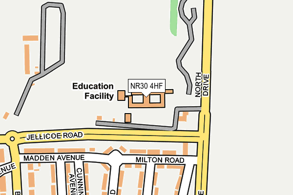
NR30 4HF lies on North Drive in Great Yarmouth. NR30 4HF is located in the Yarmouth North electoral ward, within the local authority district of Great Yarmouth and the English Parliamentary constituency of Great Yarmouth. The Sub Integrated Care Board (ICB) Location is NHS Norfolk and Waveney ICB - 26A and the police force is Norfolk. This postcode has been in use since January 1980.


GetTheData
Source: OS OpenMap – Local (Ordnance Survey)
Source: OS VectorMap District (Ordnance Survey)
Licence: Open Government Licence (requires attribution)
| Easting | 653020 |
| Northing | 310007 |
| Latitude | 52.628818 |
| Longitude | 1.737400 |
GetTheData
Source: Open Postcode Geo
Licence: Open Government Licence
| Street | North Drive |
| Town/City | Great Yarmouth |
| Country | England |
| Postcode District | NR30 |
| ➜ NR30 open data dashboard ➜ See where NR30 is on a map ➜ Where is Great Yarmouth? | |
GetTheData
Source: Land Registry Price Paid Data
Licence: Open Government Licence
Elevation or altitude of NR30 4HF as distance above sea level:
| Metres | Feet | |
|---|---|---|
| Elevation | 10m | 33ft |
Elevation is measured from the approximate centre of the postcode, to the nearest point on an OS contour line from OS Terrain 50, which has contour spacing of ten vertical metres.
➜ How high above sea level am I? Find the elevation of your current position using your device's GPS.
GetTheData
Source: Open Postcode Elevation
Licence: Open Government Licence
| Ward | Yarmouth North |
| Constituency | Great Yarmouth |
GetTheData
Source: ONS Postcode Database
Licence: Open Government Licence
IRON DUKE, NORTH DRIVE, GREAT YARMOUTH, NR30 4HF 2005 11 JUL £300,000 |
GetTheData
Source: HM Land Registry Price Paid Data
Licence: Contains HM Land Registry data © Crown copyright and database right 2024. This data is licensed under the Open Government Licence v3.0.
| November 2023 | Other theft | On or near Shakespeare Road | 335m |
| October 2023 | Other crime | On or near Shakespeare Road | 335m |
| August 2023 | Violence and sexual offences | On or near Shakespeare Road | 335m |
| ➜ Get more crime data in our Crime section | |||
GetTheData
Source: data.police.uk
Licence: Open Government Licence
| Milton Road (North Drive) | Great Yarmouth | 129m |
| Seashore Holiday South Entrance (North Drive) | Great Yarmouth | 266m |
| Milton Road (North Drive) | Great Yarmouth | 275m |
| Seashore North Entrance (North Drive) | Great Yarmouth | 296m |
| Madden Avenue (Beatty Road) | Great Yarmouth | 344m |
| Great Yarmouth Station | 2.2km |
GetTheData
Source: NaPTAN
Licence: Open Government Licence
GetTheData
Source: ONS Postcode Database
Licence: Open Government Licence


➜ Get more ratings from the Food Standards Agency
GetTheData
Source: Food Standards Agency
Licence: FSA terms & conditions
| Last Collection | |||
|---|---|---|---|
| Location | Mon-Fri | Sat | Distance |
| Seashore Camp | 17:30 | 11:30 | 461m |
| Caystreward | 17:30 | 11:30 | 581m |
| North Denes Post Office | 18:30 | 11:45 | 1,013m |
GetTheData
Source: Dracos
Licence: Creative Commons Attribution-ShareAlike
| Facility | Distance |
|---|---|
| North Denes Primary School Jellicoe Road, Great Yarmouth Grass Pitches | 63m |
| Seashore Holiday Park North Drive, Great Yarmouth Artificial Grass Pitch, Swimming Pool | 319m |
| Great Yarmouth Charter Academy (Barnard Bridge Sports Ground) Barnard Avenue, Great Yarmouth Grass Pitches | 592m |
GetTheData
Source: Active Places
Licence: Open Government Licence
| School | Phase of Education | Distance |
|---|---|---|
| North Denes Primary School and Nursery North Denes Primary School and Nursery, Jellicoe Road, Great Yarmouth, NR30 4HF | Primary | 63m |
| Bure Park Specialist Academy 16a Keyes Avenue, Great Yarmouth, NR30 4AE | Not applicable | 733m |
| Great Yarmouth Charter Academy Salisbury Road, Great Yarmouth, NR30 4LS | Secondary | 1.1km |
GetTheData
Source: Edubase
Licence: Open Government Licence
The below table lists the International Territorial Level (ITL) codes (formerly Nomenclature of Territorial Units for Statistics (NUTS) codes) and Local Administrative Units (LAU) codes for NR30 4HF:
| ITL 1 Code | Name |
|---|---|
| TLH | East |
| ITL 2 Code | Name |
| TLH1 | East Anglia |
| ITL 3 Code | Name |
| TLH15 | Norwich and East Norfolk |
| LAU 1 Code | Name |
| E07000145 | Great Yarmouth |
GetTheData
Source: ONS Postcode Directory
Licence: Open Government Licence
The below table lists the Census Output Area (OA), Lower Layer Super Output Area (LSOA), and Middle Layer Super Output Area (MSOA) for NR30 4HF:
| Code | Name | |
|---|---|---|
| OA | E00135378 | |
| LSOA | E01026641 | Great Yarmouth 004D |
| MSOA | E02005541 | Great Yarmouth 004 |
GetTheData
Source: ONS Postcode Directory
Licence: Open Government Licence
| NR30 4HB | Milton Road | 171m |
| NR30 4HH | Madden Avenue | 261m |
| NR30 4HA | Chaucer Road | 275m |
| NR30 4HQ | Cunningham Avenue | 292m |
| NR30 4HE | Shakespeare Road | 311m |
| NR30 4HD | Byron Road | 324m |
| NR30 4HL | Sturdee Avenue | 351m |
| NR30 4BA | Beatty Road | 357m |
| NR30 4HJ | Sturdee Avenue | 357m |
| NR30 4BQ | Beatty Road | 390m |
GetTheData
Source: Open Postcode Geo; Land Registry Price Paid Data
Licence: Open Government Licence