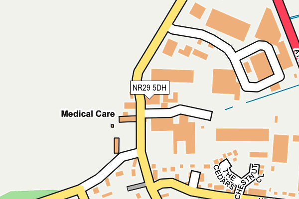
NR29 5DH is located in the Stalham electoral ward, within the local authority district of North Norfolk and the English Parliamentary constituency of North Norfolk. The Sub Integrated Care Board (ICB) Location is NHS Norfolk and Waveney ICB - 26A and the police force is Norfolk. This postcode has been in use since June 2000.


GetTheData
Source: OS OpenMap – Local (Ordnance Survey)
Source: OS VectorMap District (Ordnance Survey)
Licence: Open Government Licence (requires attribution)
| Easting | 638616 |
| Northing | 322059 |
| Latitude | 52.743446 |
| Longitude | 1.533713 |
GetTheData
Source: Open Postcode Geo
Licence: Open Government Licence
| Country | England |
| Postcode District | NR29 |
| ➜ NR29 open data dashboard ➜ See where NR29 is on a map ➜ Where is Catfield? | |
GetTheData
Source: Land Registry Price Paid Data
Licence: Open Government Licence
Elevation or altitude of NR29 5DH as distance above sea level:
| Metres | Feet | |
|---|---|---|
| Elevation | 10m | 33ft |
Elevation is measured from the approximate centre of the postcode, to the nearest point on an OS contour line from OS Terrain 50, which has contour spacing of ten vertical metres.
➜ How high above sea level am I? Find the elevation of your current position using your device's GPS.
GetTheData
Source: Open Postcode Elevation
Licence: Open Government Licence
| Ward | Stalham |
| Constituency | North Norfolk |
GetTheData
Source: ONS Postcode Database
Licence: Open Government Licence
| June 2022 | Violence and sexual offences | On or near The Cedars | 224m |
| May 2022 | Other theft | On or near Sutton Road | 210m |
| May 2022 | Criminal damage and arson | On or near The Cedars | 224m |
| ➜ Get more crime data in our Crime section | |||
GetTheData
Source: data.police.uk
Licence: Open Government Licence
| New Road (The Street) | Catfield | 150m |
| New Road (The Street) | Catfield | 227m |
| Lea Road (New Road) | Catfield | 321m |
| Crown (The Street) | Catfield | 380m |
| Crown (The Street) | Catfield | 393m |
GetTheData
Source: NaPTAN
Licence: Open Government Licence
GetTheData
Source: ONS Postcode Database
Licence: Open Government Licence


➜ Get more ratings from the Food Standards Agency
GetTheData
Source: Food Standards Agency
Licence: FSA terms & conditions
| Last Collection | |||
|---|---|---|---|
| Location | Mon-Fri | Sat | Distance |
| Staithe | 16:45 | 08:00 | 2,933m |
| Yarmouth Road Post Office | 16:50 | 09:20 | 3,012m |
| High Street Post Office | 17:15 | 12:30 | 3,655m |
GetTheData
Source: Dracos
Licence: Creative Commons Attribution-ShareAlike
| Facility | Distance |
|---|---|
| Catfield Recreation Ground Ludham Road, Catfield, Great Yarmouth Grass Pitches | 1.4km |
| Sutton C Of E Vc Infant School Laxfield Road, Sutton, Norwich Grass Pitches | 1.9km |
| Hickling Barn Ouse Lane, Hickling, Norwich Grass Pitches, Sports Hall | 2.7km |
GetTheData
Source: Active Places
Licence: Open Government Licence
| School | Phase of Education | Distance |
|---|---|---|
| Catfield Voluntary Controlled CofE Primary School School Lane, Catfield, Great Yarmouth, NR29 5DA | Primary | 929m |
| Sutton CofE VC Infant School Denise Close, Off Laxfield Road, Sutton, Norwich, NR12 9QP | Primary | 1.9km |
| Stalham Academy Old Yarmouth Road, Stalham, Norwich, NR12 9PS | Primary | 2.9km |
GetTheData
Source: Edubase
Licence: Open Government Licence
The below table lists the International Territorial Level (ITL) codes (formerly Nomenclature of Territorial Units for Statistics (NUTS) codes) and Local Administrative Units (LAU) codes for NR29 5DH:
| ITL 1 Code | Name |
|---|---|
| TLH | East |
| ITL 2 Code | Name |
| TLH1 | East Anglia |
| ITL 3 Code | Name |
| TLH16 | North and West Norfolk |
| LAU 1 Code | Name |
| E07000147 | North Norfolk |
GetTheData
Source: ONS Postcode Directory
Licence: Open Government Licence
The below table lists the Census Output Area (OA), Lower Layer Super Output Area (LSOA), and Middle Layer Super Output Area (MSOA) for NR29 5DH:
| Code | Name | |
|---|---|---|
| OA | E00136194 | |
| LSOA | E01026785 | North Norfolk 014E |
| MSOA | E02005583 | North Norfolk 014 |
GetTheData
Source: ONS Postcode Directory
Licence: Open Government Licence
| NR29 5BE | Bleak House Cottages | 40m |
| NR29 5RF | Birch End | 173m |
| NR29 5RG | The Cedars | 187m |
| NR29 5AA | The Street | 214m |
| NR29 5HP | Street Farm Barns | 221m |
| NR29 5AZ | The Street | 250m |
| NR29 5RH | Chestnut Close | 260m |
| NR29 5AU | Back Lane | 268m |
| NR29 5BQ | New Road | 274m |
| NR29 5DW | New Road | 320m |
GetTheData
Source: Open Postcode Geo; Land Registry Price Paid Data
Licence: Open Government Licence