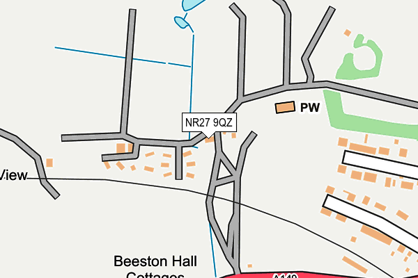
NR27 9QZ is located in the Beeston Regis & The Runtons electoral ward, within the local authority district of North Norfolk and the English Parliamentary constituency of North Norfolk. The Sub Integrated Care Board (ICB) Location is NHS Norfolk and Waveney ICB - 26A and the police force is Norfolk. This postcode has been in use since June 1996.


GetTheData
Source: OS OpenMap – Local (Ordnance Survey)
Source: OS VectorMap District (Ordnance Survey)
Licence: Open Government Licence (requires attribution)
| Easting | 617352 |
| Northing | 343113 |
| Latitude | 52.941398 |
| Longitude | 1.233289 |
GetTheData
Source: Open Postcode Geo
Licence: Open Government Licence
| Country | England |
| Postcode District | NR27 |
| ➜ NR27 open data dashboard ➜ See where NR27 is on a map | |
GetTheData
Source: Land Registry Price Paid Data
Licence: Open Government Licence
Elevation or altitude of NR27 9QZ as distance above sea level:
| Metres | Feet | |
|---|---|---|
| Elevation | 30m | 98ft |
Elevation is measured from the approximate centre of the postcode, to the nearest point on an OS contour line from OS Terrain 50, which has contour spacing of ten vertical metres.
➜ How high above sea level am I? Find the elevation of your current position using your device's GPS.
GetTheData
Source: Open Postcode Elevation
Licence: Open Government Licence
| Ward | Beeston Regis & The Runtons |
| Constituency | North Norfolk |
GetTheData
Source: ONS Postcode Database
Licence: Open Government Licence
| June 2022 | Violence and sexual offences | On or near Church Close | 307m |
| June 2022 | Violence and sexual offences | On or near Church Close | 307m |
| September 2021 | Violence and sexual offences | On or near Church Close | 307m |
| ➜ Get more crime data in our Crime section | |||
GetTheData
Source: data.police.uk
Licence: Open Government Licence
| Beeston Hall (Cromer Road) | Beeston Regis | 284m |
| Beeston Hall (Cromer Road) | Beeston Regis | 292m |
| Church Close (Cromer Road) | West Runton | 456m |
| Church Close (Cromer Road) | West Runton | 458m |
| Britons Lane (Cromer Road) | Beeston Regis | 628m |
| West Runton Station | 1km |
| Sheringham Station | 1.5km |
| Cromer Station | 4.2km |
GetTheData
Source: NaPTAN
Licence: Open Government Licence
GetTheData
Source: ONS Postcode Database
Licence: Open Government Licence


➜ Get more ratings from the Food Standards Agency
GetTheData
Source: Food Standards Agency
Licence: FSA terms & conditions
| Last Collection | |||
|---|---|---|---|
| Location | Mon-Fri | Sat | Distance |
| Britons Lane | 16:30 | 07:30 | 626m |
| Nelson Road | 16:15 | 10:00 | 738m |
| Cromer Road Post Office | 17:45 | 10:00 | 885m |
GetTheData
Source: Dracos
Licence: Creative Commons Attribution-ShareAlike
| Facility | Distance |
|---|---|
| Beeston Hall School Beeston Regis, Cromer Artificial Grass Pitch, Swimming Pool, Grass Pitches, Sports Hall, Outdoor Tennis Courts | 458m |
| Links Country Park Hotel And Golf Club Sandy Lane, West Runton, Cromer Health and Fitness Gym, Swimming Pool, Golf, Outdoor Tennis Courts | 1.2km |
| Sheringham Golf Club Sweet Briar Lane, Sheringham Golf | 2.3km |
GetTheData
Source: Active Places
Licence: Open Government Licence
| School | Phase of Education | Distance |
|---|---|---|
| Beeston Hall School West Runton, Cromer, Norfolk, Cromer, NR27 9NQ | Not applicable | 455m |
| Sheringham Community Primary School Cooper Road, Off Holway Road, Sheringham, NR26 8UH | Primary | 2.3km |
| St Andrew's School Aylmerton Hall, Holt Road, Aylmerton, Cromer, NR11 8QA | Not applicable | 2.4km |
GetTheData
Source: Edubase
Licence: Open Government Licence
The below table lists the International Territorial Level (ITL) codes (formerly Nomenclature of Territorial Units for Statistics (NUTS) codes) and Local Administrative Units (LAU) codes for NR27 9QZ:
| ITL 1 Code | Name |
|---|---|
| TLH | East |
| ITL 2 Code | Name |
| TLH1 | East Anglia |
| ITL 3 Code | Name |
| TLH16 | North and West Norfolk |
| LAU 1 Code | Name |
| E07000147 | North Norfolk |
GetTheData
Source: ONS Postcode Directory
Licence: Open Government Licence
The below table lists the Census Output Area (OA), Lower Layer Super Output Area (LSOA), and Middle Layer Super Output Area (MSOA) for NR27 9QZ:
| Code | Name | |
|---|---|---|
| OA | E00135880 | |
| LSOA | E01026731 | North Norfolk 006A |
| MSOA | E02005575 | North Norfolk 006 |
GetTheData
Source: ONS Postcode Directory
Licence: Open Government Licence
| NR27 9RS | Nelson Road | 284m |
| NR27 9QY | Church Close | 299m |
| NR27 9NG | Cromer Road | 324m |
| NR26 8DD | Conway Road | 511m |
| NR26 8SQ | Cromer Road | 577m |
| NR26 8DA | Nelson Road | 613m |
| NR27 9QU | Church Cottages | 616m |
| NR26 8BX | Nelson Road | 653m |
| NR26 8DB | Hillside | 659m |
| NR27 9QT | Cromer Road | 665m |
GetTheData
Source: Open Postcode Geo; Land Registry Price Paid Data
Licence: Open Government Licence