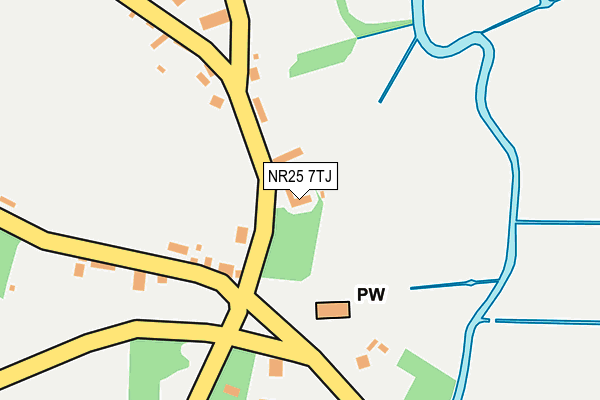
NR25 7TJ lies on The Street in Wiveton, Holt. NR25 7TJ is located in the Coastal electoral ward, within the local authority district of North Norfolk and the English Parliamentary constituency of North Norfolk. The Sub Integrated Care Board (ICB) Location is NHS Norfolk and Waveney ICB - 26A and the police force is Norfolk. This postcode has been in use since January 1980.


GetTheData
Source: OS OpenMap – Local (Ordnance Survey)
Source: OS VectorMap District (Ordnance Survey)
Licence: Open Government Licence (requires attribution)
| Easting | 604283 |
| Northing | 342988 |
| Latitude | 52.945403 |
| Longitude | 1.039019 |
GetTheData
Source: Open Postcode Geo
Licence: Open Government Licence
| Street | The Street |
| Locality | Wiveton |
| Town/City | Holt |
| Country | England |
| Postcode District | NR25 |
| ➜ NR25 open data dashboard ➜ See where NR25 is on a map ➜ Where is Wiveton? | |
GetTheData
Source: Land Registry Price Paid Data
Licence: Open Government Licence
Elevation or altitude of NR25 7TJ as distance above sea level:
| Metres | Feet | |
|---|---|---|
| Elevation | 10m | 33ft |
Elevation is measured from the approximate centre of the postcode, to the nearest point on an OS contour line from OS Terrain 50, which has contour spacing of ten vertical metres.
➜ How high above sea level am I? Find the elevation of your current position using your device's GPS.
GetTheData
Source: Open Postcode Elevation
Licence: Open Government Licence
| Ward | Coastal |
| Constituency | North Norfolk |
GetTheData
Source: ONS Postcode Database
Licence: Open Government Licence
| September 2021 | Anti-social behaviour | On or near Chapel Lane | 228m |
| May 2021 | Criminal damage and arson | On or near Chapel Lane | 228m |
| May 2021 | Violence and sexual offences | On or near Chapel Lane | 228m |
| ➜ Get more crime data in our Crime section | |||
GetTheData
Source: data.police.uk
Licence: Open Government Licence
| Wiveton Bell (Bridgefoot Lane) | Wiveton | 215m |
| Wiveton Bell (Wiveton Road) | Wiveton | 222m |
| Three Swallows (Holt Road) | Cley Next The Sea | 472m |
| Three Swallows (Holt Road) | Cley Next The Sea | 486m |
| Newgate Farm (Holt Road) | Cley Next The Sea | 672m |
GetTheData
Source: NaPTAN
Licence: Open Government Licence
| Percentage of properties with Next Generation Access | 100.0% |
| Percentage of properties with Superfast Broadband | 100.0% |
| Percentage of properties with Ultrafast Broadband | 0.0% |
| Percentage of properties with Full Fibre Broadband | 0.0% |
Superfast Broadband is between 30Mbps and 300Mbps
Ultrafast Broadband is > 300Mbps
| Percentage of properties unable to receive 2Mbps | 0.0% |
| Percentage of properties unable to receive 5Mbps | 0.0% |
| Percentage of properties unable to receive 10Mbps | 0.0% |
| Percentage of properties unable to receive 30Mbps | 0.0% |
GetTheData
Source: Ofcom
Licence: Ofcom Terms of Use (requires attribution)
GetTheData
Source: ONS Postcode Database
Licence: Open Government Licence


➜ Get more ratings from the Food Standards Agency
GetTheData
Source: Food Standards Agency
Licence: FSA terms & conditions
| Last Collection | |||
|---|---|---|---|
| Location | Mon-Fri | Sat | Distance |
| Iron Box Corner | 16:00 | 11:30 | 60m |
| Newgate St | 16:00 | 11:00 | 643m |
| Hall Lane | 16:10 | 11:30 | 731m |
GetTheData
Source: Dracos
Licence: Creative Commons Attribution-ShareAlike
| Facility | Distance |
|---|---|
| Blakeney Playing Field Langham Road, Blakeney, Holt Grass Pitches, Outdoor Tennis Courts | 1.8km |
| The Playing Field (Closed) Field Dalling, Holt Grass Pitches | 5.3km |
| Holt Playing Fields Woodfield Road, Holt Grass Pitches | 5.3km |
GetTheData
Source: Active Places
Licence: Open Government Licence
| School | Phase of Education | Distance |
|---|---|---|
| Blakeney Church of England Voluntary Aided Primary School Wiveton Road, Blakeney, Holt, NR25 7NJ | Primary | 1.2km |
| Langham Village School North Street, Langham, Holt, NR25 7DG | Primary | 3.8km |
| Holt Community Primary School Norwich Road, Holt, NR25 6SG | Primary | 5.7km |
GetTheData
Source: Edubase
Licence: Open Government Licence
The below table lists the International Territorial Level (ITL) codes (formerly Nomenclature of Territorial Units for Statistics (NUTS) codes) and Local Administrative Units (LAU) codes for NR25 7TJ:
| ITL 1 Code | Name |
|---|---|
| TLH | East |
| ITL 2 Code | Name |
| TLH1 | East Anglia |
| ITL 3 Code | Name |
| TLH16 | North and West Norfolk |
| LAU 1 Code | Name |
| E07000147 | North Norfolk |
GetTheData
Source: ONS Postcode Directory
Licence: Open Government Licence
The below table lists the Census Output Area (OA), Lower Layer Super Output Area (LSOA), and Middle Layer Super Output Area (MSOA) for NR25 7TJ:
| Code | Name | |
|---|---|---|
| OA | E00135937 | |
| LSOA | E01026739 | North Norfolk 002A |
| MSOA | E02005571 | North Norfolk 002 |
GetTheData
Source: ONS Postcode Directory
Licence: Open Government Licence
| NR25 7TL | Blakeney Road | 175m |
| NR25 7TH | The Street | 189m |
| NR25 7TQ | Chapel Street | 226m |
| NR25 7TW | Glandford Road | 270m |
| NR25 7TN | Blakeney Road | 300m |
| NR25 7TR | Glandford Road | 508m |
| NR25 7TT | Newgate Green | 520m |
| NR25 7TG | Hall Lane | 529m |
| NR25 7TF | Leatherpool Lane | 537m |
| NR25 7TZ | Chalk Lane | 542m |
GetTheData
Source: Open Postcode Geo; Land Registry Price Paid Data
Licence: Open Government Licence