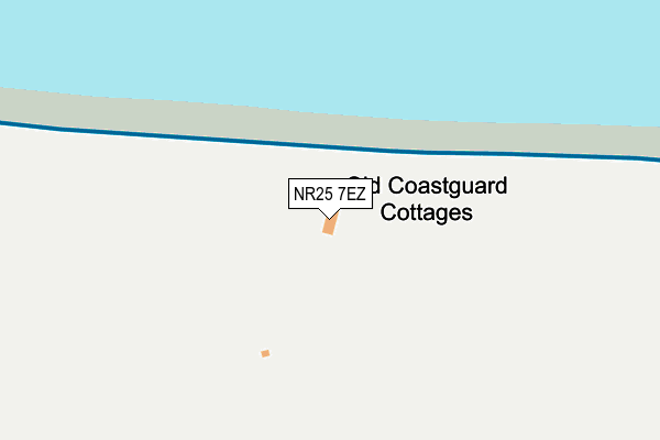
NR25 7EZ lies on Coast Guard Cottages in Weybourne, Holt. NR25 7EZ is located in the Coastal electoral ward, within the local authority district of North Norfolk and the English Parliamentary constituency of North Norfolk. The Sub Integrated Care Board (ICB) Location is NHS Norfolk and Waveney ICB - 26A and the police force is Norfolk. This postcode has been in use since January 1980.


GetTheData
Source: OS OpenMap – Local (Ordnance Survey)
Source: OS VectorMap District (Ordnance Survey)
Licence: Open Government Licence (requires attribution)
| Easting | 611669 |
| Northing | 343600 |
| Latitude | 52.948010 |
| Longitude | 1.149154 |
GetTheData
Source: Open Postcode Geo
Licence: Open Government Licence
| Street | Coast Guard Cottages |
| Locality | Weybourne |
| Town/City | Holt |
| Country | England |
| Postcode District | NR25 |
| ➜ NR25 open data dashboard ➜ See where NR25 is on a map | |
GetTheData
Source: Land Registry Price Paid Data
Licence: Open Government Licence
Elevation or altitude of NR25 7EZ as distance above sea level:
| Metres | Feet | |
|---|---|---|
| Elevation | 20m | 66ft |
Elevation is measured from the approximate centre of the postcode, to the nearest point on an OS contour line from OS Terrain 50, which has contour spacing of ten vertical metres.
➜ How high above sea level am I? Find the elevation of your current position using your device's GPS.
GetTheData
Source: Open Postcode Elevation
Licence: Open Government Licence
| Ward | Coastal |
| Constituency | North Norfolk |
GetTheData
Source: ONS Postcode Database
Licence: Open Government Licence
| Church (The Street) | Weybourne | 791m |
| Church (The Street) | Weybourne | 810m |
| Muckleburgh Grounds | Muckleburgh Collection | 1,315m |
| Weynor Gardens (A149) | Kelling | 1,528m |
| Weynor Gardens (A149) | Kelling | 1,529m |
| Sheringham Station | 4.2km |
GetTheData
Source: NaPTAN
Licence: Open Government Licence
| Percentage of properties with Next Generation Access | 100.0% |
| Percentage of properties with Superfast Broadband | 0.0% |
| Percentage of properties with Ultrafast Broadband | 0.0% |
| Percentage of properties with Full Fibre Broadband | 0.0% |
Superfast Broadband is between 30Mbps and 300Mbps
Ultrafast Broadband is > 300Mbps
| Percentage of properties unable to receive 2Mbps | 0.0% |
| Percentage of properties unable to receive 5Mbps | 0.0% |
| Percentage of properties unable to receive 10Mbps | 0.0% |
| Percentage of properties unable to receive 30Mbps | 100.0% |
GetTheData
Source: Ofcom
Licence: Ofcom Terms of Use (requires attribution)
GetTheData
Source: ONS Postcode Database
Licence: Open Government Licence


➜ Get more ratings from the Food Standards Agency
GetTheData
Source: Food Standards Agency
Licence: FSA terms & conditions
| Last Collection | |||
|---|---|---|---|
| Location | Mon-Fri | Sat | Distance |
| Coast Road Post Office | 16:00 | 10:45 | 809m |
| Station Road | 16:00 | 10:45 | 880m |
| The Street | 16:00 | 11:00 | 2,461m |
GetTheData
Source: Dracos
Licence: Creative Commons Attribution-ShareAlike
| Facility | Distance |
|---|---|
| Fitness Express At Kelling Heath Sandy Hill Lane, Weybourne, Holt Swimming Pool, Health and Fitness Gym, Outdoor Tennis Courts | 2.2km |
| Woodlands Leisure (Closed) Holt Road, Upper Sheringham, Sheringham Indoor Bowls, Swimming Pool, Health and Fitness Gym | 3.1km |
| Sheringham Recreation Ground Weybourne Road , Sheringham Grass Pitches, Outdoor Tennis Courts | 3.3km |
GetTheData
Source: Active Places
Licence: Open Government Licence
| School | Phase of Education | Distance |
|---|---|---|
| Kelling CE Primary School Salthouse Road, Kelling, NR25 7ED | Primary | 2.4km |
| Sheringham High School Holt Road, Sheringham, NR26 8ND | Secondary | 3.5km |
| Sheringham Woodfields School Holt Road, Sheringham, NR26 8ND | Not applicable | 3.7km |
GetTheData
Source: Edubase
Licence: Open Government Licence
The below table lists the International Territorial Level (ITL) codes (formerly Nomenclature of Territorial Units for Statistics (NUTS) codes) and Local Administrative Units (LAU) codes for NR25 7EZ:
| ITL 1 Code | Name |
|---|---|
| TLH | East |
| ITL 2 Code | Name |
| TLH1 | East Anglia |
| ITL 3 Code | Name |
| TLH16 | North and West Norfolk |
| LAU 1 Code | Name |
| E07000147 | North Norfolk |
GetTheData
Source: ONS Postcode Directory
Licence: Open Government Licence
The below table lists the Census Output Area (OA), Lower Layer Super Output Area (LSOA), and Middle Layer Super Output Area (MSOA) for NR25 7EZ:
| Code | Name | |
|---|---|---|
| OA | E00135953 | |
| LSOA | E01026741 | North Norfolk 004A |
| MSOA | E02005573 | North Norfolk 004 |
GetTheData
Source: ONS Postcode Directory
Licence: Open Government Licence
| NR25 7EX | 567m | |
| NR25 7ET | Temple Drive | 629m |
| NR25 7EU | Temple Close | 667m |
| NR25 7EY | Sheringham Road | 691m |
| NR25 7SR | Beach Lane | 693m |
| NR25 7HH | All Saints Close | 769m |
| NR25 7AH | Beach Lane | 786m |
| NR25 7HP | Church Farm Close | 808m |
| NR25 7SZ | The Street | 816m |
| NR25 7SX | Church Street | 823m |
GetTheData
Source: Open Postcode Geo; Land Registry Price Paid Data
Licence: Open Government Licence