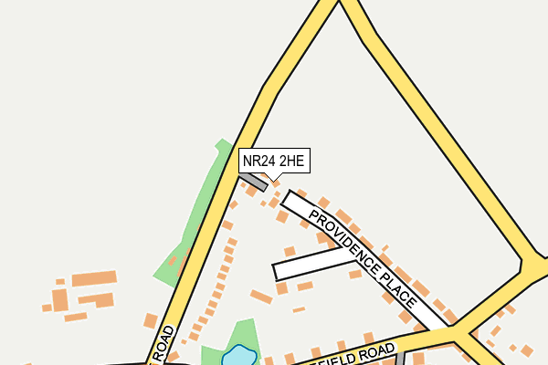
NR24 2HE lies on Oaklands in Briston, Melton Constable. NR24 2HE is located in the Briston electoral ward, within the local authority district of North Norfolk and the English Parliamentary constituency of North Norfolk. The Sub Integrated Care Board (ICB) Location is NHS Norfolk and Waveney ICB - 26A and the police force is Norfolk. This postcode has been in use since January 1992.


GetTheData
Source: OS OpenMap – Local (Ordnance Survey)
Source: OS VectorMap District (Ordnance Survey)
Licence: Open Government Licence (requires attribution)
| Easting | 606306 |
| Northing | 333286 |
| Latitude | 52.857514 |
| Longitude | 1.062913 |
GetTheData
Source: Open Postcode Geo
Licence: Open Government Licence
| Street | Oaklands |
| Locality | Briston |
| Town/City | Melton Constable |
| Country | England |
| Postcode District | NR24 |
| ➜ NR24 open data dashboard ➜ See where NR24 is on a map ➜ Where is Briston? | |
GetTheData
Source: Land Registry Price Paid Data
Licence: Open Government Licence
Elevation or altitude of NR24 2HE as distance above sea level:
| Metres | Feet | |
|---|---|---|
| Elevation | 50m | 164ft |
Elevation is measured from the approximate centre of the postcode, to the nearest point on an OS contour line from OS Terrain 50, which has contour spacing of ten vertical metres.
➜ How high above sea level am I? Find the elevation of your current position using your device's GPS.
GetTheData
Source: Open Postcode Elevation
Licence: Open Government Licence
| Ward | Briston |
| Constituency | North Norfolk |
GetTheData
Source: ONS Postcode Database
Licence: Open Government Licence
2018 20 DEC £380,000 |
2004 30 APR £260,000 |
4, OAKLANDS, BRISTON, MELTON CONSTABLE, NR24 2HE 2003 2 DEC £182,000 |
2002 26 MAR £187,000 |
1998 5 OCT £112,500 |
1996 23 FEB £88,000 |
GetTheData
Source: HM Land Registry Price Paid Data
Licence: Contains HM Land Registry data © Crown copyright and database right 2024. This data is licensed under the Open Government Licence v3.0.
| June 2022 | Criminal damage and arson | On or near Providence Place | 129m |
| June 2022 | Anti-social behaviour | On or near Providence Place | 129m |
| May 2022 | Anti-social behaviour | On or near Providence Place | 129m |
| ➜ Oaklands crime map and outcomes | |||
GetTheData
Source: data.police.uk
Licence: Open Government Licence
| Stody Turn (Holt Road) | Briston | 248m |
| Stody Turn (Holt Road) | Briston | 260m |
| Vicarage Corner (Holt Road) | Briston | 260m |
| Vicarage Corner (Holt Road) | Briston | 264m |
| The John H Stracey (West End) | Briston | 451m |
GetTheData
Source: NaPTAN
Licence: Open Government Licence
| Percentage of properties with Next Generation Access | 100.0% |
| Percentage of properties with Superfast Broadband | 100.0% |
| Percentage of properties with Ultrafast Broadband | 0.0% |
| Percentage of properties with Full Fibre Broadband | 0.0% |
Superfast Broadband is between 30Mbps and 300Mbps
Ultrafast Broadband is > 300Mbps
| Percentage of properties unable to receive 2Mbps | 0.0% |
| Percentage of properties unable to receive 5Mbps | 0.0% |
| Percentage of properties unable to receive 10Mbps | 0.0% |
| Percentage of properties unable to receive 30Mbps | 0.0% |
GetTheData
Source: Ofcom
Licence: Ofcom Terms of Use (requires attribution)
GetTheData
Source: ONS Postcode Database
Licence: Open Government Licence


➜ Get more ratings from the Food Standards Agency
GetTheData
Source: Food Standards Agency
Licence: FSA terms & conditions
| Last Collection | |||
|---|---|---|---|
| Location | Mon-Fri | Sat | Distance |
| Holt Road | 16:45 | 08:45 | 3,339m |
GetTheData
Source: Dracos
Licence: Creative Commons Attribution-ShareAlike
| Facility | Distance |
|---|---|
| Briston Recreation Ground Stone Beck Lane, Melton Constable, Briston Grass Pitches, Outdoor Tennis Courts | 946m |
| Astley Primary School Fakenham Road, Briston, Melton Constable Grass Pitches | 986m |
| Hunworth & Stody Village Hall Hunworth, Melton Constable Sports Hall | 2.2km |
GetTheData
Source: Active Places
Licence: Open Government Licence
| School | Phase of Education | Distance |
|---|---|---|
| Astley Primary School Fakenham Road, Melton Constable, NR24 2HH | Primary | 960m |
GetTheData
Source: Edubase
Licence: Open Government Licence
The below table lists the International Territorial Level (ITL) codes (formerly Nomenclature of Territorial Units for Statistics (NUTS) codes) and Local Administrative Units (LAU) codes for NR24 2HE:
| ITL 1 Code | Name |
|---|---|
| TLH | East |
| ITL 2 Code | Name |
| TLH1 | East Anglia |
| ITL 3 Code | Name |
| TLH16 | North and West Norfolk |
| LAU 1 Code | Name |
| E07000147 | North Norfolk |
GetTheData
Source: ONS Postcode Directory
Licence: Open Government Licence
The below table lists the Census Output Area (OA), Lower Layer Super Output Area (LSOA), and Middle Layer Super Output Area (MSOA) for NR24 2HE:
| Code | Name | |
|---|---|---|
| OA | E00135874 | |
| LSOA | E01026730 | North Norfolk 008B |
| MSOA | E02005577 | North Norfolk 008 |
GetTheData
Source: ONS Postcode Directory
Licence: Open Government Licence
| NR24 2HR | Horseshoe Common | 128m |
| NR24 2HZ | Providence Place | 133m |
| NR24 2HU | Edgefield Road | 229m |
| NR24 2HT | Norwich Road | 264m |
| NR24 2HS | Norwich Road | 265m |
| NR24 2HY | West End | 338m |
| NR24 2HP | Holt Road | 392m |
| NR24 2HJ | Fakenham Road | 435m |
| NR24 2HN | Church Street | 464m |
| NR24 2NZ | Hall Lane | 506m |
GetTheData
Source: Open Postcode Geo; Land Registry Price Paid Data
Licence: Open Government Licence