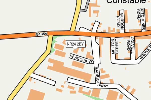
NR24 2BY is located in the Stody electoral ward, within the local authority district of North Norfolk and the English Parliamentary constituency of Broadland. The Sub Integrated Care Board (ICB) Location is NHS Norfolk and Waveney ICB - 26A and the police force is Norfolk. This postcode has been in use since January 1980.


GetTheData
Source: OS OpenMap – Local (Ordnance Survey)
Source: OS VectorMap District (Ordnance Survey)
Licence: Open Government Licence (requires attribution)
| Easting | 604354 |
| Northing | 333006 |
| Latitude | 52.855770 |
| Longitude | 1.033806 |
GetTheData
Source: Open Postcode Geo
Licence: Open Government Licence
| Country | England |
| Postcode District | NR24 |
| ➜ NR24 open data dashboard ➜ See where NR24 is on a map ➜ Where is Melton Constable? | |
GetTheData
Source: Land Registry Price Paid Data
Licence: Open Government Licence
Elevation or altitude of NR24 2BY as distance above sea level:
| Metres | Feet | |
|---|---|---|
| Elevation | 80m | 262ft |
Elevation is measured from the approximate centre of the postcode, to the nearest point on an OS contour line from OS Terrain 50, which has contour spacing of ten vertical metres.
➜ How high above sea level am I? Find the elevation of your current position using your device's GPS.
GetTheData
Source: Open Postcode Elevation
Licence: Open Government Licence
| Ward | Stody |
| Constituency | Broadland |
GetTheData
Source: ONS Postcode Database
Licence: Open Government Licence
| August 2022 | Public order | On or near Garden Close | 463m |
| August 2022 | Criminal damage and arson | On or near Garden Close | 463m |
| June 2022 | Anti-social behaviour | On or near Marriott Way | 26m |
| ➜ Get more crime data in our Crime section | |||
GetTheData
Source: data.police.uk
Licence: Open Government Licence
| Bus Shelter (Fakenham Road) | Melton Constable | 102m |
| Bus Shelter (Fakenham Road) | Melton Constable | 116m |
| Hillside (Fakenham Road) | Melton Constable | 523m |
| Hillside (Fakenham Road) | Melton Constable | 552m |
| School (Fakenham Road) | Briston | 1,079m |
GetTheData
Source: NaPTAN
Licence: Open Government Licence
GetTheData
Source: ONS Postcode Database
Licence: Open Government Licence

➜ Get more ratings from the Food Standards Agency
GetTheData
Source: Food Standards Agency
Licence: FSA terms & conditions
| Last Collection | |||
|---|---|---|---|
| Location | Mon-Fri | Sat | Distance |
| Holt Road | 16:45 | 08:45 | 3,516m |
| Filling Station Post Office | 15:20 | 11:00 | 4,717m |
| The Oaks | 15:15 | 10:00 | 5,739m |
GetTheData
Source: Dracos
Licence: Creative Commons Attribution-ShareAlike
| Facility | Distance |
|---|---|
| Astley Primary School Fakenham Road, Briston, Melton Constable Grass Pitches | 999m |
| Briston Recreation Ground Stone Beck Lane, Melton Constable, Briston Grass Pitches, Outdoor Tennis Courts | 2km |
| Hunworth & Stody Village Hall Hunworth, Melton Constable Sports Hall | 3.3km |
GetTheData
Source: Active Places
Licence: Open Government Licence
| School | Phase of Education | Distance |
|---|---|---|
| Astley Primary School Fakenham Road, Melton Constable, NR24 2HH | Primary | 1km |
GetTheData
Source: Edubase
Licence: Open Government Licence
The below table lists the International Territorial Level (ITL) codes (formerly Nomenclature of Territorial Units for Statistics (NUTS) codes) and Local Administrative Units (LAU) codes for NR24 2BY:
| ITL 1 Code | Name |
|---|---|
| TLH | East |
| ITL 2 Code | Name |
| TLH1 | East Anglia |
| ITL 3 Code | Name |
| TLH16 | North and West Norfolk |
| LAU 1 Code | Name |
| E07000147 | North Norfolk |
GetTheData
Source: ONS Postcode Directory
Licence: Open Government Licence
The below table lists the Census Output Area (OA), Lower Layer Super Output Area (LSOA), and Middle Layer Super Output Area (MSOA) for NR24 2BY:
| Code | Name | |
|---|---|---|
| OA | E00135867 | |
| LSOA | E01026729 | North Norfolk 008A |
| MSOA | E02005577 | North Norfolk 008 |
GetTheData
Source: ONS Postcode Directory
Licence: Open Government Licence
| NR24 2BS | Astley Terrace | 40m |
| NR24 2DB | Melton Street | 81m |
| NR24 2BT | Marriott Way | 122m |
| NR24 2DR | Hastings Close | 132m |
| NR24 2DP | Melton Mews | 138m |
| NR24 2DA | Briston Road | 152m |
| NR24 2DG | Briston Road | 166m |
| NR24 2DD | Colville Road | 178m |
| NR24 2DE | Grove Road | 212m |
| NR24 2BW | Gordon Road | 213m |
GetTheData
Source: Open Postcode Geo; Land Registry Price Paid Data
Licence: Open Government Licence