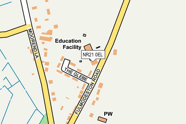
NR21 0EL is located in the Stibbard electoral ward, within the local authority district of North Norfolk and the English Parliamentary constituency of Broadland. The Sub Integrated Care Board (ICB) Location is NHS Norfolk and Waveney ICB - 26A and the police force is Norfolk. This postcode has been in use since January 1980.


GetTheData
Source: OS OpenMap – Local (Ordnance Survey)
Source: OS VectorMap District (Ordnance Survey)
Licence: Open Government Licence (requires attribution)
| Easting | 598283 |
| Northing | 328612 |
| Latitude | 52.818590 |
| Longitude | 0.941099 |
GetTheData
Source: Open Postcode Geo
Licence: Open Government Licence
| Country | England |
| Postcode District | NR21 |
| ➜ NR21 open data dashboard ➜ See where NR21 is on a map ➜ Where is Stibbard? | |
GetTheData
Source: Land Registry Price Paid Data
Licence: Open Government Licence
Elevation or altitude of NR21 0EL as distance above sea level:
| Metres | Feet | |
|---|---|---|
| Elevation | 50m | 164ft |
Elevation is measured from the approximate centre of the postcode, to the nearest point on an OS contour line from OS Terrain 50, which has contour spacing of ten vertical metres.
➜ How high above sea level am I? Find the elevation of your current position using your device's GPS.
GetTheData
Source: Open Postcode Elevation
Licence: Open Government Licence
| Ward | Stibbard |
| Constituency | Broadland |
GetTheData
Source: ONS Postcode Database
Licence: Open Government Licence
| June 2022 | Violence and sexual offences | On or near The Glebe | 71m |
| June 2022 | Violence and sexual offences | On or near The Glebe | 71m |
| June 2022 | Violence and sexual offences | On or near The Glebe | 71m |
| ➜ Get more crime data in our Crime section | |||
GetTheData
Source: data.police.uk
Licence: Open Government Licence
| Primary School (Fulmodeston Road) | Stibbard | 288m |
| Primary School (Fulmodeston Road) | Stibbard | 295m |
| Green (Fulmodeston Road) | Stibbard | 363m |
| Green (Fulmodeston Road) | Stibbard | 372m |
| Bridge Road (A1067) | Stibbard | 862m |
GetTheData
Source: NaPTAN
Licence: Open Government Licence
GetTheData
Source: ONS Postcode Database
Licence: Open Government Licence


➜ Get more ratings from the Food Standards Agency
GetTheData
Source: Food Standards Agency
Licence: FSA terms & conditions
| Last Collection | |||
|---|---|---|---|
| Location | Mon-Fri | Sat | Distance |
| Church Corner | 15:55 | 09:15 | 2,482m |
| Station Road Post Office | 16:00 | 08:50 | 2,783m |
| Fakenham Road | 16:00 | 07:30 | 3,353m |
GetTheData
Source: Dracos
Licence: Creative Commons Attribution-ShareAlike
| Facility | Distance |
|---|---|
| Wood Norton Village Hall Stibbard Road, Wood Norton, Dereham Sports Hall | 2.8km |
| Great Ryburgh Playing Field Fakenham Road, Great Ryburgh, Fakenham Grass Pitches | 3km |
| Barney And Fulmodeston Cricket Club The Drift, Barney, Fakenham Grass Pitches | 3.8km |
GetTheData
Source: Active Places
Licence: Open Government Licence
| School | Phase of Education | Distance |
|---|---|---|
| All Saints Church of England CEVA Primary School Part of Flourish Federation Fulmodeston Road, Stibbard, Fakenham, NR21 0LT | Primary | 174m |
| Little Snoring Community Primary Academy Thursford Road, Little Snoring, Fakenham, NR21 0JN | Primary | 4.6km |
| Foulsham Primary School Academy High Street, Foulsham, Dereham, NR20 5RT | Primary | 6.2km |
GetTheData
Source: Edubase
Licence: Open Government Licence
The below table lists the International Territorial Level (ITL) codes (formerly Nomenclature of Territorial Units for Statistics (NUTS) codes) and Local Administrative Units (LAU) codes for NR21 0EL:
| ITL 1 Code | Name |
|---|---|
| TLH | East |
| ITL 2 Code | Name |
| TLH1 | East Anglia |
| ITL 3 Code | Name |
| TLH16 | North and West Norfolk |
| LAU 1 Code | Name |
| E07000147 | North Norfolk |
GetTheData
Source: ONS Postcode Directory
Licence: Open Government Licence
The below table lists the Census Output Area (OA), Lower Layer Super Output Area (LSOA), and Middle Layer Super Output Area (MSOA) for NR21 0EL:
| Code | Name | |
|---|---|---|
| OA | E00136222 | |
| LSOA | E01026787 | North Norfolk 009C |
| MSOA | E02005578 | North Norfolk 009 |
GetTheData
Source: ONS Postcode Directory
Licence: Open Government Licence
| NR21 0LU | The Glebe | 65m |
| NR21 0NA | Fulmodeston Road | 77m |
| NR21 0LT | Fulmodeston Road | 158m |
| NR21 0EJ | Moor End Lane | 211m |
| NR21 0EX | Wood Norton Road | 413m |
| NR21 0EN | Fakenham Road | 415m |
| NR21 0AQ | Guist Bottom Road | 572m |
| NR21 0EQ | Moor End Road | 574m |
| NR21 0LX | Stibbard Road | 774m |
| NR21 0EE | Great Ryburgh Road | 922m |
GetTheData
Source: Open Postcode Geo; Land Registry Price Paid Data
Licence: Open Government Licence