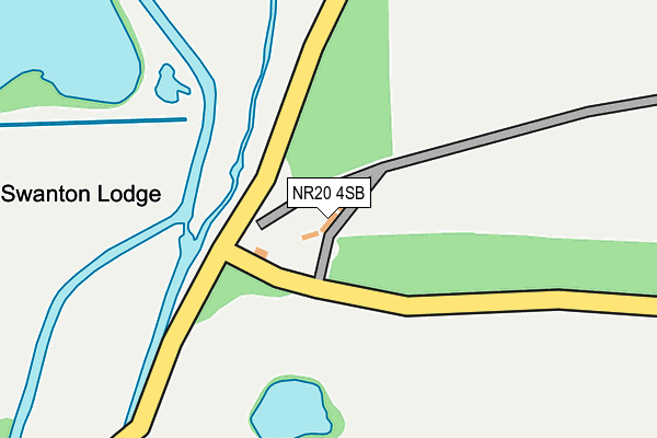
NR20 4SB is located in the Upper Wensum electoral ward, within the local authority district of Breckland and the English Parliamentary constituency of Mid Norfolk. The Sub Integrated Care Board (ICB) Location is NHS Norfolk and Waveney ICB - 26A and the police force is Norfolk. This postcode has been in use since February 2009.


GetTheData
Source: OS OpenMap – Local (Ordnance Survey)
Source: OS VectorMap District (Ordnance Survey)
Licence: Open Government Licence (requires attribution)
| Easting | 602335 |
| Northing | 318703 |
| Latitude | 52.728105 |
| Longitude | 0.995007 |
GetTheData
Source: Open Postcode Geo
Licence: Open Government Licence
| Country | England |
| Postcode District | NR20 |
| ➜ NR20 open data dashboard ➜ See where NR20 is on a map | |
GetTheData
Source: Land Registry Price Paid Data
Licence: Open Government Licence
Elevation or altitude of NR20 4SB as distance above sea level:
| Metres | Feet | |
|---|---|---|
| Elevation | 30m | 98ft |
Elevation is measured from the approximate centre of the postcode, to the nearest point on an OS contour line from OS Terrain 50, which has contour spacing of ten vertical metres.
➜ How high above sea level am I? Find the elevation of your current position using your device's GPS.
GetTheData
Source: Open Postcode Elevation
Licence: Open Government Licence
| Ward | Upper Wensum |
| Constituency | Mid Norfolk |
GetTheData
Source: ONS Postcode Database
Licence: Open Government Licence
| June 2021 | Violence and sexual offences | On or near Mill Street | 182m |
| June 2021 | Anti-social behaviour | On or near Mill Street | 426m |
| ➜ Get more crime data in our Crime section | |||
GetTheData
Source: data.police.uk
Licence: Open Government Licence
| Barracks (South Avenue) | Swanton Morley | 1,233m |
| South Avenue | Swanton Morley | 1,276m |
| Hannah Road | Swanton Morley | 1,438m |
| Hannah Road | Swanton Morley | 1,454m |
| Worthing Road | Swanton Morley | 1,456m |
GetTheData
Source: NaPTAN
Licence: Open Government Licence
GetTheData
Source: ONS Postcode Database
Licence: Open Government Licence


➜ Get more ratings from the Food Standards Agency
GetTheData
Source: Food Standards Agency
Licence: FSA terms & conditions
| Last Collection | |||
|---|---|---|---|
| Location | Mon-Fri | Sat | Distance |
| Swanton Bridge | 16:15 | 11:30 | 441m |
| Swanton Morley Road | 16:15 | 11:30 | 2,775m |
| Mill Street | 16:45 | 08:45 | 2,934m |
GetTheData
Source: Dracos
Licence: Creative Commons Attribution-ShareAlike
| Facility | Distance |
|---|---|
| Robertson Barracks Swanton Morley, Dereham Grass Pitches | 1.4km |
| Swanton Morley Village Hall And Playing Field Manns Lane, Swanton Morley, Dereham Grass Pitches, Sports Hall | 1.9km |
| Billingford Playing Fields The Street, Billingford, Dereham Grass Pitches | 1.9km |
GetTheData
Source: Active Places
Licence: Open Government Licence
| School | Phase of Education | Distance |
|---|---|---|
| Swanton Morley VC Primary School Manns Lane, Swanton Morley, Dereham, NR20 4PX | Primary | 1.9km |
| Bawdeswell Community Primary School Fakenham Road, Bawdeswell, Dereham, NR20 4RR | Primary | 2.8km |
| North Elmham CEVA Primary School part of Flourish Federation Holt Road, North Elmham, Dereham, NR20 5JS | Primary | 4.4km |
GetTheData
Source: Edubase
Licence: Open Government Licence
The below table lists the International Territorial Level (ITL) codes (formerly Nomenclature of Territorial Units for Statistics (NUTS) codes) and Local Administrative Units (LAU) codes for NR20 4SB:
| ITL 1 Code | Name |
|---|---|
| TLH | East |
| ITL 2 Code | Name |
| TLH1 | East Anglia |
| ITL 3 Code | Name |
| TLH17 | Breckland and South Norfolk |
| LAU 1 Code | Name |
| E07000143 | Breckland |
GetTheData
Source: ONS Postcode Directory
Licence: Open Government Licence
The below table lists the Census Output Area (OA), Lower Layer Super Output Area (LSOA), and Middle Layer Super Output Area (MSOA) for NR20 4SB:
| Code | Name | |
|---|---|---|
| OA | E00134328 | |
| LSOA | E01026436 | Breckland 001A |
| MSOA | E02005503 | Breckland 001 |
GetTheData
Source: ONS Postcode Directory
Licence: Open Government Licence
| NR20 4RJ | 317m | |
| NR20 4QB | Mill Street | 791m |
| NR20 4QE | 957m | |
| NR20 4PN | Primrose Square | 1371m |
| NR20 4RL | Bylaugh Park | 1402m |
| NR20 4PF | Hannah Road | 1468m |
| NR20 4QA | Rectory Road | 1478m |
| NR20 4FU | Dennis Close | 1501m |
| NR20 4QD | Worthing Road | 1511m |
| NR20 4PH | Ward Crescent | 1520m |
GetTheData
Source: Open Postcode Geo; Land Registry Price Paid Data
Licence: Open Government Licence