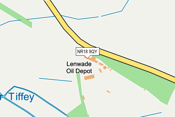
NR18 9QY is located in the South Wymondham electoral ward, within the local authority district of South Norfolk and the English Parliamentary constituency of Mid Norfolk. The Sub Integrated Care Board (ICB) Location is NHS Norfolk and Waveney ICB - 26A and the police force is Norfolk. This postcode has been in use since October 1984.


GetTheData
Source: OS OpenMap – Local (Ordnance Survey)
Source: OS VectorMap District (Ordnance Survey)
Licence: Open Government Licence (requires attribution)
| Easting | 613149 |
| Northing | 300703 |
| Latitude | 52.562386 |
| Longitude | 1.143282 |
GetTheData
Source: Open Postcode Geo
Licence: Open Government Licence
| Country | England |
| Postcode District | NR18 |
| ➜ NR18 open data dashboard ➜ See where NR18 is on a map | |
GetTheData
Source: Land Registry Price Paid Data
Licence: Open Government Licence
Elevation or altitude of NR18 9QY as distance above sea level:
| Metres | Feet | |
|---|---|---|
| Elevation | 40m | 131ft |
Elevation is measured from the approximate centre of the postcode, to the nearest point on an OS contour line from OS Terrain 50, which has contour spacing of ten vertical metres.
➜ How high above sea level am I? Find the elevation of your current position using your device's GPS.
GetTheData
Source: Open Postcode Elevation
Licence: Open Government Licence
| Ward | South Wymondham |
| Constituency | Mid Norfolk |
GetTheData
Source: ONS Postcode Database
Licence: Open Government Licence
| Holly Blue Road (Blackthorn Road) | Harts Farm | 1,513m |
| Mallow Road (Holly Blue Road) | Harts Farm | 1,532m |
| Speedwell Road (Holly Blue Road) | Harts Farm | 1,712m |
| Garage (Norwich Road) | Wymondham | 1,907m |
| Wymondham Station | 1.7km |
| Spooner Row Station | 4.9km |
GetTheData
Source: NaPTAN
Licence: Open Government Licence
| Percentage of properties with Next Generation Access | 0.0% |
| Percentage of properties with Superfast Broadband | 0.0% |
| Percentage of properties with Ultrafast Broadband | 0.0% |
| Percentage of properties with Full Fibre Broadband | 0.0% |
Superfast Broadband is between 30Mbps and 300Mbps
Ultrafast Broadband is > 300Mbps
| Percentage of properties unable to receive 2Mbps | 0.0% |
| Percentage of properties unable to receive 5Mbps | 100.0% |
| Percentage of properties unable to receive 10Mbps | 100.0% |
| Percentage of properties unable to receive 30Mbps | 100.0% |
GetTheData
Source: Ofcom
Licence: Ofcom Terms of Use (requires attribution)
GetTheData
Source: ONS Postcode Database
Licence: Open Government Licence


➜ Get more ratings from the Food Standards Agency
GetTheData
Source: Food Standards Agency
Licence: FSA terms & conditions
| Last Collection | |||
|---|---|---|---|
| Location | Mon-Fri | Sat | Distance |
| The Lodge | 17:15 | 12:00 | 1,612m |
| Green Lane Post Office | 17:15 | 12:00 | 1,669m |
| Ayton Road | 17:30 | 12:00 | 1,844m |
GetTheData
Source: Dracos
Licence: Creative Commons Attribution-ShareAlike
| Facility | Distance |
|---|---|
| Ketts Park Community Recreation Centre Harts Farm Road, Wymondham Grass Pitches, Outdoor Tennis Courts, Artificial Grass Pitch | 1.7km |
| Browick Recreation Ground Browick Road, Wymondham Grass Pitches, Outdoor Tennis Courts, Cycling | 1.7km |
| Wymondham Dell Indoor Bowls Club Norwich Road, Wymondham Indoor Bowls | 1.9km |
GetTheData
Source: Active Places
Licence: Open Government Licence
| School | Phase of Education | Distance |
|---|---|---|
| Browick Road Primary and Nursery School 8 - 12 Browick Road, Wymondham, NR18 0QW | Primary | 1.9km |
| Wymondham High Academy Folly Road, Wymondham, NR18 0QT | Secondary | 2.3km |
| Ashleigh Primary School and Nursery, Wymondham Sheffield Road, Wymondham, NR18 0HL | Primary | 2.3km |
GetTheData
Source: Edubase
Licence: Open Government Licence
The below table lists the International Territorial Level (ITL) codes (formerly Nomenclature of Territorial Units for Statistics (NUTS) codes) and Local Administrative Units (LAU) codes for NR18 9QY:
| ITL 1 Code | Name |
|---|---|
| TLH | East |
| ITL 2 Code | Name |
| TLH1 | East Anglia |
| ITL 3 Code | Name |
| TLH17 | Breckland and South Norfolk |
| LAU 1 Code | Name |
| E07000149 | South Norfolk |
GetTheData
Source: ONS Postcode Directory
Licence: Open Government Licence
The below table lists the Census Output Area (OA), Lower Layer Super Output Area (LSOA), and Middle Layer Super Output Area (MSOA) for NR18 9QY:
| Code | Name | |
|---|---|---|
| OA | E00136740 | |
| LSOA | E01026885 | South Norfolk 007B |
| MSOA | E02005603 | South Norfolk 007 |
GetTheData
Source: ONS Postcode Directory
Licence: Open Government Licence
| NR18 9QF | Stanfield Road | 620m |
| NR18 9RB | Browick Road | 670m |
| NR18 9NP | Burnthouse Lane | 702m |
| NR18 9NN | Compass Road | 794m |
| NR18 9RL | 977m | |
| NR18 9NS | Silfield Street | 1093m |
| NR18 0XT | Crab Apple Close | 1289m |
| NR18 0XP | Wood Avens Way | 1292m |
| NR18 0XS | Herb Robert Glade | 1300m |
| NR18 0XU | Willow Herb Walk | 1341m |
GetTheData
Source: Open Postcode Geo; Land Registry Price Paid Data
Licence: Open Government Licence