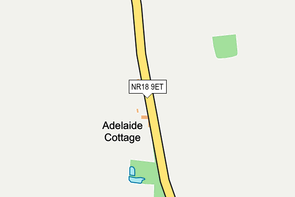
NR18 9ET lies on Green Lane in Wicklewood, Wymondham. NR18 9ET is located in the Wicklewood electoral ward, within the local authority district of South Norfolk and the English Parliamentary constituency of Mid Norfolk. The Sub Integrated Care Board (ICB) Location is NHS Norfolk and Waveney ICB - 26A and the police force is Norfolk. This postcode has been in use since January 1980.


GetTheData
Source: OS OpenMap – Local (Ordnance Survey)
Source: OS VectorMap District (Ordnance Survey)
Licence: Open Government Licence (requires attribution)
| Easting | 608311 |
| Northing | 302493 |
| Latitude | 52.580327 |
| Longitude | 1.073141 |
GetTheData
Source: Open Postcode Geo
Licence: Open Government Licence
| Street | Green Lane |
| Locality | Wicklewood |
| Town/City | Wymondham |
| Country | England |
| Postcode District | NR18 |
| ➜ NR18 open data dashboard ➜ See where NR18 is on a map | |
GetTheData
Source: Land Registry Price Paid Data
Licence: Open Government Licence
Elevation or altitude of NR18 9ET as distance above sea level:
| Metres | Feet | |
|---|---|---|
| Elevation | 50m | 164ft |
Elevation is measured from the approximate centre of the postcode, to the nearest point on an OS contour line from OS Terrain 50, which has contour spacing of ten vertical metres.
➜ How high above sea level am I? Find the elevation of your current position using your device's GPS.
GetTheData
Source: Open Postcode Elevation
Licence: Open Government Licence
| Ward | Wicklewood |
| Constituency | Mid Norfolk |
GetTheData
Source: ONS Postcode Database
Licence: Open Government Licence
| June 2022 | Other theft | On or near Wymondham Road | 412m |
| ➜ Get more crime data in our Crime section | |||
GetTheData
Source: data.police.uk
Licence: Open Government Licence
| Hillside Crescent (High Street) | Wicklewood | 734m |
| Cherry Tree (High Street) | Wicklewood | 803m |
| Cherry Tree (High Street) | Wicklewood | 808m |
| High Street (Wymondham Road) | Wicklewood | 815m |
| High Street (Wymondham Road) | Wicklewood | 847m |
| Wymondham Station | 3.5km |
GetTheData
Source: NaPTAN
Licence: Open Government Licence
| Percentage of properties with Next Generation Access | 40.0% |
| Percentage of properties with Superfast Broadband | 20.0% |
| Percentage of properties with Ultrafast Broadband | 0.0% |
| Percentage of properties with Full Fibre Broadband | 0.0% |
Superfast Broadband is between 30Mbps and 300Mbps
Ultrafast Broadband is > 300Mbps
| Percentage of properties unable to receive 2Mbps | 40.0% |
| Percentage of properties unable to receive 5Mbps | 60.0% |
| Percentage of properties unable to receive 10Mbps | 60.0% |
| Percentage of properties unable to receive 30Mbps | 80.0% |
GetTheData
Source: Ofcom
Licence: Ofcom Terms of Use (requires attribution)
GetTheData
Source: ONS Postcode Database
Licence: Open Government Licence


➜ Get more ratings from the Food Standards Agency
GetTheData
Source: Food Standards Agency
Licence: FSA terms & conditions
| Last Collection | |||
|---|---|---|---|
| Location | Mon-Fri | Sat | Distance |
| Church Lane | 16:00 | 11:15 | 807m |
| The Green | 17:15 | 10:15 | 1,187m |
| Kimberley Green | 16:00 | 12:00 | 2,141m |
GetTheData
Source: Dracos
Licence: Creative Commons Attribution-ShareAlike
| Facility | Distance |
|---|---|
| Wicklewood Playing Field High Street, Wicklewood, Wymondham Grass Pitches | 608m |
| Robert Kett Primary School Hewitts Lane, Wymondham Grass Pitches, Sports Hall | 2.9km |
| Nr Health And Fitness (Wymondham) Chestnut Drive, Wymondham Health and Fitness Gym | 2.9km |
GetTheData
Source: Active Places
Licence: Open Government Licence
| School | Phase of Education | Distance |
|---|---|---|
| Wicklewood Primary School and Nursery Hackford Road, Wicklewood, Wymondham, NR18 9QJ | Primary | 1.2km |
| Robert Kett Primary School Hewitts Lane, Wymondham, NR18 0LS | Primary | 2.9km |
| Wymondham High Academy Folly Road, Wymondham, NR18 0QT | Secondary | 3.1km |
GetTheData
Source: Edubase
Licence: Open Government Licence
The below table lists the International Territorial Level (ITL) codes (formerly Nomenclature of Territorial Units for Statistics (NUTS) codes) and Local Administrative Units (LAU) codes for NR18 9ET:
| ITL 1 Code | Name |
|---|---|
| TLH | East |
| ITL 2 Code | Name |
| TLH1 | East Anglia |
| ITL 3 Code | Name |
| TLH17 | Breckland and South Norfolk |
| LAU 1 Code | Name |
| E07000149 | South Norfolk |
GetTheData
Source: ONS Postcode Directory
Licence: Open Government Licence
The below table lists the Census Output Area (OA), Lower Layer Super Output Area (LSOA), and Middle Layer Super Output Area (MSOA) for NR18 9ET:
| Code | Name | |
|---|---|---|
| OA | E00137067 | |
| LSOA | E01026948 | South Norfolk 004D |
| MSOA | E02005600 | South Norfolk 004 |
GetTheData
Source: ONS Postcode Directory
Licence: Open Government Licence
| NR18 9ES | Wymondham Road | 443m |
| NR18 9QQ | Cooks Terrace | 543m |
| NR18 9EU | Low Street | 589m |
| NR18 9PR | Hospital Road | 667m |
| NR18 9QG | Low Street | 674m |
| NR18 9AJ | High Street | 738m |
| NR18 9PD | St Georges | 739m |
| NR18 9QA | High Street | 771m |
| NR18 9QD | Hillside Crescent | 827m |
| NR18 9QE | High Street | 906m |
GetTheData
Source: Open Postcode Geo; Land Registry Price Paid Data
Licence: Open Government Licence