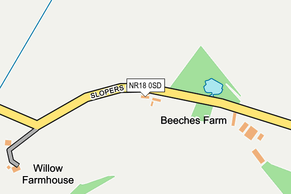
NR18 0SD is located in the North Wymondham electoral ward, within the local authority district of South Norfolk and the English Parliamentary constituency of Mid Norfolk. The Sub Integrated Care Board (ICB) Location is NHS Norfolk and Waveney ICB - 26A and the police force is Norfolk. This postcode has been in use since January 1980.


GetTheData
Source: OS OpenMap – Local (Ordnance Survey)
Source: OS VectorMap District (Ordnance Survey)
Licence: Open Government Licence (requires attribution)
| Easting | 612007 |
| Northing | 304154 |
| Latitude | 52.593833 |
| Longitude | 1.128690 |
GetTheData
Source: Open Postcode Geo
Licence: Open Government Licence
| Country | England |
| Postcode District | NR18 |
| ➜ NR18 open data dashboard ➜ See where NR18 is on a map | |
GetTheData
Source: Land Registry Price Paid Data
Licence: Open Government Licence
Elevation or altitude of NR18 0SD as distance above sea level:
| Metres | Feet | |
|---|---|---|
| Elevation | 40m | 131ft |
Elevation is measured from the approximate centre of the postcode, to the nearest point on an OS contour line from OS Terrain 50, which has contour spacing of ten vertical metres.
➜ How high above sea level am I? Find the elevation of your current position using your device's GPS.
GetTheData
Source: Open Postcode Elevation
Licence: Open Government Licence
| Ward | North Wymondham |
| Constituency | Mid Norfolk |
GetTheData
Source: ONS Postcode Database
Licence: Open Government Licence
| November 2021 | Burglary | On or near Wramplingham Road | 454m |
| September 2021 | Violence and sexual offences | On or near Wramplingham Road | 454m |
| August 2021 | Criminal damage and arson | On or near Wramplingham Road | 454m |
| ➜ Get more crime data in our Crime section | |||
GetTheData
Source: data.police.uk
Licence: Open Government Licence
| Estelle Way (Tuttles Lane) | Wymondham | 1,424m |
| Estelle Way (Tuttles Lane) | Wymondham | 1,424m |
| Greenland Avenue (Tuttles Lane) | Wymondham | 1,494m |
| Ash Close (Sheffield Road) | Wymondham | 1,503m |
| Ash Close (Sheffield Road) | Wymondham | 1,512m |
| Wymondham Station | 3.2km |
GetTheData
Source: NaPTAN
Licence: Open Government Licence
| Percentage of properties with Next Generation Access | 80.0% |
| Percentage of properties with Superfast Broadband | 0.0% |
| Percentage of properties with Ultrafast Broadband | 0.0% |
| Percentage of properties with Full Fibre Broadband | 0.0% |
Superfast Broadband is between 30Mbps and 300Mbps
Ultrafast Broadband is > 300Mbps
| Percentage of properties unable to receive 2Mbps | 20.0% |
| Percentage of properties unable to receive 5Mbps | 60.0% |
| Percentage of properties unable to receive 10Mbps | 80.0% |
| Percentage of properties unable to receive 30Mbps | 80.0% |
GetTheData
Source: Ofcom
Licence: Ofcom Terms of Use (requires attribution)
GetTheData
Source: ONS Postcode Database
Licence: Open Government Licence

➜ Get more ratings from the Food Standards Agency
GetTheData
Source: Food Standards Agency
Licence: FSA terms & conditions
| Last Collection | |||
|---|---|---|---|
| Location | Mon-Fri | Sat | Distance |
| Tuttles Lane East | 17:00 | 11:45 | 1,506m |
| Limetree Avenue Post Office | 17:00 | 12:00 | 1,575m |
| Norwich Road | 17:15 | 09:00 | 1,930m |
GetTheData
Source: Dracos
Licence: Creative Commons Attribution-ShareAlike
| Facility | Distance |
|---|---|
| Wymondham Rugby Club Bray Drive, Wymondham Grass Pitches | 785m |
| Wymondham Rufc (Closed) Tuttles Lane East, Wymondham Grass Pitches | 1.3km |
| Robert Kett Primary School Hewitts Lane, Wymondham Grass Pitches, Sports Hall | 1.9km |
GetTheData
Source: Active Places
Licence: Open Government Licence
| School | Phase of Education | Distance |
|---|---|---|
| Ashleigh Primary School and Nursery, Wymondham Sheffield Road, Wymondham, NR18 0HL | Primary | 1.5km |
| Robert Kett Primary School Hewitts Lane, Wymondham, NR18 0LS | Primary | 1.9km |
| Wymondham High Academy Folly Road, Wymondham, NR18 0QT | Secondary | 2.2km |
GetTheData
Source: Edubase
Licence: Open Government Licence
The below table lists the International Territorial Level (ITL) codes (formerly Nomenclature of Territorial Units for Statistics (NUTS) codes) and Local Administrative Units (LAU) codes for NR18 0SD:
| ITL 1 Code | Name |
|---|---|
| TLH | East |
| ITL 2 Code | Name |
| TLH1 | East Anglia |
| ITL 3 Code | Name |
| TLH17 | Breckland and South Norfolk |
| LAU 1 Code | Name |
| E07000149 | South Norfolk |
GetTheData
Source: ONS Postcode Directory
Licence: Open Government Licence
The below table lists the Census Output Area (OA), Lower Layer Super Output Area (LSOA), and Middle Layer Super Output Area (MSOA) for NR18 0SD:
| Code | Name | |
|---|---|---|
| OA | E00136937 | |
| LSOA | E01026921 | South Norfolk 005C |
| MSOA | E02005601 | South Norfolk 005 |
GetTheData
Source: ONS Postcode Directory
Licence: Open Government Licence
| NR18 0SB | Wramplingham Road | 453m |
| NR18 0SE | Melton Road | 484m |
| NR9 3BT | Melton Road | 781m |
| NR18 0SN | Downham Grove | 1022m |
| NR18 0RZ | Wymondham Road | 1117m |
| NR18 0XD | Pond Way | 1150m |
| NR18 0UX | Blake Drive | 1161m |
| NR18 0XE | Simpson Way | 1162m |
| NR18 0WR | Mann Close | 1203m |
| NR18 0GD | Jeckyll Road | 1218m |
GetTheData
Source: Open Postcode Geo; Land Registry Price Paid Data
Licence: Open Government Licence