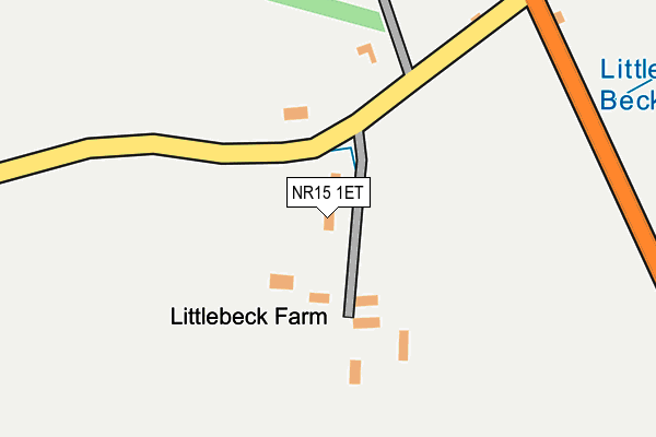
NR15 1ET lies on Littlebeck Lane in Brooke, Norwich. NR15 1ET is located in the Brooke electoral ward, within the local authority district of South Norfolk and the English Parliamentary constituency of South Norfolk. The Sub Integrated Care Board (ICB) Location is NHS Norfolk and Waveney ICB - 26A and the police force is Norfolk. This postcode has been in use since January 1980.


GetTheData
Source: OS OpenMap – Local (Ordnance Survey)
Source: OS VectorMap District (Ordnance Survey)
Licence: Open Government Licence (requires attribution)
| Easting | 628772 |
| Northing | 297747 |
| Latitude | 52.529520 |
| Longitude | 1.371323 |
GetTheData
Source: Open Postcode Geo
Licence: Open Government Licence
| Street | Littlebeck Lane |
| Locality | Brooke |
| Town/City | Norwich |
| Country | England |
| Postcode District | NR15 |
| ➜ NR15 open data dashboard ➜ See where NR15 is on a map | |
GetTheData
Source: Land Registry Price Paid Data
Licence: Open Government Licence
Elevation or altitude of NR15 1ET as distance above sea level:
| Metres | Feet | |
|---|---|---|
| Elevation | 30m | 98ft |
Elevation is measured from the approximate centre of the postcode, to the nearest point on an OS contour line from OS Terrain 50, which has contour spacing of ten vertical metres.
➜ How high above sea level am I? Find the elevation of your current position using your device's GPS.
GetTheData
Source: Open Postcode Elevation
Licence: Open Government Licence
| Ward | Brooke |
| Constituency | South Norfolk |
GetTheData
Source: ONS Postcode Database
Licence: Open Government Licence
| Bypass Bus Shelter (Norwich Road) | Kirstead | 1,025m |
| Bypass Bus Shelter (Norwich Road) | Kirstead | 1,103m |
| Village Sign (The Street) | Brooke | 1,283m |
| Village Sign (The Street) | Brooke | 1,292m |
| Kings Head (Norwich Road) | Brooke | 1,370m |
GetTheData
Source: NaPTAN
Licence: Open Government Licence
| Percentage of properties with Next Generation Access | 100.0% |
| Percentage of properties with Superfast Broadband | 0.0% |
| Percentage of properties with Ultrafast Broadband | 0.0% |
| Percentage of properties with Full Fibre Broadband | 0.0% |
Superfast Broadband is between 30Mbps and 300Mbps
Ultrafast Broadband is > 300Mbps
| Percentage of properties unable to receive 2Mbps | 0.0% |
| Percentage of properties unable to receive 5Mbps | 0.0% |
| Percentage of properties unable to receive 10Mbps | 0.0% |
| Percentage of properties unable to receive 30Mbps | 100.0% |
GetTheData
Source: Ofcom
Licence: Ofcom Terms of Use (requires attribution)
GetTheData
Source: ONS Postcode Database
Licence: Open Government Licence


➜ Get more ratings from the Food Standards Agency
GetTheData
Source: Food Standards Agency
Licence: FSA terms & conditions
| Last Collection | |||
|---|---|---|---|
| Location | Mon-Fri | Sat | Distance |
| Howe Church | 16:30 | 08:30 | 2,535m |
| Kirstead Green | 14:30 | 07:30 | 3,753m |
| Hempnall Road Post Office | 16:15 | 09:45 | 3,788m |
GetTheData
Source: Dracos
Licence: Creative Commons Attribution-ShareAlike
| Facility | Distance |
|---|---|
| Brooke & District Cricket Club Brooke Gardens, Brooke, Norwich Grass Pitches | 1.1km |
| Brooke Village Hall Norwich Road, Brooke, Norwich Grass Pitches, Outdoor Tennis Courts | 1.5km |
| Seething And Mundham Playing Field Wheelers Lane, Seething Grass Pitches | 3.1km |
GetTheData
Source: Active Places
Licence: Open Government Licence
| School | Phase of Education | Distance |
|---|---|---|
| Brooke Voluntary Controlled Church of England Primary School High Green, Brooke, Norwich, NR15 1HP | Primary | 1.3km |
| Seething and Mundham Primary School Brooke Road, Seething, Norwich, NR15 1DJ | Primary | 3.1km |
| Woodton Primary School Norwich Road, Woodton, Bungay, NR35 2LL | Primary | 3.3km |
GetTheData
Source: Edubase
Licence: Open Government Licence
The below table lists the International Territorial Level (ITL) codes (formerly Nomenclature of Territorial Units for Statistics (NUTS) codes) and Local Administrative Units (LAU) codes for NR15 1ET:
| ITL 1 Code | Name |
|---|---|
| TLH | East |
| ITL 2 Code | Name |
| TLH1 | East Anglia |
| ITL 3 Code | Name |
| TLH17 | Breckland and South Norfolk |
| LAU 1 Code | Name |
| E07000149 | South Norfolk |
GetTheData
Source: ONS Postcode Directory
Licence: Open Government Licence
The below table lists the Census Output Area (OA), Lower Layer Super Output Area (LSOA), and Middle Layer Super Output Area (MSOA) for NR15 1ET:
| Code | Name | |
|---|---|---|
| OA | E00136698 | |
| LSOA | E01026875 | South Norfolk 006A |
| MSOA | E02005602 | South Norfolk 006 |
GetTheData
Source: ONS Postcode Directory
Licence: Open Government Licence
| NR15 1DY | Bungay Road | 265m |
| NR15 1ES | Church Road | 648m |
| NR15 1DX | Bungay Road | 723m |
| NR15 1EA | Kirstead Green | 781m |
| NR15 1EP | Green Man Lane | 962m |
| NR15 1EW | Drovers Rest | 967m |
| NR15 1HY | High Green Gardens | 1029m |
| NR15 1EB | Kirstead Green | 1103m |
| NR15 1AE | St Christophers Close | 1106m |
| NR15 1JD | High Green | 1163m |
GetTheData
Source: Open Postcode Geo; Land Registry Price Paid Data
Licence: Open Government Licence