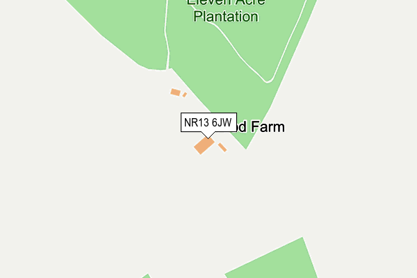
NR13 6JW is located in the Wroxham electoral ward, within the local authority district of Broadland and the English Parliamentary constituency of Broadland. The Sub Integrated Care Board (ICB) Location is NHS Norfolk and Waveney ICB - 26A and the police force is Norfolk. This postcode has been in use since January 1980.


GetTheData
Source: OS OpenMap – Local (Ordnance Survey)
Source: OS VectorMap District (Ordnance Survey)
Licence: Open Government Licence (requires attribution)
| Easting | 630432 |
| Northing | 313271 |
| Latitude | 52.668158 |
| Longitude | 1.406573 |
GetTheData
Source: Open Postcode Geo
Licence: Open Government Licence
| Country | England |
| Postcode District | NR13 |
| ➜ NR13 open data dashboard ➜ See where NR13 is on a map | |
GetTheData
Source: Land Registry Price Paid Data
Licence: Open Government Licence
Elevation or altitude of NR13 6JW as distance above sea level:
| Metres | Feet | |
|---|---|---|
| Elevation | 20m | 66ft |
Elevation is measured from the approximate centre of the postcode, to the nearest point on an OS contour line from OS Terrain 50, which has contour spacing of ten vertical metres.
➜ How high above sea level am I? Find the elevation of your current position using your device's GPS.
GetTheData
Source: Open Postcode Elevation
Licence: Open Government Licence
| Ward | Wroxham |
| Constituency | Broadland |
GetTheData
Source: ONS Postcode Database
Licence: Open Government Licence
| Station Road (Norwich Road) | Salhouse | 760m |
| Station Road (Norwich Road) | Salhouse | 783m |
| Norwich Road | Salhouse | 838m |
| Mill Road (Norwich Road) | Salhouse | 870m |
| Mill Road (Norwich Road) | Salhouse | 874m |
| Salhouse Station | 1.3km |
| Brundall Gardens Station | 5km |
GetTheData
Source: NaPTAN
Licence: Open Government Licence
| Percentage of properties with Next Generation Access | 100.0% |
| Percentage of properties with Superfast Broadband | 100.0% |
| Percentage of properties with Ultrafast Broadband | 0.0% |
| Percentage of properties with Full Fibre Broadband | 0.0% |
Superfast Broadband is between 30Mbps and 300Mbps
Ultrafast Broadband is > 300Mbps
| Percentage of properties unable to receive 2Mbps | 0.0% |
| Percentage of properties unable to receive 5Mbps | 0.0% |
| Percentage of properties unable to receive 10Mbps | 0.0% |
| Percentage of properties unable to receive 30Mbps | 0.0% |
GetTheData
Source: Ofcom
Licence: Ofcom Terms of Use (requires attribution)
GetTheData
Source: ONS Postcode Database
Licence: Open Government Licence


➜ Get more ratings from the Food Standards Agency
GetTheData
Source: Food Standards Agency
Licence: FSA terms & conditions
| Last Collection | |||
|---|---|---|---|
| Location | Mon-Fri | Sat | Distance |
| Station Road/Dakenham Close | 16:15 | 07:45 | 833m |
| Mill Corner/Bell Ph | 16:15 | 07:45 | 1,050m |
| Lt Plumstead Post Office | 16:00 | 09:30 | 1,690m |
GetTheData
Source: Dracos
Licence: Creative Commons Attribution-ShareAlike
| Facility | Distance |
|---|---|
| Salhouse Vc Primary School Cheyney Avenue, Salhouse, Norwich Grass Pitches | 1.1km |
| Salhouse Recreation Field Thieves Lane, Salhouse, Norwich Grass Pitches, Outdoor Tennis Courts | 1.3km |
| Rackheath Playing Fields Green Lane West, Rackheath, Norwich Grass Pitches, Outdoor Tennis Courts | 2.6km |
GetTheData
Source: Active Places
Licence: Open Government Licence
| School | Phase of Education | Distance |
|---|---|---|
| Salhouse CofE Primary School Cheyney Avenue, Salhouse, NR13 6RJ | Primary | 1.1km |
| Rackheath Primary School Willoughby Way, Rackheath, Norwich, NR13 6SL | Primary | 2km |
| Little Plumstead Church of England Primary Academy Old Hall Road, Little Plumstead, Norwich, NR13 5FA | Primary | 2.5km |
GetTheData
Source: Edubase
Licence: Open Government Licence
The below table lists the International Territorial Level (ITL) codes (formerly Nomenclature of Territorial Units for Statistics (NUTS) codes) and Local Administrative Units (LAU) codes for NR13 6JW:
| ITL 1 Code | Name |
|---|---|
| TLH | East |
| ITL 2 Code | Name |
| TLH1 | East Anglia |
| ITL 3 Code | Name |
| TLH15 | Norwich and East Norfolk |
| LAU 1 Code | Name |
| E07000144 | Broadland |
GetTheData
Source: ONS Postcode Directory
Licence: Open Government Licence
The below table lists the Census Output Area (OA), Lower Layer Super Output Area (LSOA), and Middle Layer Super Output Area (MSOA) for NR13 6JW:
| Code | Name | |
|---|---|---|
| OA | E00135055 | |
| LSOA | E01026579 | Broadland 008D |
| MSOA | E02005527 | Broadland 008 |
GetTheData
Source: ONS Postcode Directory
Licence: Open Government Licence
| NR13 6JP | Honeycombe Road | 507m |
| NR13 6QG | Norwich Road | 625m |
| NR13 6RT | Barn Piece Close | 750m |
| NR13 6QQ | Norwich Road | 755m |
| NR13 6QF | Norwich Road | 770m |
| NR13 6PA | Dakenham Close | 795m |
| NR13 6QE | Mill Road | 871m |
| NR13 6QZ | Norwich Road | 873m |
| NR13 6PB | Norwich Road | 884m |
| NR13 6QB | Mill Close | 890m |
GetTheData
Source: Open Postcode Geo; Land Registry Price Paid Data
Licence: Open Government Licence