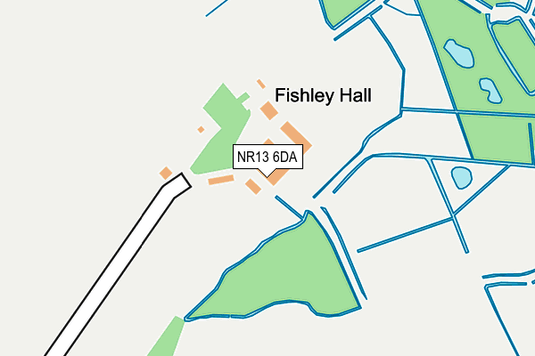
NR13 6DA is located in the Blofield with South Walsham electoral ward, within the local authority district of Broadland and the English Parliamentary constituency of Broadland. The Sub Integrated Care Board (ICB) Location is NHS Norfolk and Waveney ICB - 26A and the police force is Norfolk. This postcode has been in use since January 1980.


GetTheData
Source: OS OpenMap – Local (Ordnance Survey)
Source: OS VectorMap District (Ordnance Survey)
Licence: Open Government Licence (requires attribution)
| Easting | 640142 |
| Northing | 311851 |
| Latitude | 52.651181 |
| Longitude | 1.548830 |
GetTheData
Source: Open Postcode Geo
Licence: Open Government Licence
| Country | England |
| Postcode District | NR13 |
| ➜ NR13 open data dashboard ➜ See where NR13 is on a map | |
GetTheData
Source: Land Registry Price Paid Data
Licence: Open Government Licence
Elevation or altitude of NR13 6DA as distance above sea level:
| Metres | Feet | |
|---|---|---|
| Elevation | 0m | 0ft |
Elevation is measured from the approximate centre of the postcode, to the nearest point on an OS contour line from OS Terrain 50, which has contour spacing of ten vertical metres.
➜ How high above sea level am I? Find the elevation of your current position using your device's GPS.
GetTheData
Source: Open Postcode Elevation
Licence: Open Government Licence
| Ward | Blofield With South Walsham |
| Constituency | Broadland |
GetTheData
Source: ONS Postcode Database
Licence: Open Government Licence
| Cargate Lane (Church Road) | Upton | 885m |
| Cargate Lane (Church Road) | Upton | 888m |
| Church Road | Upton | 1,183m |
| Church Road | Upton | 1,198m |
| Crossways Terrace (The Street) | Acle | 1,210m |
| Acle Station | 1.9km |
| Lingwood Station | 5.1km |
GetTheData
Source: NaPTAN
Licence: Open Government Licence
GetTheData
Source: ONS Postcode Database
Licence: Open Government Licence


➜ Get more ratings from the Food Standards Agency
GetTheData
Source: Food Standards Agency
Licence: FSA terms & conditions
| Last Collection | |||
|---|---|---|---|
| Location | Mon-Fri | Sat | Distance |
| Upton Post Office | 16:45 | 10:30 | 860m |
| Acle Bridge | 17:00 | 07:15 | 1,259m |
| 2 Priory Close Post Office | 17:30 | 10:45 | 1,526m |
GetTheData
Source: Dracos
Licence: Creative Commons Attribution-ShareAlike
| Facility | Distance |
|---|---|
| Acle War Memorial Recreation Centre Bridewell Lane, Acle, Norwich Grass Pitches, Outdoor Tennis Courts, Artificial Grass Pitch, Sports Hall, Indoor Bowls | 1km |
| Cargate Lane Playing Field Cargate Lane, Upton, Norwich Grass Pitches | 1.1km |
| Acle St. Edmund Primary School Fletcher Way, Acle, Norwich Grass Pitches | 1.1km |
GetTheData
Source: Active Places
Licence: Open Government Licence
| School | Phase of Education | Distance |
|---|---|---|
| Acle Church of England Primary Academy Fletcher Way, Acle, Norwich, NR13 3RQ | Primary | 1.1km |
| Acle Academy South Walsham Road, Acle, Norwich, NR13 3ER | Secondary | 1.2km |
| Fairhaven Church of England Voluntary Aided Primary School School Road, South Walsham, Norwich, NR13 6DZ | Primary | 3.3km |
GetTheData
Source: Edubase
Licence: Open Government Licence
The below table lists the International Territorial Level (ITL) codes (formerly Nomenclature of Territorial Units for Statistics (NUTS) codes) and Local Administrative Units (LAU) codes for NR13 6DA:
| ITL 1 Code | Name |
|---|---|
| TLH | East |
| ITL 2 Code | Name |
| TLH1 | East Anglia |
| ITL 3 Code | Name |
| TLH15 | Norwich and East Norfolk |
| LAU 1 Code | Name |
| E07000144 | Broadland |
GetTheData
Source: ONS Postcode Directory
Licence: Open Government Licence
The below table lists the Census Output Area (OA), Lower Layer Super Output Area (LSOA), and Middle Layer Super Output Area (MSOA) for NR13 6DA:
| Code | Name | |
|---|---|---|
| OA | E00134699 | |
| LSOA | E01026504 | Broadland 014A |
| MSOA | E02005533 | Broadland 014 |
GetTheData
Source: ONS Postcode Directory
Licence: Open Government Licence
| NR13 6AZ | Horses Head | 558m |
| NR13 6AY | The Green | 767m |
| NR13 6AS | Church Road | 778m |
| NR13 6BA | The Green | 785m |
| NR13 6BB | The Green | 787m |
| NR13 6AR | Church Road | 836m |
| NR13 6AJ | Church Road | 838m |
| NR13 6BH | Riverview Drive | 859m |
| NR13 6BD | St Margarets Close | 867m |
| NR13 3EL | Fishley View | 874m |
GetTheData
Source: Open Postcode Geo; Land Registry Price Paid Data
Licence: Open Government Licence