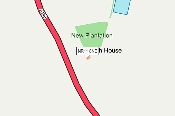
NR11 8NE lies on Cromer Road in Thorpe Market, Norwich. NR11 8NE is located in the Roughton electoral ward, within the local authority district of North Norfolk and the English Parliamentary constituency of North Norfolk. The Sub Integrated Care Board (ICB) Location is NHS Norfolk and Waveney ICB - 26A and the police force is Norfolk. This postcode has been in use since January 1980.


GetTheData
Source: OS OpenMap – Local (Ordnance Survey)
Source: OS VectorMap District (Ordnance Survey)
Licence: Open Government Licence (requires attribution)
| Easting | 623716 |
| Northing | 336844 |
| Latitude | 52.882527 |
| Longitude | 1.323518 |
GetTheData
Source: Open Postcode Geo
Licence: Open Government Licence
| Street | Cromer Road |
| Locality | Thorpe Market |
| Town/City | Norwich |
| Country | England |
| Postcode District | NR11 |
| ➜ NR11 open data dashboard ➜ See where NR11 is on a map | |
GetTheData
Source: Land Registry Price Paid Data
Licence: Open Government Licence
Elevation or altitude of NR11 8NE as distance above sea level:
| Metres | Feet | |
|---|---|---|
| Elevation | 50m | 164ft |
Elevation is measured from the approximate centre of the postcode, to the nearest point on an OS contour line from OS Terrain 50, which has contour spacing of ten vertical metres.
➜ How high above sea level am I? Find the elevation of your current position using your device's GPS.
GetTheData
Source: Open Postcode Elevation
Licence: Open Government Licence
| Ward | Roughton |
| Constituency | North Norfolk |
GetTheData
Source: ONS Postcode Database
Licence: Open Government Licence
| North Walsham Road | Thorpe Market | 847m |
| North Walsham Road | Thorpe Market | 874m |
| Gunton Station | 2.5km |
| Roughton Road Station | 4.3km |
GetTheData
Source: NaPTAN
Licence: Open Government Licence
GetTheData
Source: ONS Postcode Database
Licence: Open Government Licence


➜ Get more ratings from the Food Standards Agency
GetTheData
Source: Food Standards Agency
Licence: FSA terms & conditions
| Last Collection | |||
|---|---|---|---|
| Location | Mon-Fri | Sat | Distance |
| Post Office Roughton Garage | 17:00 | 11:30 | 1,791m |
| High Street Post Office | 16:30 | 10:00 | 1,920m |
| The Rectory | 16:00 | 08:30 | 2,150m |
GetTheData
Source: Dracos
Licence: Creative Commons Attribution-ShareAlike
| Facility | Distance |
|---|---|
| St Marys Endowed Va Primary School Chapel Road, Roughton, Norwich Grass Pitches | 1.8km |
| Southrepps Playing Field Chapel Street, Chapel Street, Southrepps Grass Pitches | 2km |
| Northrepps Playing Field School Lane, Northrepps, Cromer Grass Pitches | 2.6km |
GetTheData
Source: Active Places
Licence: Open Government Licence
| School | Phase of Education | Distance |
|---|---|---|
| St. Mary's (Endowed) CofE VA Primary School Chapel Road, Roughton, Norwich, NR11 8AF | Primary | 1.7km |
| Northrepps Primary School Church Street, Northrepps, Cromer, NR27 0LG | Primary | 2.6km |
| Antingham and Southrepps Primary School Lower Street, Southrepps, Norwich, NR11 8UG | Primary | 2.8km |
GetTheData
Source: Edubase
Licence: Open Government Licence
The below table lists the International Territorial Level (ITL) codes (formerly Nomenclature of Territorial Units for Statistics (NUTS) codes) and Local Administrative Units (LAU) codes for NR11 8NE:
| ITL 1 Code | Name |
|---|---|
| TLH | East |
| ITL 2 Code | Name |
| TLH1 | East Anglia |
| ITL 3 Code | Name |
| TLH16 | North and West Norfolk |
| LAU 1 Code | Name |
| E07000147 | North Norfolk |
GetTheData
Source: ONS Postcode Directory
Licence: Open Government Licence
The below table lists the Census Output Area (OA), Lower Layer Super Output Area (LSOA), and Middle Layer Super Output Area (MSOA) for NR11 8NE:
| Code | Name | |
|---|---|---|
| OA | E00136092 | |
| LSOA | E01026766 | North Norfolk 005B |
| MSOA | E02005574 | North Norfolk 005 |
GetTheData
Source: ONS Postcode Directory
Licence: Open Government Licence
| NR11 8TG | 520m | |
| NR11 8TD | Heather Cottages | 546m |
| NR11 8TE | Roughton Road | 606m |
| NR11 8TF | Cromer Road | 681m |
| NR11 8TJ | Sandpit Lane | 740m |
| NR11 8TL | The Green | 804m |
| NR11 8TH | 808m | |
| NR27 9LF | North Walsham Road | 900m |
| NR11 8TN | 933m | |
| NR11 8AJ | 962m |
GetTheData
Source: Open Postcode Geo; Land Registry Price Paid Data
Licence: Open Government Licence