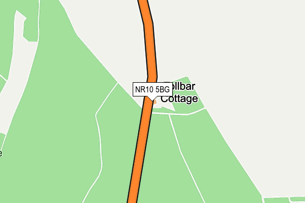
NR10 5BG is located in the Worstead electoral ward, within the local authority district of North Norfolk and the English Parliamentary constituency of North Norfolk. The Sub Integrated Care Board (ICB) Location is NHS Norfolk and Waveney ICB - 26A and the police force is Norfolk. This postcode has been in use since June 2000.


GetTheData
Source: OS OpenMap – Local (Ordnance Survey)
Source: OS VectorMap District (Ordnance Survey)
Licence: Open Government Licence (requires attribution)
| Easting | 627879 |
| Northing | 327803 |
| Latitude | 52.799648 |
| Longitude | 1.378964 |
GetTheData
Source: Open Postcode Geo
Licence: Open Government Licence
| Country | England |
| Postcode District | NR10 |
| ➜ NR10 open data dashboard ➜ See where NR10 is on a map | |
GetTheData
Source: Land Registry Price Paid Data
Licence: Open Government Licence
Elevation or altitude of NR10 5BG as distance above sea level:
| Metres | Feet | |
|---|---|---|
| Elevation | 30m | 98ft |
Elevation is measured from the approximate centre of the postcode, to the nearest point on an OS contour line from OS Terrain 50, which has contour spacing of ten vertical metres.
➜ How high above sea level am I? Find the elevation of your current position using your device's GPS.
GetTheData
Source: Open Postcode Elevation
Licence: Open Government Licence
| Ward | Worstead |
| Constituency | North Norfolk |
GetTheData
Source: ONS Postcode Database
Licence: Open Government Licence
| June 2022 | Other theft | On or near B1150 | 469m |
| ➜ Get more crime data in our Crime section | |||
GetTheData
Source: data.police.uk
Licence: Open Government Licence
| Water Tower (Norwich Road) | North Walsham | 1,395m |
| Water Tower (Norwich Road) | North Walsham | 1,472m |
| North Walsham Station | 2km |
| Worstead Station | 3km |
GetTheData
Source: NaPTAN
Licence: Open Government Licence
| Percentage of properties with Next Generation Access | 100.0% |
| Percentage of properties with Superfast Broadband | 0.0% |
| Percentage of properties with Ultrafast Broadband | 0.0% |
| Percentage of properties with Full Fibre Broadband | 0.0% |
Superfast Broadband is between 30Mbps and 300Mbps
Ultrafast Broadband is > 300Mbps
| Percentage of properties unable to receive 2Mbps | 0.0% |
| Percentage of properties unable to receive 5Mbps | 0.0% |
| Percentage of properties unable to receive 10Mbps | 0.0% |
| Percentage of properties unable to receive 30Mbps | 100.0% |
GetTheData
Source: Ofcom
Licence: Ofcom Terms of Use (requires attribution)
GetTheData
Source: ONS Postcode Database
Licence: Open Government Licence


➜ Get more ratings from the Food Standards Agency
GetTheData
Source: Food Standards Agency
Licence: FSA terms & conditions
| Last Collection | |||
|---|---|---|---|
| Location | Mon-Fri | Sat | Distance |
| Millfield Estate | 16:30 | 11:10 | 1,815m |
| Brookes Drive | 16:30 | 11:10 | 1,896m |
| Spenser Ave | 16:00 | 11:00 | 1,961m |
GetTheData
Source: Dracos
Licence: Creative Commons Attribution-ShareAlike
| Facility | Distance |
|---|---|
| Millfield Primary School Recreation Road, North Walsham Grass Pitches | 1.8km |
| Victory Swim And Fitness Centre Station Road, North Walsham Swimming Pool, Health and Fitness Gym, Studio | 2.1km |
| Paston College Playing Field Norwich Road, North Walsham Grass Pitches | 2.2km |
GetTheData
Source: Active Places
Licence: Open Government Licence
| School | Phase of Education | Distance |
|---|---|---|
| Millfield Primary School Recreation Road, Millfield Primary School, North Walsham, NR28 0ES | Primary | 1.8km |
| Swanton Abbott Community Primary School Youngman's Lane, Swanton Abbott, Norwich, NR10 5DZ | Primary | 2.2km |
| North Walsham High School Spenser Avenue, North Walsham, NR28 9HZ | Secondary | 2.2km |
GetTheData
Source: Edubase
Licence: Open Government Licence
The below table lists the International Territorial Level (ITL) codes (formerly Nomenclature of Territorial Units for Statistics (NUTS) codes) and Local Administrative Units (LAU) codes for NR10 5BG:
| ITL 1 Code | Name |
|---|---|
| TLH | East |
| ITL 2 Code | Name |
| TLH1 | East Anglia |
| ITL 3 Code | Name |
| TLH16 | North and West Norfolk |
| LAU 1 Code | Name |
| E07000147 | North Norfolk |
GetTheData
Source: ONS Postcode Directory
Licence: Open Government Licence
The below table lists the Census Output Area (OA), Lower Layer Super Output Area (LSOA), and Middle Layer Super Output Area (MSOA) for NR10 5BG:
| Code | Name | |
|---|---|---|
| OA | E00136229 | |
| LSOA | E01026790 | North Norfolk 012E |
| MSOA | E02005581 | North Norfolk 012 |
GetTheData
Source: ONS Postcode Directory
Licence: Open Government Licence
| NR28 0JB | Heath Road | 661m |
| NR10 5BQ | The Hill | 925m |
| NR28 0AF | Foundry Court | 1365m |
| NR28 0DY | Norwich Road | 1434m |
| NR28 9AX | Yarmouth Road | 1450m |
| NR28 9NA | Yarmouth Road | 1451m |
| NR28 9AE | Legrice Crescent | 1536m |
| NR28 9LZ | Sandy Hills | 1555m |
| NR28 0DX | Norwich Road | 1571m |
| NR28 9AG | Ellinor Road | 1584m |
GetTheData
Source: Open Postcode Geo; Land Registry Price Paid Data
Licence: Open Government Licence