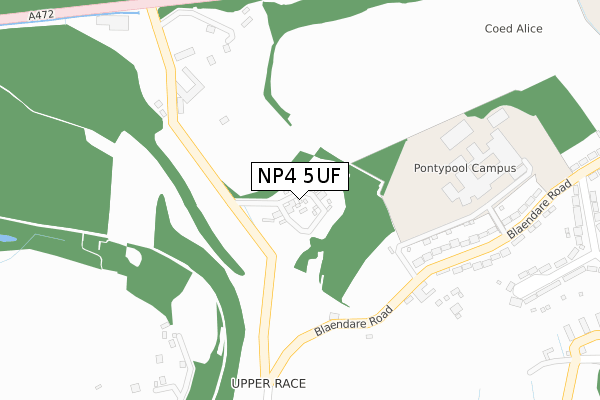
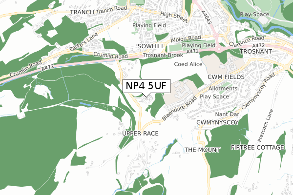
NP4 5UF is located in the Pontypool Fawr electoral ward, within the unitary authority of Torfaen and the Welsh Parliamentary constituency of Torfaen. The Local Health Board is Aneurin Bevan University and the police force is Gwent. This postcode has been in use since January 1980.


GetTheData
Source: OS Open Zoomstack (Ordnance Survey)
Licence: Open Government Licence (requires attribution)
Attribution: Contains OS data © Crown copyright and database right 2024
Source: Open Postcode Geo
Licence: Open Government Licence (requires attribution)
Attribution: Contains OS data © Crown copyright and database right 2024; Contains Royal Mail data © Royal Mail copyright and database right 2024; Source: Office for National Statistics licensed under the Open Government Licence v.3.0
| Easting | 327625 |
| Northing | 200009 |
| Latitude | 51.694148 |
| Longitude | -3.048519 |
GetTheData
Source: Open Postcode Geo
Licence: Open Government Licence
| Country | Wales |
| Postcode District | NP4 |
| ➜ NP4 open data dashboard ➜ See where NP4 is on a map ➜ Where is Pontypool? | |
GetTheData
Source: Land Registry Price Paid Data
Licence: Open Government Licence
Elevation or altitude of NP4 5UF as distance above sea level:
| Metres | Feet | |
|---|---|---|
| Elevation | 180m | 591ft |
Elevation is measured from the approximate centre of the postcode, to the nearest point on an OS contour line from OS Terrain 50, which has contour spacing of ten vertical metres.
➜ How high above sea level am I? Find the elevation of your current position using your device's GPS.
GetTheData
Source: Open Postcode Elevation
Licence: Open Government Licence
| Ward | Pontypool Fawr |
| Constituency | Torfaen |
GetTheData
Source: ONS Postcode Database
Licence: Open Government Licence
| June 2022 | Public order | On or near Further/Higher Educational Building | 329m |
| May 2022 | Violence and sexual offences | On or near Blaendare Road | 420m |
| May 2022 | Violence and sexual offences | On or near Blaendare Road | 420m |
| ➜ Get more crime data in our Crime section | |||
GetTheData
Source: data.police.uk
Licence: Open Government Licence
| Race Club (Blaendare Road) | Upper Race | 229m |
| Terminus (Blaendare Road) | Upper Race | 367m |
| Pontypool College (Blaendare Road) | Upper Race | 368m |
| Mynydd Court (Hillside Drive) | Upper Race | 476m |
| Mynydd Court (Blaendare Road) | Upper Race | 485m |
| Pontypool & New Inn Station | 2.4km |
| Cwmbran Station | 4.7km |
GetTheData
Source: NaPTAN
Licence: Open Government Licence
➜ Broadband speed and availability dashboard for NP4 5UF
| Percentage of properties with Next Generation Access | 100.0% |
| Percentage of properties with Superfast Broadband | 0.0% |
| Percentage of properties with Ultrafast Broadband | 0.0% |
| Percentage of properties with Full Fibre Broadband | 0.0% |
Superfast Broadband is between 30Mbps and 300Mbps
Ultrafast Broadband is > 300Mbps
| Median download speed | 5.7Mbps |
| Average download speed | 11.8Mbps |
| Maximum download speed | 44.22Mbps |
| Median upload speed | 0.7Mbps |
| Average upload speed | 1.6Mbps |
| Maximum upload speed | 7.74Mbps |
| Percentage of properties unable to receive 2Mbps | 0.0% |
| Percentage of properties unable to receive 5Mbps | 0.0% |
| Percentage of properties unable to receive 10Mbps | 0.0% |
| Percentage of properties unable to receive 30Mbps | 100.0% |
➜ Broadband speed and availability dashboard for NP4 5UF
GetTheData
Source: Ofcom
Licence: Ofcom Terms of Use (requires attribution)
GetTheData
Source: ONS Postcode Database
Licence: Open Government Licence


➜ Get more ratings from the Food Standards Agency
GetTheData
Source: Food Standards Agency
Licence: FSA terms & conditions
| Last Collection | |||
|---|---|---|---|
| Location | Mon-Fri | Sat | Distance |
| Garn Yr Erw | 11:30 | 10:00 | 1,127m |
| Forgeside Post Office | 16:45 | 11:45 | 1,127m |
| Penygarn Post Office | 16:00 | 11:15 | 2,430m |
GetTheData
Source: Dracos
Licence: Creative Commons Attribution-ShareAlike
| School | Phase of Education | Distance |
|---|---|---|
| West Monmouth Comprehensive School Blaendare Road, Pontypool, Torfaen, NP4 5YG | Not applicable | 795m |
| St Alban's R.C. High School The Park, Pontypool, Torfaen, NP4 6XG | Not applicable | 1.2km |
| George Street Primary School Wainfelin Road, Pontypool, Torfaen, NP4 6BX | Not applicable | 1.3km |
GetTheData
Source: Edubase
Licence: Open Government Licence
The below table lists the International Territorial Level (ITL) codes (formerly Nomenclature of Territorial Units for Statistics (NUTS) codes) and Local Administrative Units (LAU) codes for NP4 5UF:
| ITL 1 Code | Name |
|---|---|
| TLL | Wales |
| ITL 2 Code | Name |
| TLL1 | West Wales and The Valleys |
| ITL 3 Code | Name |
| TLL16 | Gwent Valleys |
| LAU 1 Code | Name |
| W06000020 | Torfaen |
GetTheData
Source: ONS Postcode Directory
Licence: Open Government Licence
The below table lists the Census Output Area (OA), Lower Layer Super Output Area (LSOA), and Middle Layer Super Output Area (MSOA) for NP4 5UF:
| Code | Name | |
|---|---|---|
| OA | W00007818 | |
| LSOA | W01001496 | Torfaen 004B |
| MSOA | W02000326 | Torfaen 004 |
GetTheData
Source: ONS Postcode Directory
Licence: Open Government Licence
| NP4 5UH | 252m | |
| NP4 5RS | 270m | |
| NP4 5RT | Blaendare Road | 301m |
| NP4 5RR | Blaendare Road | 391m |
| NP4 6AT | Crumlin Road | 401m |
| NP4 5SJ | Mynydd View | 429m |
| NP4 6AS | Glanwern Terrace | 471m |
| NP4 6LH | Albion Road | 485m |
| NP4 5RU | Blaendare Road | 506m |
| NP4 5XE | 507m |
GetTheData
Source: Open Postcode Geo; Land Registry Price Paid Data
Licence: Open Government Licence