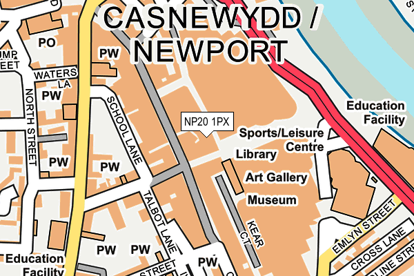
NP20 1PX is located in the Stow Hill electoral ward, within the unitary authority of Newport and the Welsh Parliamentary constituency of Newport West. The Local Health Board is Aneurin Bevan University and the police force is Gwent. This postcode has been in use since June 1999.


GetTheData
Source: OS OpenMap – Local (Ordnance Survey)
Source: OS VectorMap District (Ordnance Survey)
Licence: Open Government Licence (requires attribution)
| Easting | 331211 |
| Northing | 187947 |
| Latitude | 51.586161 |
| Longitude | -2.994265 |
GetTheData
Source: Open Postcode Geo
Licence: Open Government Licence
| Country | Wales |
| Postcode District | NP20 |
| ➜ NP20 open data dashboard ➜ See where NP20 is on a map ➜ Where is Newport? | |
GetTheData
Source: Land Registry Price Paid Data
Licence: Open Government Licence
Elevation or altitude of NP20 1PX as distance above sea level:
| Metres | Feet | |
|---|---|---|
| Elevation | 10m | 33ft |
Elevation is measured from the approximate centre of the postcode, to the nearest point on an OS contour line from OS Terrain 50, which has contour spacing of ten vertical metres.
➜ How high above sea level am I? Find the elevation of your current position using your device's GPS.
GetTheData
Source: Open Postcode Elevation
Licence: Open Government Licence
| Ward | Stow Hill |
| Constituency | Newport West |
GetTheData
Source: ONS Postcode Database
Licence: Open Government Licence
| January 2024 | Burglary | On or near Parking Area | 399m |
| January 2024 | Public order | On or near Parking Area | 399m |
| January 2024 | Public order | On or near Parking Area | 399m |
| ➜ Get more crime data in our Crime section | |||
GetTheData
Source: data.police.uk
Licence: Open Government Licence
| Kingsway | Newport | 185m |
| Kingsway | Newport | 192m |
| Stow Hill | Newport | 195m |
| Kingsway | Newport | 205m |
| Havelock Street | Newport | 226m |
| Newport (S Wales) Station | 0.5km |
| Rogerstone Station | 5.1km |
GetTheData
Source: NaPTAN
Licence: Open Government Licence
GetTheData
Source: ONS Postcode Database
Licence: Open Government Licence


➜ Get more ratings from the Food Standards Agency
GetTheData
Source: Food Standards Agency
Licence: FSA terms & conditions
| Last Collection | |||
|---|---|---|---|
| Location | Mon-Fri | Sat | Distance |
| Havelock Street | 18:30 | 11:30 | 197m |
| Clarence Place | 17:30 | 12:00 | 256m |
| Bridge Street Post Office | 18:00 | 13:00 | 303m |
GetTheData
Source: Dracos
Licence: Creative Commons Attribution-ShareAlike
| School | Phase of Education | Distance |
|---|---|---|
| St Woolos Primary School Stow Hill, Newport, NP20 4DW | Not applicable | 266m |
| Maindee C.P. School Rodney Road, Newport, NP19 0AP | Not applicable | 408m |
| St Mary's R.C. Primary School Queens Hill, Newport, NP20 5HJ | Not applicable | 712m |
GetTheData
Source: Edubase
Licence: Open Government Licence
The below table lists the International Territorial Level (ITL) codes (formerly Nomenclature of Territorial Units for Statistics (NUTS) codes) and Local Administrative Units (LAU) codes for NP20 1PX:
| ITL 1 Code | Name |
|---|---|
| TLL | Wales |
| ITL 2 Code | Name |
| TLL2 | East Wales |
| ITL 3 Code | Name |
| TLL21 | Monmouthshire and Newport |
| LAU 1 Code | Name |
| W06000022 | Newport |
GetTheData
Source: ONS Postcode Directory
Licence: Open Government Licence
The below table lists the Census Output Area (OA), Lower Layer Super Output Area (LSOA), and Middle Layer Super Output Area (MSOA) for NP20 1PX:
| Code | Name | |
|---|---|---|
| OA | W00008733 | |
| LSOA | W01001687 | Newport 014D |
| MSOA | W02000360 | Newport 014 |
GetTheData
Source: ONS Postcode Directory
Licence: Open Government Licence
| NP20 1YD | Commercial Street | 72m |
| NP20 1TS | Commercial Street | 76m |
| NP20 1JQ | Commercial Street | 93m |
| NP20 1LN | Commercial Street | 110m |
| NP20 1HF | Commercial Street | 121m |
| NP20 1JT | Charles Street | 145m |
| NP20 1JU | Charles Street | 150m |
| NP20 1JH | Stow Hill | 173m |
| NP20 1JN | Commercial Street | 176m |
| NP20 1LQ | Commercial Street | 179m |
GetTheData
Source: Open Postcode Geo; Land Registry Price Paid Data
Licence: Open Government Licence