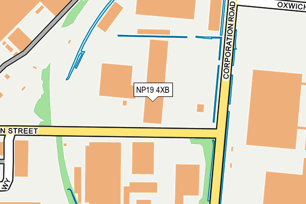
NP19 4XB is located in the Lliswerry electoral ward, within the unitary authority of Newport and the Welsh Parliamentary constituency of Newport East. The Local Health Board is Aneurin Bevan University and the police force is Gwent. This postcode has been in use since July 2006.


GetTheData
Source: OS OpenMap – Local (Ordnance Survey)
Source: OS VectorMap District (Ordnance Survey)
Licence: Open Government Licence (requires attribution)
| Easting | 332764 |
| Northing | 186164 |
| Latitude | 51.570320 |
| Longitude | -2.971511 |
GetTheData
Source: Open Postcode Geo
Licence: Open Government Licence
| Country | Wales |
| Postcode District | NP19 |
| ➜ NP19 open data dashboard ➜ See where NP19 is on a map ➜ Where is Newport? | |
GetTheData
Source: Land Registry Price Paid Data
Licence: Open Government Licence
Elevation or altitude of NP19 4XB as distance above sea level:
| Metres | Feet | |
|---|---|---|
| Elevation | 10m | 33ft |
Elevation is measured from the approximate centre of the postcode, to the nearest point on an OS contour line from OS Terrain 50, which has contour spacing of ten vertical metres.
➜ How high above sea level am I? Find the elevation of your current position using your device's GPS.
GetTheData
Source: Open Postcode Elevation
Licence: Open Government Licence
| Ward | Lliswerry |
| Constituency | Newport East |
GetTheData
Source: ONS Postcode Database
Licence: Open Government Licence
| June 2022 | Other theft | On or near Mariner Way | 304m |
| May 2022 | Anti-social behaviour | On or near Mariner Way | 304m |
| May 2022 | Other theft | On or near Broad Quay Road | 481m |
| ➜ Get more crime data in our Crime section | |||
GetTheData
Source: data.police.uk
Licence: Open Government Licence
| Stephenson Street (Corporation Road) | Liswerry | 147m |
| Reevesland Industrial Est (Corporation Road) | Liswerry | 301m |
| Reevesland Industrial Est (Corporation Road) | Liswerry | 323m |
| Felnex Industrial Estate (Mariner Way) | Liswerry | 388m |
| Weight And Measures Office (Mariner Way) | Liswerry | 397m |
| Newport (S Wales) Station | 2.9km |
GetTheData
Source: NaPTAN
Licence: Open Government Licence
GetTheData
Source: ONS Postcode Database
Licence: Open Government Licence


➜ Get more ratings from the Food Standards Agency
GetTheData
Source: Food Standards Agency
Licence: FSA terms & conditions
| Last Collection | |||
|---|---|---|---|
| Location | Mon-Fri | Sat | Distance |
| Alexandra Post Office | 18:30 | 12:00 | 1,252m |
| Alexandra Road | 18:30 | 12:00 | 1,278m |
| Capel Street | 18:30 | 12:00 | 1,371m |
GetTheData
Source: Dracos
Licence: Creative Commons Attribution-ShareAlike
| School | Phase of Education | Distance |
|---|---|---|
| Sporting Chance Unit 2, Usk Way Industrial Estate, Newport, NP20 2HZ | Not applicable | 1.1km |
| Lliswerry High School Nash Road, Newport, NP19 4RP | Not applicable | 1.3km |
| Catch22 Include Wales St Patrick's Rc Church Hall, Cromwell Road, Newport, NP19 0HS | Not applicable | 1.4km |
GetTheData
Source: Edubase
Licence: Open Government Licence
The below table lists the International Territorial Level (ITL) codes (formerly Nomenclature of Territorial Units for Statistics (NUTS) codes) and Local Administrative Units (LAU) codes for NP19 4XB:
| ITL 1 Code | Name |
|---|---|
| TLL | Wales |
| ITL 2 Code | Name |
| TLL2 | East Wales |
| ITL 3 Code | Name |
| TLL21 | Monmouthshire and Newport |
| LAU 1 Code | Name |
| W06000022 | Newport |
GetTheData
Source: ONS Postcode Directory
Licence: Open Government Licence
The below table lists the Census Output Area (OA), Lower Layer Super Output Area (LSOA), and Middle Layer Super Output Area (MSOA) for NP19 4XB:
| Code | Name | |
|---|---|---|
| OA | W00008541 | |
| LSOA | W01001647 | Newport 015F |
| MSOA | W02000361 | Newport 015 |
GetTheData
Source: ONS Postcode Directory
Licence: Open Government Licence
| NP19 4RD | Corporation Road | 369m |
| NP19 4BD | Lysaght Avenue | 414m |
| NP19 4BE | Lysaght Avenue | 439m |
| NP19 4AH | Lysaght Avenue | 457m |
| NP19 4AG | Lysaght Circle | 510m |
| NP19 4AQ | Lockwood Court | 542m |
| NP19 4AR | Kingfisher Walk | 559m |
| NP19 4AF | Corporation Road | 560m |
| NP19 4AL | Lysaght Way | 563m |
| NP19 4AN | Lysaght Way | 566m |
GetTheData
Source: Open Postcode Geo; Land Registry Price Paid Data
Licence: Open Government Licence