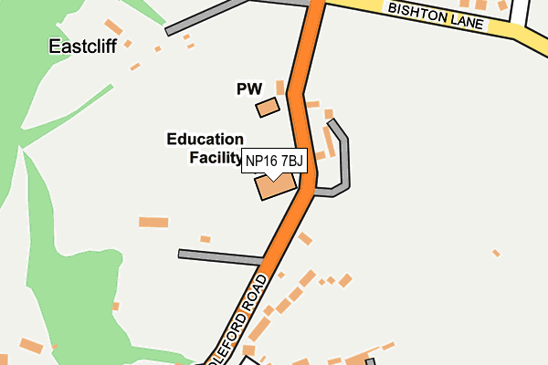
NP16 7BJ is located in the Tidenham electoral ward, within the local authority district of Forest of Dean and the English Parliamentary constituency of Forest of Dean. The Sub Integrated Care Board (ICB) Location is NHS Gloucestershire ICB - 11M and the police force is Gloucestershire. This postcode has been in use since June 1999.


GetTheData
Source: OS OpenMap – Local (Ordnance Survey)
Source: OS VectorMap District (Ordnance Survey)
Licence: Open Government Licence (requires attribution)
| Easting | 354037 |
| Northing | 195219 |
| Latitude | 51.653870 |
| Longitude | -2.665791 |
GetTheData
Source: Open Postcode Geo
Licence: Open Government Licence
| Country | England |
| Postcode District | NP16 |
| ➜ NP16 open data dashboard ➜ See where NP16 is on a map ➜ Where is Tutshill? | |
GetTheData
Source: Land Registry Price Paid Data
Licence: Open Government Licence
Elevation or altitude of NP16 7BJ as distance above sea level:
| Metres | Feet | |
|---|---|---|
| Elevation | 70m | 230ft |
Elevation is measured from the approximate centre of the postcode, to the nearest point on an OS contour line from OS Terrain 50, which has contour spacing of ten vertical metres.
➜ How high above sea level am I? Find the elevation of your current position using your device's GPS.
GetTheData
Source: Open Postcode Elevation
Licence: Open Government Licence
| Ward | Tidenham |
| Constituency | Forest Of Dean |
GetTheData
Source: ONS Postcode Database
Licence: Open Government Licence
| March 2022 | Other theft | On or near Silley'S Close | 387m |
| March 2022 | Burglary | On or near Silley'S Close | 387m |
| March 2022 | Other theft | On or near Silley'S Close | 387m |
| ➜ Get more crime data in our Crime section | |||
GetTheData
Source: data.police.uk
Licence: Open Government Licence
| Bishton Lane (B4228) | Woodcroft | 181m |
| Bishton Lane (B4228) | Woodcroft | 217m |
| Elm Road (Coleford Road B4228) | Tutshill | 235m |
| Elm Road (Coleford Road B4228) | Tutshill | 240m |
| Elm Close (Gloucester Road) | Tutshill | 534m |
| Chepstow Station | 1.6km |
GetTheData
Source: NaPTAN
Licence: Open Government Licence
GetTheData
Source: ONS Postcode Database
Licence: Open Government Licence


➜ Get more ratings from the Food Standards Agency
GetTheData
Source: Food Standards Agency
Licence: FSA terms & conditions
| Last Collection | |||
|---|---|---|---|
| Location | Mon-Fri | Sat | Distance |
| Elm Road | 16:15 | 11:15 | 297m |
| Tutshill | 16:30 | 11:15 | 502m |
| St Annes Street | 16:00 | 12:00 | 1,057m |
GetTheData
Source: Dracos
Licence: Creative Commons Attribution-ShareAlike
| Facility | Distance |
|---|---|
| Tutshill Ce Primary School Coleford Road, Coleford Road, Tutshill, Cas-gwent Grass Pitches | 0m |
| Tidenham Recreation Ground Coleford Road, Tutshill, Chepstow Grass Pitches | 222m |
| Forest Leisure Sedbury Beachley Road, Sedbury, Cas-gwent Sports Hall, Health and Fitness Gym, Grass Pitches, Studio, Squash Courts, Outdoor Tennis Courts | 1.3km |
GetTheData
Source: Active Places
Licence: Open Government Licence
| School | Phase of Education | Distance |
|---|---|---|
| Tutshill Church of England Primary School Coleford Road, Tutshill, Chepstow, NP16 7BJ | Primary | 16m |
| Dean Close St John's Castleford Hill, Tutshill, Chepstow, NP16 7LE | Not applicable | 700m |
| Wyedean School and Sixth Form Centre Beachley Road, Sedbury, Chepstow, NP16 7AA | Secondary | 1.3km |
GetTheData
Source: Edubase
Licence: Open Government Licence
The below table lists the International Territorial Level (ITL) codes (formerly Nomenclature of Territorial Units for Statistics (NUTS) codes) and Local Administrative Units (LAU) codes for NP16 7BJ:
| ITL 1 Code | Name |
|---|---|
| TLK | South West (England) |
| ITL 2 Code | Name |
| TLK1 | Gloucestershire, Wiltshire and Bath/Bristol area |
| ITL 3 Code | Name |
| TLK13 | Gloucestershire CC |
| LAU 1 Code | Name |
| E07000080 | Forest of Dean |
GetTheData
Source: ONS Postcode Directory
Licence: Open Government Licence
The below table lists the Census Output Area (OA), Lower Layer Super Output Area (LSOA), and Middle Layer Super Output Area (MSOA) for NP16 7BJ:
| Code | Name | |
|---|---|---|
| OA | E00113240 | |
| LSOA | E01022275 | Forest of Dean 010E |
| MSOA | E02004635 | Forest of Dean 010 |
GetTheData
Source: ONS Postcode Directory
Licence: Open Government Licence
| NP16 7PT | 106m | |
| NP16 7BU | Coleford Road | 168m |
| NP16 7BT | Coleford Road | 305m |
| NP16 7BX | Elm Road | 314m |
| NP16 7BY | Wirewood Close | 316m |
| NP16 7BP | Silleys Close | 371m |
| NP16 7FF | The Gardens | 399m |
| NP16 7PS | Mopla Road | 401m |
| NP16 7BZ | Wirewood Crescent | 415m |
| NP16 7BN | Coleford Road | 438m |
GetTheData
Source: Open Postcode Geo; Land Registry Price Paid Data
Licence: Open Government Licence