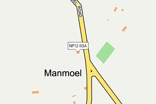
NP12 0GA is located in the Argoed electoral ward, within the unitary authority of Caerphilly and the Welsh Parliamentary constituency of Islwyn. The Local Health Board is Aneurin Bevan University and the police force is Gwent. This postcode has been in use since May 2009.


GetTheData
Source: OS OpenMap – Local (Ordnance Survey)
Source: OS VectorMap District (Ordnance Survey)
Licence: Open Government Licence (requires attribution)
| Easting | 317930 |
| Northing | 203644 |
| Latitude | 51.725486 |
| Longitude | -3.189606 |
GetTheData
Source: Open Postcode Geo
Licence: Open Government Licence
| Country | Wales |
| Postcode District | NP12 |
| ➜ NP12 open data dashboard ➜ See where NP12 is on a map ➜ Where is Manmoel? | |
GetTheData
Source: Land Registry Price Paid Data
Licence: Open Government Licence
Elevation or altitude of NP12 0GA as distance above sea level:
| Metres | Feet | |
|---|---|---|
| Elevation | 360m | 1,181ft |
Elevation is measured from the approximate centre of the postcode, to the nearest point on an OS contour line from OS Terrain 50, which has contour spacing of ten vertical metres.
➜ How high above sea level am I? Find the elevation of your current position using your device's GPS.
GetTheData
Source: Open Postcode Elevation
Licence: Open Government Licence
| Ward | Argoed |
| Constituency | Islwyn |
GetTheData
Source: ONS Postcode Database
Licence: Open Government Licence
| Rhymney Inn (Main Road) | Manmoel | 228m |
| Tir Y Pentre Farm (Manmoel Road) | Manmoel | 493m |
| Tir Y Pentre Farm (Manmoel Road) | Manmoel | 505m |
| Ton-yr-efail-fach Farm (Manmoel Road) | Manmoel | 719m |
| Ton-yr-efail-fach Farm (Mamoel Road) | Manmoel | 740m |
| Brithdir Station | 3.2km |
| Ebbw Vale Parkway Station | 3.5km |
| Tir-phil Station | 4km |
GetTheData
Source: NaPTAN
Licence: Open Government Licence
GetTheData
Source: ONS Postcode Database
Licence: Open Government Licence


➜ Get more ratings from the Food Standards Agency
GetTheData
Source: Food Standards Agency
Licence: FSA terms & conditions
| Last Collection | |||
|---|---|---|---|
| Location | Mon-Fri | Sat | Distance |
| Marine Street | 16:30 | 11:00 | 1,405m |
| Alma Street | 16:45 | 11:45 | 4,530m |
| Bargoed Post Office | 17:15 | 11:45 | 4,923m |
GetTheData
Source: Dracos
Licence: Creative Commons Attribution-ShareAlike
| School | Phase of Education | Distance |
|---|---|---|
| Cwm Primary School Canning Street, Cwm, Ebbw Vale, Blaenau Gwent, NP23 7RD | Not applicable | 2.1km |
| Markham Primary School Pantycefn Road, Markham, Blackwood, NP12 0QD | Not applicable | 2.7km |
| Whiterose Primary White Rose Way, New Tredegar, NP24 6DF | Not applicable | 3.4km |
GetTheData
Source: Edubase
Licence: Open Government Licence
The below table lists the International Territorial Level (ITL) codes (formerly Nomenclature of Territorial Units for Statistics (NUTS) codes) and Local Administrative Units (LAU) codes for NP12 0GA:
| ITL 1 Code | Name |
|---|---|
| TLL | Wales |
| ITL 2 Code | Name |
| TLL1 | West Wales and The Valleys |
| ITL 3 Code | Name |
| TLL16 | Gwent Valleys |
| LAU 1 Code | Name |
| W06000018 | Caerphilly |
GetTheData
Source: ONS Postcode Directory
Licence: Open Government Licence
The below table lists the Census Output Area (OA), Lower Layer Super Output Area (LSOA), and Middle Layer Super Output Area (MSOA) for NP12 0GA:
| Code | Name | |
|---|---|---|
| OA | W00006995 | |
| LSOA | W01001335 | Caerphilly 005B |
| MSOA | W02000294 | Caerphilly 005 |
GetTheData
Source: ONS Postcode Directory
Licence: Open Government Licence
| NP12 0RJ | The Village | 223m |
| NP12 0RW | 274m | |
| NP12 0RL | 285m | |
| NP12 0RN | Pentre Cottages | 410m |
| NP23 7TE | Stewart Street | 1295m |
| NP23 7TA | Marine Street | 1312m |
| NP23 7TF | Graig Terrace | 1323m |
| NP23 7SH | New Victoria | 1330m |
| NP12 0SL | William Street | 1353m |
| NP23 7TG | Stanfield Street | 1378m |
GetTheData
Source: Open Postcode Geo; Land Registry Price Paid Data
Licence: Open Government Licence