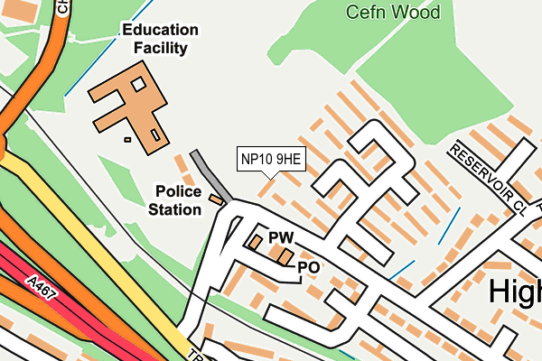
NP10 9HE is located in the Rogerstone East electoral ward, within the unitary authority of Newport and the Welsh Parliamentary constituency of Newport West. The Local Health Board is Aneurin Bevan University and the police force is Gwent. This postcode has been in use since June 1999.


GetTheData
Source: OS OpenMap – Local (Ordnance Survey)
Source: OS VectorMap District (Ordnance Survey)
Licence: Open Government Licence (requires attribution)
| Easting | 327510 |
| Northing | 187940 |
| Latitude | 51.585634 |
| Longitude | -3.047672 |
GetTheData
Source: Open Postcode Geo
Licence: Open Government Licence
| Country | Wales |
| Postcode District | NP10 |
| ➜ NP10 open data dashboard ➜ See where NP10 is on a map ➜ Where is Newport? | |
GetTheData
Source: Land Registry Price Paid Data
Licence: Open Government Licence
Elevation or altitude of NP10 9HE as distance above sea level:
| Metres | Feet | |
|---|---|---|
| Elevation | 40m | 131ft |
Elevation is measured from the approximate centre of the postcode, to the nearest point on an OS contour line from OS Terrain 50, which has contour spacing of ten vertical metres.
➜ How high above sea level am I? Find the elevation of your current position using your device's GPS.
GetTheData
Source: Open Postcode Elevation
Licence: Open Government Licence
| Ward | Rogerstone East |
| Constituency | Newport West |
GetTheData
Source: ONS Postcode Database
Licence: Open Government Licence
| June 2022 | Public order | On or near Reservoir Close | 242m |
| June 2022 | Anti-social behaviour | On or near Reservoir Close | 242m |
| June 2022 | Anti-social behaviour | On or near Reservoir Close | 242m |
| ➜ Get more crime data in our Crime section | |||
GetTheData
Source: data.police.uk
Licence: Open Government Licence
| Cefn Wood School (Ebenezer Drive) | High Cross | 49m |
| Cefn Wood School (Ebenezer Drive) | High Cross | 115m |
| Greenfield Road (Tudor Crescent) | High Cross | 246m |
| Greenfield Road (Tudor Crescent) | High Cross | 284m |
| St Basil's Church (Tregwilym Road) | High Cross | 286m |
| Rogerstone Station | 1.7km |
| Newport (S Wales) Station | 3.3km |
| Risca & Pontymister Station | 3.8km |
GetTheData
Source: NaPTAN
Licence: Open Government Licence
| Percentage of properties with Next Generation Access | 100.0% |
| Percentage of properties with Superfast Broadband | 100.0% |
| Percentage of properties with Ultrafast Broadband | 100.0% |
| Percentage of properties with Full Fibre Broadband | 0.0% |
Superfast Broadband is between 30Mbps and 300Mbps
Ultrafast Broadband is > 300Mbps
| Percentage of properties unable to receive 2Mbps | 0.0% |
| Percentage of properties unable to receive 5Mbps | 0.0% |
| Percentage of properties unable to receive 10Mbps | 0.0% |
| Percentage of properties unable to receive 30Mbps | 0.0% |
GetTheData
Source: Ofcom
Licence: Ofcom Terms of Use (requires attribution)
GetTheData
Source: ONS Postcode Database
Licence: Open Government Licence


➜ Get more ratings from the Food Standards Agency
GetTheData
Source: Food Standards Agency
Licence: FSA terms & conditions
| Last Collection | |||
|---|---|---|---|
| Location | Mon-Fri | Sat | Distance |
| Tregwilym Road | 16:00 | 11:15 | 464m |
| Tydu Rogerstone | 16:00 | 11:15 | 793m |
| Rogerstone Post Office | 17:30 | 12:00 | 1,085m |
GetTheData
Source: Dracos
Licence: Creative Commons Attribution-ShareAlike
| School | Phase of Education | Distance |
|---|---|---|
| Rogerstone Primary School Ebenezer Drive, Highcross Estate, Rogerstone, Newport, NP10 9YX | Not applicable | 172m |
| High Cross Primary High Cross Drive, High Cross, Rogerstone, Newport, NP10 9AB | Not applicable | 644m |
| Mount Pleasant Primary Ruskin Avenue, Rogerstone, Newport, NP10 0AB | Not applicable | 1.1km |
GetTheData
Source: Edubase
Licence: Open Government Licence
The below table lists the International Territorial Level (ITL) codes (formerly Nomenclature of Territorial Units for Statistics (NUTS) codes) and Local Administrative Units (LAU) codes for NP10 9HE:
| ITL 1 Code | Name |
|---|---|
| TLL | Wales |
| ITL 2 Code | Name |
| TLL2 | East Wales |
| ITL 3 Code | Name |
| TLL21 | Monmouthshire and Newport |
| LAU 1 Code | Name |
| W06000022 | Newport |
GetTheData
Source: ONS Postcode Directory
Licence: Open Government Licence
The below table lists the Census Output Area (OA), Lower Layer Super Output Area (LSOA), and Middle Layer Super Output Area (MSOA) for NP10 9HE:
| Code | Name | |
|---|---|---|
| OA | W00008655 | |
| LSOA | W01001671 | Newport 016D |
| MSOA | W02000362 | Newport 016 |
GetTheData
Source: ONS Postcode Directory
Licence: Open Government Licence
| NP10 9HU | Windsor Place | 54m |
| NP10 9HR | Phillips Green | 58m |
| NP10 9HS | Watkins Walk | 73m |
| NP10 9HT | Harold Walk | 86m |
| NP10 9GW | Benson Avenue | 108m |
| NP10 9DP | Thornbury Park | 113m |
| NP10 9GU | Wills Row | 118m |
| NP10 9DL | Alan Close | 121m |
| NP10 9GT | Leslie Terrace | 126m |
| NP10 9GZ | Lyndon Way | 155m |
GetTheData
Source: Open Postcode Geo; Land Registry Price Paid Data
Licence: Open Government Licence