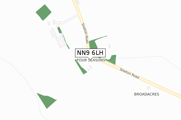
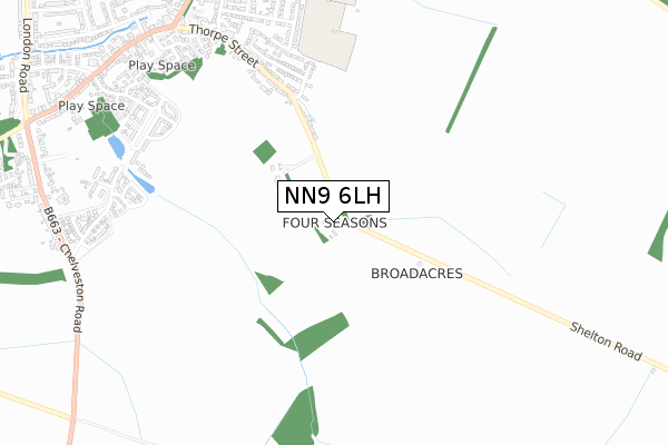
NN9 6LH is located in the Raunds electoral ward, within the unitary authority of North Northamptonshire and the English Parliamentary constituency of Corby. The Sub Integrated Care Board (ICB) Location is NHS Northamptonshire ICB - 78H and the police force is Northamptonshire. This postcode has been in use since January 1980.


GetTheData
Source: OS Open Zoomstack (Ordnance Survey)
Licence: Open Government Licence (requires attribution)
Attribution: Contains OS data © Crown copyright and database right 2024
Source: Open Postcode Geo
Licence: Open Government Licence (requires attribution)
Attribution: Contains OS data © Crown copyright and database right 2024; Contains Royal Mail data © Royal Mail copyright and database right 2024; Source: Office for National Statistics licensed under the Open Government Licence v.3.0
| Easting | 500245 |
| Northing | 271727 |
| Latitude | 52.334480 |
| Longitude | -0.530214 |
GetTheData
Source: Open Postcode Geo
Licence: Open Government Licence
| Country | England |
| Postcode District | NN9 |
| ➜ NN9 open data dashboard ➜ See where NN9 is on a map | |
GetTheData
Source: Land Registry Price Paid Data
Licence: Open Government Licence
Elevation or altitude of NN9 6LH as distance above sea level:
| Metres | Feet | |
|---|---|---|
| Elevation | 60m | 197ft |
Elevation is measured from the approximate centre of the postcode, to the nearest point on an OS contour line from OS Terrain 50, which has contour spacing of ten vertical metres.
➜ How high above sea level am I? Find the elevation of your current position using your device's GPS.
GetTheData
Source: Open Postcode Elevation
Licence: Open Government Licence
| Ward | Raunds |
| Constituency | Corby |
GetTheData
Source: ONS Postcode Database
Licence: Open Government Licence
| June 2022 | Anti-social behaviour | On or near Newtown Road | 454m |
| April 2022 | Anti-social behaviour | On or near Newtown Road | 454m |
| October 2021 | Anti-social behaviour | On or near Newtown Road | 454m |
| ➜ Get more crime data in our Crime section | |||
GetTheData
Source: data.police.uk
Licence: Open Government Licence
| Harcourt Street | Raunds | 848m |
| Primrose Hill | Raunds | 875m |
| Manor School Sports College (Park Street) | Raunds | 880m |
| Thorpe Street | Raunds | 884m |
| Co-op Store (Brook Street) | Raunds | 961m |
GetTheData
Source: NaPTAN
Licence: Open Government Licence
| Percentage of properties with Next Generation Access | 100.0% |
| Percentage of properties with Superfast Broadband | 100.0% |
| Percentage of properties with Ultrafast Broadband | 100.0% |
| Percentage of properties with Full Fibre Broadband | 100.0% |
Superfast Broadband is between 30Mbps and 300Mbps
Ultrafast Broadband is > 300Mbps
| Percentage of properties unable to receive 2Mbps | 0.0% |
| Percentage of properties unable to receive 5Mbps | 0.0% |
| Percentage of properties unable to receive 10Mbps | 0.0% |
| Percentage of properties unable to receive 30Mbps | 0.0% |
GetTheData
Source: Ofcom
Licence: Ofcom Terms of Use (requires attribution)
GetTheData
Source: ONS Postcode Database
Licence: Open Government Licence


➜ Get more ratings from the Food Standards Agency
GetTheData
Source: Food Standards Agency
Licence: FSA terms & conditions
| Last Collection | |||
|---|---|---|---|
| Location | Mon-Fri | Sat | Distance |
| Marshalls Road | 16:15 | 08:00 | 1,384m |
| Mallows Drive | 16:45 | 08:30 | 1,980m |
| Chelveston Tso | 16:15 | 10:45 | 2,431m |
GetTheData
Source: Dracos
Licence: Creative Commons Attribution-ShareAlike
| Facility | Distance |
|---|---|
| Manor Sport And Leisure Ltd Mountbatten Way, Raunds, Wellingborough Sports Hall, Health and Fitness Gym, Artificial Grass Pitch, Grass Pitches, Studio, Outdoor Tennis Courts | 876m |
| Raunds Cricket Club Marshalls Road, Raunds, Wellingborough Grass Pitches | 1.4km |
| Windmill Primary School Windmill Lane, Raunds, Wellingborough Grass Pitches, Sports Hall | 1.5km |
GetTheData
Source: Active Places
Licence: Open Government Licence
| School | Phase of Education | Distance |
|---|---|---|
| St Peter's Church of England Academy Mountbatten Way, Raunds, Wellingborough, NN9 6PA | Primary | 918m |
| Manor School Mountbatten Way, Raunds, Wellingborough, NN9 6PA | Secondary | 930m |
| Raunds Park Infant School Park Street, Raunds, Wellingborough, NN9 6NB | Primary | 936m |
GetTheData
Source: Edubase
Licence: Open Government Licence
The below table lists the International Territorial Level (ITL) codes (formerly Nomenclature of Territorial Units for Statistics (NUTS) codes) and Local Administrative Units (LAU) codes for NN9 6LH:
| ITL 1 Code | Name |
|---|---|
| TLF | East Midlands (England) |
| ITL 2 Code | Name |
| TLF2 | Leicestershire, Rutland and Northamptonshire |
| ITL 3 Code | Name |
| TLF25 | North Northamptonshire |
| LAU 1 Code | Name |
| E07000152 | East Northamptonshire |
GetTheData
Source: ONS Postcode Directory
Licence: Open Government Licence
The below table lists the Census Output Area (OA), Lower Layer Super Output Area (LSOA), and Middle Layer Super Output Area (MSOA) for NN9 6LH:
| Code | Name | |
|---|---|---|
| OA | E00137605 | |
| LSOA | E01027053 | East Northamptonshire 005C |
| MSOA | E02005633 | East Northamptonshire 005 |
GetTheData
Source: ONS Postcode Directory
Licence: Open Government Licence
| NN9 6SY | Randsway | 485m |
| NN9 6LX | Newtown Road | 503m |
| NN9 6NF | Shortwoods Close | 571m |
| NN9 6SZ | Holmes Avenue | 623m |
| NN9 6NA | Park Avenue | 713m |
| NN9 6LS | Thorpe Street | 769m |
| NN9 6JH | Warwick Close | 814m |
| NN9 6LZ | Harcourt Street | 831m |
| NN9 6PG | Primrose Gardens | 834m |
| NN9 6UL | Centenary Way | 863m |
GetTheData
Source: Open Postcode Geo; Land Registry Price Paid Data
Licence: Open Government Licence