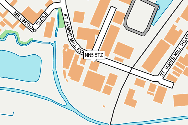
NN5 5TZ is located in the Dallington Spencer electoral ward, within the unitary authority of West Northamptonshire and the English Parliamentary constituency of Northampton South. The Sub Integrated Care Board (ICB) Location is NHS Northamptonshire ICB - 78H and the police force is Northamptonshire. This postcode has been in use since December 1998.


GetTheData
Source: OS OpenMap – Local (Ordnance Survey)
Source: OS VectorMap District (Ordnance Survey)
Licence: Open Government Licence (requires attribution)
| Easting | 474342 |
| Northing | 259829 |
| Latitude | 52.231650 |
| Longitude | -0.912903 |
GetTheData
Source: Open Postcode Geo
Licence: Open Government Licence
| Country | England |
| Postcode District | NN5 |
➜ See where NN5 is on a map ➜ Where is Northampton? | |
GetTheData
Source: Land Registry Price Paid Data
Licence: Open Government Licence
Elevation or altitude of NN5 5TZ as distance above sea level:
| Metres | Feet | |
|---|---|---|
| Elevation | 60m | 197ft |
Elevation is measured from the approximate centre of the postcode, to the nearest point on an OS contour line from OS Terrain 50, which has contour spacing of ten vertical metres.
➜ How high above sea level am I? Find the elevation of your current position using your device's GPS.
GetTheData
Source: Open Postcode Elevation
Licence: Open Government Licence
| Ward | Dallington Spencer |
| Constituency | Northampton South |
GetTheData
Source: ONS Postcode Database
Licence: Open Government Licence
| Thorn Hill (Ring Way) | Briar Hill | 397m |
| Stagecoach Depot (Main Road) | Far Cotton | 441m |
| Thorn Hill | Briar Hill | 447m |
| Stagecoach Depot (Main Road) | Far Cotton | 452m |
| Borough Council Depot (St James Mill Road) | St James End | 453m |
| Northampton Station | 0.8km |
GetTheData
Source: NaPTAN
Licence: Open Government Licence
GetTheData
Source: ONS Postcode Database
Licence: Open Government Licence


➜ Get more ratings from the Food Standards Agency
GetTheData
Source: Food Standards Agency
Licence: FSA terms & conditions
| Last Collection | |||
|---|---|---|---|
| Location | Mon-Fri | Sat | Distance |
| St James Mill Road | 18:30 | 390m | |
| St James Mill Road | 18:30 | 11:30 | 395m |
| Arrowhead Road | 17:30 | 11:30 | 716m |
GetTheData
Source: Dracos
Licence: Creative Commons Attribution-ShareAlike
| Risk of NN5 5TZ flooding from rivers and sea | Low |
| ➜ NN5 5TZ flood map | |
GetTheData
Source: Open Flood Risk by Postcode
Licence: Open Government Licence
The below table lists the International Territorial Level (ITL) codes (formerly Nomenclature of Territorial Units for Statistics (NUTS) codes) and Local Administrative Units (LAU) codes for NN5 5TZ:
| ITL 1 Code | Name |
|---|---|
| TLF | East Midlands (England) |
| ITL 2 Code | Name |
| TLF2 | Leicestershire, Rutland and Northamptonshire |
| ITL 3 Code | Name |
| TLF24 | West Northamptonshire |
| LAU 1 Code | Name |
| E07000154 | Northampton |
GetTheData
Source: ONS Postcode Directory
Licence: Open Government Licence
The below table lists the Census Output Area (OA), Lower Layer Super Output Area (LSOA), and Middle Layer Super Output Area (MSOA) for NN5 5TZ:
| Code | Name | |
|---|---|---|
| OA | E00169259 | |
| LSOA | E01032979 | Northampton 021F |
| MSOA | E02005670 | Northampton 021 |
GetTheData
Source: ONS Postcode Directory
Licence: Open Government Licence
| NN5 5JP | St James Mill Road | 182m |
| NN5 5JF | Millbrook Close | 396m |
| NN4 8SJ | Ringway | 419m |
| NN4 8SL | Ringway | 467m |
| NN4 8SH | Ringway | 489m |
| NN4 8SN | Thorn Hill | 509m |
| NN4 8SP | The Briars | 533m |
| NN4 8JD | Rothersthorpe Crescent | 543m |
| NN5 5JX | Spencer Street | 548m |
| NN5 5JS | Lincoln Road | 552m |
GetTheData
Source: Open Postcode Geo; Land Registry Price Paid Data
Licence: Open Government Licence