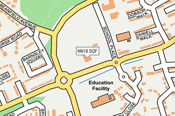
NN18 0QF is located in the Kingswood electoral ward, within the unitary authority of North Northamptonshire and the English Parliamentary constituency of Corby. The Sub Integrated Care Board (ICB) Location is NHS Northamptonshire ICB - 78H and the police force is Northamptonshire. This postcode has been in use since January 1980.


GetTheData
Source: OS OpenMap – Local (Ordnance Survey)
Source: OS VectorMap District (Ordnance Survey)
Licence: Open Government Licence (requires attribution)
| Easting | 487483 |
| Northing | 288031 |
| Latitude | 52.483198 |
| Longitude | -0.713199 |
GetTheData
Source: Open Postcode Geo
Licence: Open Government Licence
| Country | England |
| Postcode District | NN18 |
| ➜ NN18 open data dashboard ➜ See where NN18 is on a map ➜ Where is Corby? | |
GetTheData
Source: Land Registry Price Paid Data
Licence: Open Government Licence
Elevation or altitude of NN18 0QF as distance above sea level:
| Metres | Feet | |
|---|---|---|
| Elevation | 110m | 361ft |
Elevation is measured from the approximate centre of the postcode, to the nearest point on an OS contour line from OS Terrain 50, which has contour spacing of ten vertical metres.
➜ How high above sea level am I? Find the elevation of your current position using your device's GPS.
GetTheData
Source: Open Postcode Elevation
Licence: Open Government Licence
| Ward | Kingswood |
| Constituency | Corby |
GetTheData
Source: ONS Postcode Database
Licence: Open Government Licence
| October 2023 | Drugs | On or near Lowry Close | 178m |
| October 2023 | Drugs | On or near Sower Leys Road | 376m |
| September 2023 | Public order | On or near Parking Area | 83m |
| ➜ Get more crime data in our Crime section | |||
GetTheData
Source: data.police.uk
Licence: Open Government Licence
| Recreation Ground (Gainsborough Road) | Hazel Leys | 43m |
| Recreation Ground (Gainsborough Road) | Hazel Leys | 45m |
| Barnsley Square (Jubilee Avenue) | Beanfield | 122m |
| 312 Gainsborough Road (Gainsborough Road) | Kingswood | 190m |
| Hazel Leys School (Sower Leys Road) | Kingswood | 214m |
| Corby Station | 1.8km |
GetTheData
Source: NaPTAN
Licence: Open Government Licence
GetTheData
Source: ONS Postcode Database
Licence: Open Government Licence


➜ Get more ratings from the Food Standards Agency
GetTheData
Source: Food Standards Agency
Licence: FSA terms & conditions
| Last Collection | |||
|---|---|---|---|
| Location | Mon-Fri | Sat | Distance |
| Farmstead Road | 17:00 | 11:15 | 426m |
| Saxon Way East | 18:00 | 09:00 | 550m |
| Great Oakley | 16:00 | 08:00 | 1,293m |
GetTheData
Source: Dracos
Licence: Creative Commons Attribution-ShareAlike
| Facility | Distance |
|---|---|
| Woodsend Pavilion Gainsborough Road, Corby Grass Pitches | 5m |
| Hazel Leys Academy Gainsborough Road, Corby Grass Pitches | 152m |
| St Patricks Catholic Primary School (Corby) Patrick Road, Corby Grass Pitches | 434m |
GetTheData
Source: Active Places
Licence: Open Government Licence
| School | Phase of Education | Distance |
|---|---|---|
| Hazel Leys Academy Gainsborough Road, Corby, NN18 0QF | Primary | 150m |
| St Patrick's Catholic Primary School, Corby Patrick Road, Corby, NN18 9NT | Primary | 543m |
| Kingswood Primary Academy Southbrook, Corby, NN18 9BE | Primary | 709m |
GetTheData
Source: Edubase
Licence: Open Government Licence
The below table lists the International Territorial Level (ITL) codes (formerly Nomenclature of Territorial Units for Statistics (NUTS) codes) and Local Administrative Units (LAU) codes for NN18 0QF:
| ITL 1 Code | Name |
|---|---|
| TLF | East Midlands (England) |
| ITL 2 Code | Name |
| TLF2 | Leicestershire, Rutland and Northamptonshire |
| ITL 3 Code | Name |
| TLF25 | North Northamptonshire |
| LAU 1 Code | Name |
| E07000150 | Corby |
GetTheData
Source: ONS Postcode Directory
Licence: Open Government Licence
The below table lists the Census Output Area (OA), Lower Layer Super Output Area (LSOA), and Middle Layer Super Output Area (MSOA) for NN18 0QF:
| Code | Name | |
|---|---|---|
| OA | E00137125 | |
| LSOA | E01026960 | Corby 006B |
| MSOA | E02005617 | Corby 006 |
GetTheData
Source: ONS Postcode Directory
Licence: Open Government Licence
| NN18 0QN | Gainsborough Road | 180m |
| NN18 0PQ | Barnsley Square | 183m |
| NN18 0QT | Lowry Close | 184m |
| NN18 0SG | Dobson Walk | 223m |
| NN18 0SF | Daniell Walk | 224m |
| NN18 9LJ | Beardsley Court | 232m |
| NN18 0PE | Beverley Walk | 245m |
| NN18 9HR | Stamford Walk | 262m |
| NN18 0PG | Bentley Walk | 278m |
| NN18 9HS | Spilsby Close | 282m |
GetTheData
Source: Open Postcode Geo; Land Registry Price Paid Data
Licence: Open Government Licence